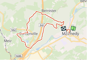
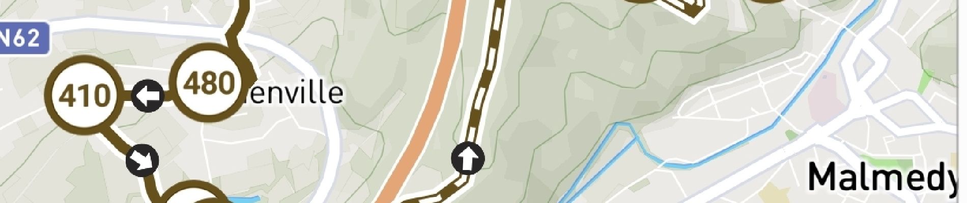
![](/images/other/stat-length.png)
![Tour Wandern Malmedy - Malmedy - Bernister - Burnenville - Photo](https://media.geolcdn.com/t/1900/400/d66b3b4b-66a9-40d9-9348-1acdf7b699fc.jpg&format=pjpeg&maxdim=2)
Malmedy - Bernister - Burnenville
Je vous emmène sur mes chemins
Par Mumu.larandonneuse
![Länge](/images/other/stat-length.png)
Länge
9,3 km
![Maximale Höhe](https://static1.geolcdn.com/siteimages/upload/files/1508320355ic_sort_altitude_max_24dp.png)
Maximale Höhe
501 m
![Positive Höhendifferenz](https://static1.geolcdn.com/siteimages/upload/files/1508320355ic_sort_den_pos_24dp.png)
Positive Höhendifferenz
332 m
![Km-Effort](/images/other/stat-length.png)
Km-Effort
13,8 km
![Min. Höhe](https://static1.geolcdn.com/siteimages/upload/files/1508320355ic_sort_altitude_min_24dp.png)
Min. Höhe
333 m
![Negative Höhendifferenz](https://static1.geolcdn.com/siteimages/upload/files/1508320355ic_sort_den_neg_24dp.png)
Negative Höhendifferenz
337 m
![Boucle](https://static1.geolcdn.com/siteimages/upload/files/16400158638029165_repeat_loop_refresh_sync_direction_icon.png)
Boucle
Ja
Erstellungsdatum :
2024-08-15 08:53:31.019
Letzte Änderung :
2024-08-15 14:37:37.007
![Wandern](https://static1.geolcdn.com/sitytour/trail-icons/101.png)
2h19
Schwierigkeit : Medium
![Scannen Sie diesen QR-Code, um die Tour in der SityTrail-Anwendung zu öffnen](https://capi.geolives.com/qq0zvz2zws4bq2lad0pu/sitytour/trails/4156185/qr.png?size=200)
Kostenlosegpshiking-Anwendung
Über SityTrail
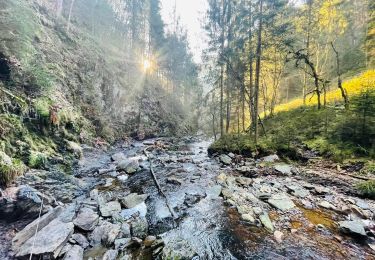
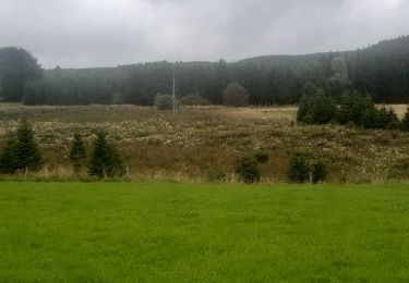
Tour Wandern von 9,3 km verfügbar auf Wallonien, Lüttich, Malmedy. Diese Tour wird von Je vous emmène sur mes chemins vorgeschlagen.
Beschreibung
Un parcours basé sur une création de l'app NodeMapp (points-noeuds virtuels en Wallonie)
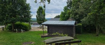
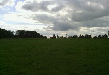
Ort
Land:
Belgium
Region :
Wallonien
Abteilung/Provinz :
Lüttich
Kommune :
Malmedy
Standort:
Unknown
Gehen Sie:(Dec)
Gehen Sie:(UTM)
288860 ; 5590272 (32U) N.
Kommentare
Touren in der Umgebung
![Tour Wandern Malmedy - RB-Lg-31_Malmedy - Photo](https://media.geolcdn.com/t/375/260/ext.jpg?maxdim=2&url=https%3A%2F%2Fservices.sitytrail.com%2FGeolivesWS%2FDownloadMedia.ashx%3FTrailID%3D402114%26Media%3D216d2e53-3b66-4632-8b4d-0cea30889665.jpg)
![Wandern Wandern](https://static1.geolcdn.com/sitytour/trail-icons/101.png)
![Tour Wandern Malmedy - Le trôs Maret - Photo](https://media.geolcdn.com/t/375/260/97b4be7b-87c1-46c9-b673-d6e164fd84f1.jpg&format=jpg&maxdim=2)
![Wandern Wandern](https://static1.geolcdn.com/sitytour/trail-icons/101.png)
Le trôs Maret
Wandern
Medium
(14)
Malmedy,
Wallonien,
Lüttich,
Belgium
![](/images/other/stat-length.png)
7,3 km | 10,1 km-effort
2h 11min
![](https://static1.geolcdn.com/siteimages/upload/files/16400158638029165_repeat_loop_refresh_sync_direction_icon.png)
Ja
![Tour Wandern Malmedy - La petite vallée sauvage du Trôs Marets - Photo](https://media.geolcdn.com/t/375/260/ext.jpg?maxdim=2&url=https%3A%2F%2Fstatic1.geolcdn.com%2Fsiteimages%2Fupload%2Ffiles%2F1553511878bg_sport_marche.png)
![Wandern Wandern](https://static1.geolcdn.com/sitytour/trail-icons/101.png)
La petite vallée sauvage du Trôs Marets
Wandern
Medium
(8)
Malmedy,
Wallonien,
Lüttich,
Belgium
![](/images/other/stat-length.png)
9,1 km | 12 km-effort
2h 37min
![](https://static1.geolcdn.com/siteimages/upload/files/16400158638029165_repeat_loop_refresh_sync_direction_icon.png)
Ja
![Tour Wandern Malmedy - Malmedy - Baugnez - Photo](https://media.geolcdn.com/t/375/260/a34fa6e8-977c-4cba-8883-b5a7429035f5.jpg&format=jpg&maxdim=2)
![Wandern Wandern](https://static1.geolcdn.com/sitytour/trail-icons/101.png)
Malmedy - Baugnez
Wandern
Medium
(1)
Malmedy,
Wallonien,
Lüttich,
Belgium
![](/images/other/stat-length.png)
14,8 km | 18,9 km-effort
3h 15min
![](https://static1.geolcdn.com/siteimages/upload/files/16400158638029165_repeat_loop_refresh_sync_direction_icon.png)
Ja
![Tour Wandern Malmedy - 2021-10-22_19h44m15_1102 - Photo](https://media.geolcdn.com/t/375/260/f624bfad-0543-4f87-8b2e-a4874ba371b1.jpg&format=jpg&maxdim=2)
![Wandern Wandern](https://static1.geolcdn.com/sitytour/trail-icons/101.png)
2021-10-22_19h44m15_1102
Wandern
Medium
(2)
Malmedy,
Wallonien,
Lüttich,
Belgium
![](/images/other/stat-length.png)
15,2 km | 21 km-effort
4h 41min
![](https://static1.geolcdn.com/siteimages/upload/files/16400158638029165_repeat_loop_refresh_sync_direction_icon.png)
Ja
![Tour Wandern Malmedy - ferme libert tro maret - Photo](https://media.geolcdn.com/t/375/260/ext.jpg?maxdim=2&url=https%3A%2F%2Fservices.sitytrail.com%2FGeolivesWS%2FDownloadMedia.ashx%3FTrailID%3D202740%26Media%3D20130704170612.jpeg)
![Wandern Wandern](https://static1.geolcdn.com/sitytour/trail-icons/101.png)
ferme libert tro maret
Wandern
Medium
(1)
Malmedy,
Wallonien,
Lüttich,
Belgium
![](/images/other/stat-length.png)
5,5 km | 7,4 km-effort
1h 35min
![](https://static1.geolcdn.com/siteimages/upload/files/16400158638029165_repeat_loop_refresh_sync_direction_icon.png)
Ja
![Tour Wandern Malmedy - RB-LG-09 - Sur les hauteurs dominant la haute vallée de l’Amblève et la Warche - Photo](https://media.geolcdn.com/t/375/260/ext.jpg?maxdim=2&url=https%3A%2F%2Fservices.sitytrail.com%2FGeolivesWS%2FDownloadMedia.ashx%3FTrailID%3D179567%26Media%3D798cfc5d-29e8-4b87-852c-cc68a99be049.jpg)
![Wandern Wandern](https://static1.geolcdn.com/sitytour/trail-icons/101.png)
RB-LG-09 - Sur les hauteurs dominant la haute vallée de l’Amblève et la Warche
Wandern
Medium
(4)
Malmedy,
Wallonien,
Lüttich,
Belgium
![](/images/other/stat-length.png)
26 km | 34 km-effort
7h 12min
![](https://static1.geolcdn.com/siteimages/upload/files/16400158638029165_repeat_loop_refresh_sync_direction_icon.png)
Ja
![Tour Wandern Malmedy - Balade de rêve 4 - Le canyon des Trôs Marets - Photo](https://media.geolcdn.com/t/375/260/00b47c34-b42a-48f8-a2cb-09ee85e4736c.jpg&format=jpg&maxdim=2)
![Wandern Wandern](https://static1.geolcdn.com/sitytour/trail-icons/101.png)
Balade de rêve 4 - Le canyon des Trôs Marets
Wandern
Medium
(2)
Malmedy,
Wallonien,
Lüttich,
Belgium
![](/images/other/stat-length.png)
5 km | 6,8 km-effort
1h 32min
![](https://static1.geolcdn.com/siteimages/upload/files/16400158638029165_repeat_loop_refresh_sync_direction_icon.png)
Ja
![Tour Wandern Malmedy - xhoffraix . cheneux . moulin et cascade bayehon . vieux chêne . longfaye . xhoffraix - Photo](https://media.geolcdn.com/t/375/260/d03e0c64-90c0-4767-998e-9e240f1eb32e.jpg&format=jpg&maxdim=2)
![Wandern Wandern](https://static1.geolcdn.com/sitytour/trail-icons/101.png)
xhoffraix . cheneux . moulin et cascade bayehon . vieux chêne . longfaye . xh...
Wandern
Einfach
(2)
Malmedy,
Wallonien,
Lüttich,
Belgium
![](/images/other/stat-length.png)
12,3 km | 15,9 km-effort
3h 7min
![](https://static1.geolcdn.com/siteimages/upload/files/16400158638029165_repeat_loop_refresh_sync_direction_icon.png)
Ja