![](/images/other/stat-length.png)
![Tour Wandern Châteauneuf-du-Rhône - 26 Châteauneuf du Rhône Navon Rac - Photo](https://media.geolcdn.com/t/1900/400/ext.pjpeg?maxdim=2&url=https%3A%2F%2Fstatic1.geolcdn.com%2Fsiteimages%2Fupload%2Ffiles%2F1553511878bg_sport_marche.png)
26 Châteauneuf du Rhône Navon Rac
Maryma
Benutzer
![Länge](/images/other/stat-length.png)
![Maximale Höhe](https://static1.geolcdn.com/siteimages/upload/files/1508320355ic_sort_altitude_max_24dp.png)
![Positive Höhendifferenz](https://static1.geolcdn.com/siteimages/upload/files/1508320355ic_sort_den_pos_24dp.png)
![Km-Effort](/images/other/stat-length.png)
![Min. Höhe](https://static1.geolcdn.com/siteimages/upload/files/1508320355ic_sort_altitude_min_24dp.png)
![Negative Höhendifferenz](https://static1.geolcdn.com/siteimages/upload/files/1508320355ic_sort_den_neg_24dp.png)
![Boucle](https://static1.geolcdn.com/siteimages/upload/files/16400158638029165_repeat_loop_refresh_sync_direction_icon.png)
![Wandern](https://static1.geolcdn.com/sitytour/trail-icons/101.png)
3h10
Schwierigkeit : Medium
![Scannen Sie diesen QR-Code, um die Tour in der SityTrail-Anwendung zu öffnen](https://capi.geolives.com/qq0zvz2zws4bq2lad0pu/sitytour/trails/4135556/qr.png?size=200)
Kostenlosegpshiking-Anwendung
Über SityTrail
Tour Wandern von 9,8 km verfügbar auf Auvergne-Rhone-Alpen, Drôme, Châteauneuf-du-Rhône. Diese Tour wird von Maryma vorgeschlagen.
Beschreibung
Se garer sur la place du Valladas, face à la piscine et sous le cimetière.
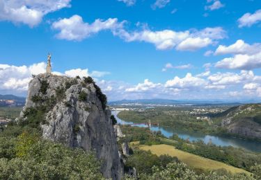
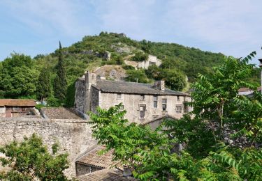
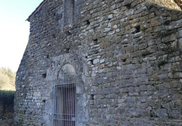
Un début de parcours par les ruelles du village médiéval de Châteauneuf du Rhône, en passant par l'église, la maison d'Arlandes avec sa façade Renaissance, le portail de Donzère. Nous commençons la rando en montant le long des remparts (11ème siècle) de la colline Montpensier par le sentier botanique. A son sommet, une vierge, en remerciement pour sa protection, domine le village. De là, un magnifique point de vue sur le village et la vallée.
Le chemin continue par la traversée de champs céréaliers comme de lavandes et de nombreux passages en sous-bois (chênes, pins, genévriers...) très agréables et souvent en monotrace.
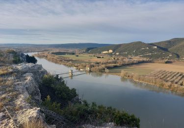
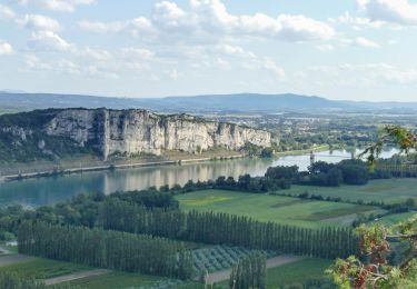
Arrivés sur la crête du Navon, à nouveau un remarquable point de vue, sur Viviers, le Rhône, la cimenterie Lafarge et la centrale de Cruas!
Après un nouveau passage en pinède, nous arrivons au hameau du Rac avec un panorama en direction de Savasse, Marsanne. Enfin la redescente par un chemin à nouveau en sous-bois, fort agréable, et monotrace.
Ort
Kommentare
Touren in der Umgebung
![Tour Wandern Donzère - Donzère et le défilé de Donzère 8km. - Photo](https://media.geolcdn.com/t/375/260/29640f3c-57e6-45f5-8c80-02a608564184.jpg&format=jpg&maxdim=2)
![Wandern Wandern](https://static1.geolcdn.com/sitytour/trail-icons/101.png)
Wandern
![](/images/other/stat-length.png)
![](https://static1.geolcdn.com/siteimages/upload/files/16400158638029165_repeat_loop_refresh_sync_direction_icon.png)
![Tour Wandern Viviers - 2024-08-09_18h31m30_t123518200_wanderung veviers erzengel - Photo](https://media.geolcdn.com/t/375/260/cf389799-c859-43e5-9cc2-efd706a42e44.jpg&format=jpg&maxdim=2)
![Wandern Wandern](https://static1.geolcdn.com/sitytour/trail-icons/101.png)
Wandern
![](/images/other/stat-length.png)
![](https://static1.geolcdn.com/siteimages/upload/files/16400158638029165_repeat_loop_refresh_sync_direction_icon.png)
![Tour Wandern Viviers - 2022-07-02_18h53m13_Viviers 6km.gpx.xml - Photo](https://media.geolcdn.com/t/375/260/2c7b7c3a-9657-4643-bedd-c867c3e314f0.jpg&format=jpg&maxdim=2)
![Wandern Wandern](https://static1.geolcdn.com/sitytour/trail-icons/101.png)
Wandern
![](/images/other/stat-length.png)
![](https://static1.geolcdn.com/siteimages/upload/files/16400158638029165_repeat_loop_refresh_sync_direction_icon.png)
![Tour Wandern Malataverne - Malataverne : Le Rac Le Navon 7km5. - Photo](https://media.geolcdn.com/t/375/260/0561eb90-e5f9-49cc-981c-c2636eb681f5.jpg&format=jpg&maxdim=2)
![Wandern Wandern](https://static1.geolcdn.com/sitytour/trail-icons/101.png)
Wandern
![](/images/other/stat-length.png)
![](https://static1.geolcdn.com/siteimages/upload/files/16400158638029165_repeat_loop_refresh_sync_direction_icon.png)
![Tour Wandern Donzère - Donzère -falaises-Navon-ruines 15km - Photo](https://media.geolcdn.com/t/375/260/43689114-f291-44a7-938f-e31d16f56bb8.jpg&format=jpg&maxdim=2)
![Wandern Wandern](https://static1.geolcdn.com/sitytour/trail-icons/101.png)
Wandern
![](/images/other/stat-length.png)
![](https://static1.geolcdn.com/siteimages/upload/files/16400158638029165_repeat_loop_refresh_sync_direction_icon.png)
![Tour Wandern Donzère - Donzère les falaises 6km - Photo](https://media.geolcdn.com/t/375/260/ext.jpg?maxdim=2&url=https%3A%2F%2Fstatic1.geolcdn.com%2Fsiteimages%2Fupload%2Ffiles%2F1553511878bg_sport_marche.png)
![Wandern Wandern](https://static1.geolcdn.com/sitytour/trail-icons/101.png)
Wandern
![](/images/other/stat-length.png)
![](https://static1.geolcdn.com/siteimages/upload/files/16400158638029165_repeat_loop_refresh_sync_direction_icon.png)
![Tour Wandern Viviers - 07 viviers st montan - Photo](https://media.geolcdn.com/t/375/260/3692a514-f42a-4bcb-a3a0-8b198053c1aa.jpg&format=jpg&maxdim=2)
![Wandern Wandern](https://static1.geolcdn.com/sitytour/trail-icons/101.png)
Wandern
![](/images/other/stat-length.png)
![](https://static1.geolcdn.com/siteimages/upload/files/16400158638029165_repeat_loop_refresh_sync_direction_icon.png)
![Tour Wandern Viviers - virade de l espoir viviers - Photo](https://media.geolcdn.com/t/375/260/ext.jpg?maxdim=2&url=https%3A%2F%2Fstatic1.geolcdn.com%2Fsiteimages%2Fupload%2Ffiles%2F1553511878bg_sport_marche.png)
![Wandern Wandern](https://static1.geolcdn.com/sitytour/trail-icons/101.png)
Wandern
![](/images/other/stat-length.png)
![](https://static1.geolcdn.com/siteimages/upload/files/16400158638029165_repeat_loop_refresh_sync_direction_icon.png)
![Tour Wandern Châteauneuf-du-Rhône - 2024-06-16_06h15m19_t219378880_chateauneuf du rhone - - Photo](https://media.geolcdn.com/t/375/260/a28cc877-61f7-4c8a-9cdf-70cf6be1b461.jpg&format=jpg&maxdim=2)
![Wandern Wandern](https://static1.geolcdn.com/sitytour/trail-icons/101.png)
Wandern
![](/images/other/stat-length.png)
![](https://static1.geolcdn.com/siteimages/upload/files/16400158638029165_repeat_loop_refresh_sync_direction_icon.png)