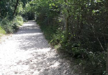
6 km | 6,1 km-effort
Les Crocs - Parc du Marquentere Le Crotoy
Roumare randonnée
Seul on va plus vite, ensemble on va plus loin
Länge
16,5 km
Maximale Höhe
26 m
Positive Höhendifferenz
67 m
Km-Effort
17,4 km
Min. Höhe
-1 m
Negative Höhendifferenz
66 m
Boucle
Ja
Erstellungsdatum :
2024-07-24 16:17:38.534
Letzte Änderung :
2024-07-24 16:19:40.736
3h57
Schwierigkeit : Schwierig
Kostenlosegpshiking-Anwendung
Über SityTrail
Tour Wandern von 16,5 km verfügbar auf Nordfrankreich, Somme, Saint-Quentin-en-Tourmont. Diese Tour wird von Roumare randonnée vorgeschlagen.
Ort
Land:
France
Region :
Nordfrankreich
Abteilung/Provinz :
Somme
Kommune :
Saint-Quentin-en-Tourmont
Standort:
Unknown
Gehen Sie:(Dec)
Gehen Sie:(UTM)
399460 ; 5569507 (31U) N.
Kommentare
Touren in der Umgebung
Les crocs - Saint Quentin en Tourmont
Wandern
Schwierig
(4)
Saint-Quentin-en-Tourmont,
Nordfrankreich,
Somme,
France
15,8 km | 16,9 km-effort
5h 30min
Ja
de la Maye vers marquenterre
Pferd
Sehr leicht
(4)
Le Crotoy,
Nordfrankreich,
Somme,
France
20 km | 21 km-effort
2h 43min
Nein
La Maille - Pointe de St Quentin
Wandern
Medium
Le Crotoy,
Nordfrankreich,
Somme,
France
9 km | 9,1 km-effort
4h 30min
Ja
Balade au Crotoy
Zu Fuß
Einfach
Le Crotoy,
Nordfrankreich,
Somme,
France
9,9 km | 10,4 km-effort
2h 22min
Ja
Le Colombier
Zu Fuß
Einfach
Quend,
Nordfrankreich,
Somme,
France
9,9 km | 10,4 km-effort
2h 22min
Ja
chemin du littoral
Wandern
Medium
Saint-Quentin-en-Tourmont,
Nordfrankreich,
Somme,
France
6,5 km | 7,3 km-effort
2h 13min
Ja
tour du parc du marquenterre.
Nordic Walking
Sehr schwierig
Saint-Quentin-en-Tourmont,
Nordfrankreich,
Somme,
France
17,1 km | 18,2 km-effort
3h 47min
Ja