![](/images/other/stat-length.png)
![Tour Andere Aktivitäten Attinghausen - Brüsti-Fürenalp - Photo](https://media.geolcdn.com/t/1900/400/ext.pjpeg?maxdim=2&url=https%3A%2F%2Fstatic1.geolcdn.com%2Fsiteimages%2Fupload%2Ffiles%2F1545311037marcheuse_200dpi.jpg)
Brüsti-Fürenalp
Dgubler
Benutzer
![Länge](/images/other/stat-length.png)
Länge
13 km
![Maximale Höhe](https://static1.geolcdn.com/siteimages/upload/files/1508320355ic_sort_altitude_max_24dp.png)
Maximale Höhe
2285 m
![Positive Höhendifferenz](https://static1.geolcdn.com/siteimages/upload/files/1508320355ic_sort_den_pos_24dp.png)
Positive Höhendifferenz
1070 m
![Km-Effort](/images/other/stat-length.png)
Km-Effort
26 km
![Min. Höhe](https://static1.geolcdn.com/siteimages/upload/files/1508320355ic_sort_altitude_min_24dp.png)
Min. Höhe
1529 m
![Negative Höhendifferenz](https://static1.geolcdn.com/siteimages/upload/files/1508320355ic_sort_den_neg_24dp.png)
Negative Höhendifferenz
768 m
![Boucle](https://static1.geolcdn.com/siteimages/upload/files/16400158638029165_repeat_loop_refresh_sync_direction_icon.png)
Boucle
Nein
Erstellungsdatum :
2014-12-10 00:00:00.0
Letzte Änderung :
2014-12-10 00:00:00.0
![Andere Aktivitäten](https://static1.geolcdn.com/sitytour/trail-icons/900.png)
5h56
Schwierigkeit : Unbekannt
![Scannen Sie diesen QR-Code, um die Tour in der SityTrail-Anwendung zu öffnen](https://capi.geolives.com/qq0zvz2zws4bq2lad0pu/sitytour/trails/41315/qr.png?size=200)
Kostenlosegpshiking-Anwendung
Über SityTrail
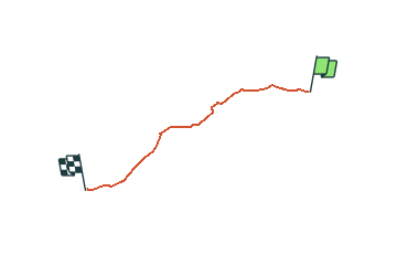
Tour Andere Aktivitäten von 13 km verfügbar auf Uri, Unbekannt, Attinghausen. Diese Tour wird von Dgubler vorgeschlagen.
Beschreibung
De la station supérieure du téléphérique Attinghausen-Brüsti, à celle du téléphérique de la Fürenalp. On peut ensuite rejoindre Engelberg.
Ort
Land:
Switzerland
Region :
Uri
Abteilung/Provinz :
Unbekannt
Kommune :
Attinghausen
Standort:
Unknown
Gehen Sie:(Dec)
Gehen Sie:(UTM)
470023 ; 5187804 (32T) N.
Kommentare
Touren in der Umgebung
![Tour Zu Fuß Erstfeld - Erstfeld-Attighauser Brücke - Photo](https://media.geolcdn.com/t/375/260/e1942dd0-5fcb-4813-a706-7d12a0769b00.jpeg&format=jpg&maxdim=2)
![Zu Fuß Zu Fuß](https://static1.geolcdn.com/sitytour/trail-icons/100.png)
Erstfeld-Attighauser Brücke
Zu Fuß
Einfach
Erstfeld,
Uri,
Unbekannt,
Switzerland
![](/images/other/stat-length.png)
5,5 km | 6,8 km-effort
1h 32min
![](https://static1.geolcdn.com/siteimages/upload/files/16400158638029165_repeat_loop_refresh_sync_direction_icon.png)
Nein
![Tour Zu Fuß Attinghausen - CH-Langschnee - Höchiberg - Photo](https://media.geolcdn.com/t/375/260/dev_578380b9-7c57-4a41-88cf-5ac73470d992.jpeg&format=jpg&maxdim=2)
![Zu Fuß Zu Fuß](https://static1.geolcdn.com/sitytour/trail-icons/100.png)
CH-Langschnee - Höchiberg
Zu Fuß
Einfach
Attinghausen,
Uri,
Unbekannt,
Switzerland
![](/images/other/stat-length.png)
5,1 km | 7,8 km-effort
1h 46min
![](https://static1.geolcdn.com/siteimages/upload/files/16400158638029165_repeat_loop_refresh_sync_direction_icon.png)
Nein
![Tour Zu Fuß Attinghausen - CH-Surenenpass - Blackenalp - Photo](https://media.geolcdn.com/t/375/260/dev_7710e4fa-5349-4767-99c5-40c368918612.jpeg&format=jpg&maxdim=2)
![Zu Fuß Zu Fuß](https://static1.geolcdn.com/sitytour/trail-icons/100.png)
CH-Surenenpass - Blackenalp
Zu Fuß
Einfach
Attinghausen,
Uri,
Unbekannt,
Switzerland
![](/images/other/stat-length.png)
3 km | 4,6 km-effort
1h 3min
![](https://static1.geolcdn.com/siteimages/upload/files/16400158638029165_repeat_loop_refresh_sync_direction_icon.png)
Nein
![Tour Zu Fuß Attinghausen - Höchiberg - FIXME - Photo](https://media.geolcdn.com/t/375/260/dev_578380b9-7c57-4a41-88cf-5ac73470d992.jpeg&format=jpg&maxdim=2)
![Zu Fuß Zu Fuß](https://static1.geolcdn.com/sitytour/trail-icons/100.png)
Höchiberg - FIXME
Zu Fuß
Einfach
Attinghausen,
Uri,
Unbekannt,
Switzerland
![](/images/other/stat-length.png)
3 km | 5,8 km-effort
1h 19min
![](https://static1.geolcdn.com/siteimages/upload/files/16400158638029165_repeat_loop_refresh_sync_direction_icon.png)
Nein
![Tour Andere Aktivitäten Attinghausen - y10_surenen - Photo](https://media.geolcdn.com/t/375/260/ext.jpg?maxdim=2&url=https%3A%2F%2Fstatic1.geolcdn.com%2Fsiteimages%2Fupload%2Ffiles%2F1545311037marcheuse_200dpi.jpg)
![Andere Aktivitäten Andere Aktivitäten](https://static1.geolcdn.com/sitytour/trail-icons/900.png)
y10_surenen
Andere Aktivitäten
Sehr leicht
Attinghausen,
Uri,
Unbekannt,
Switzerland
![](/images/other/stat-length.png)
13,3 km | 26 km-effort
Unbekannt
![](https://static1.geolcdn.com/siteimages/upload/files/16400158638029165_repeat_loop_refresh_sync_direction_icon.png)
Nein
![Tour Andere Aktivitäten Erstfeld - y10_Erstfeld_Goeschenen - Photo](https://media.geolcdn.com/t/375/260/ext.jpg?maxdim=2&url=https%3A%2F%2Fstatic1.geolcdn.com%2Fsiteimages%2Fupload%2Ffiles%2F1545311037marcheuse_200dpi.jpg)
![Andere Aktivitäten Andere Aktivitäten](https://static1.geolcdn.com/sitytour/trail-icons/900.png)
y10_Erstfeld_Goeschenen
Andere Aktivitäten
Sehr leicht
Erstfeld,
Uri,
Unbekannt,
Switzerland
![](/images/other/stat-length.png)
23 km | 35 km-effort
8h 51min
![](https://static1.geolcdn.com/siteimages/upload/files/16400158638029165_repeat_loop_refresh_sync_direction_icon.png)
Nein
![Tour Andere Aktivitäten Erstfeld - y10_Erstfeldertal_Kroenten - Photo](https://media.geolcdn.com/t/375/260/ext.jpg?maxdim=2&url=https%3A%2F%2Fstatic1.geolcdn.com%2Fsiteimages%2Fupload%2Ffiles%2F1545311037marcheuse_200dpi.jpg)
![Andere Aktivitäten Andere Aktivitäten](https://static1.geolcdn.com/sitytour/trail-icons/900.png)
y10_Erstfeldertal_Kroenten
Andere Aktivitäten
Sehr leicht
Erstfeld,
Uri,
Unbekannt,
Switzerland
![](/images/other/stat-length.png)
9,5 km | 22 km-effort
5h 27min
![](https://static1.geolcdn.com/siteimages/upload/files/16400158638029165_repeat_loop_refresh_sync_direction_icon.png)
Nein
![Tour Mountainbike Altdorf (UR) - Bike32885 - Photo](https://media.geolcdn.com/t/375/260/ext.jpg?maxdim=2&url=https%3A%2F%2Fstatic1.geolcdn.com%2Fsiteimages%2Fupload%2Ffiles%2F1524743154velo.jpg)
![Mountainbike Mountainbike](https://static1.geolcdn.com/sitytour/trail-icons/202.png)
Bike32885
Mountainbike
Sehr leicht
Altdorf (UR),
Uri,
Unbekannt,
Switzerland
![](/images/other/stat-length.png)
23 km | 37 km-effort
Unbekannt
![](https://static1.geolcdn.com/siteimages/upload/files/16400158638029165_repeat_loop_refresh_sync_direction_icon.png)
Ja
![Tour Wandern Altdorf (UR) - st_toeff4_b - Photo](https://media.geolcdn.com/t/375/260/ext.jpg?maxdim=2&url=https%3A%2F%2Fstatic1.geolcdn.com%2Fsiteimages%2Fupload%2Ffiles%2F1553511878bg_sport_marche.png)
![Wandern Wandern](https://static1.geolcdn.com/sitytour/trail-icons/101.png)
st_toeff4_b
Wandern
Sehr leicht
Altdorf (UR),
Uri,
Unbekannt,
Switzerland
![](/images/other/stat-length.png)
374 km | 531 km-effort
91h 43min
![](https://static1.geolcdn.com/siteimages/upload/files/16400158638029165_repeat_loop_refresh_sync_direction_icon.png)
Nein