![](/images/other/stat-length.png)
![Tour Radtourismus Unknown - Descente Danube - Linz à Grein - Photo](https://media.geolcdn.com/t/1900/400/ext.pjpeg?maxdim=2&url=https%3A%2F%2Fstatic1.geolcdn.com%2Fsiteimages%2Fupload%2Ffiles%2F1524743154velo.jpg)
Descente Danube - Linz à Grein
s0c7
Benutzer
![Länge](/images/other/stat-length.png)
Länge
72 km
![Maximale Höhe](https://static1.geolcdn.com/siteimages/upload/files/1508320355ic_sort_altitude_max_24dp.png)
Maximale Höhe
352 m
![Positive Höhendifferenz](https://static1.geolcdn.com/siteimages/upload/files/1508320355ic_sort_den_pos_24dp.png)
Positive Höhendifferenz
519 m
![Km-Effort](/images/other/stat-length.png)
Km-Effort
79 km
![Min. Höhe](https://static1.geolcdn.com/siteimages/upload/files/1508320355ic_sort_altitude_min_24dp.png)
Min. Höhe
225 m
![Negative Höhendifferenz](https://static1.geolcdn.com/siteimages/upload/files/1508320355ic_sort_den_neg_24dp.png)
Negative Höhendifferenz
549 m
![Boucle](https://static1.geolcdn.com/siteimages/upload/files/16400158638029165_repeat_loop_refresh_sync_direction_icon.png)
Boucle
Nein
Erstellungsdatum :
2024-07-19 07:29:46.408
Letzte Änderung :
2024-07-19 19:42:03.745
![Radtourismus](https://static1.geolcdn.com/sitytour/trail-icons/204.png)
6h32
Schwierigkeit : Einfach
![Scannen Sie diesen QR-Code, um die Tour in der SityTrail-Anwendung zu öffnen](https://capi.geolives.com/qq0zvz2zws4bq2lad0pu/sitytour/trails/4127560/qr.png?size=200)
Kostenlosegpshiking-Anwendung
Über SityTrail
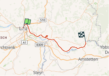
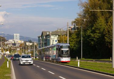
Tour Radtourismus von 72 km verfügbar auf Oberösterreich, Linz. Diese Tour wird von s0c7 vorgeschlagen.
Beschreibung
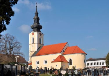
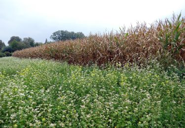
Parcours facile sur routes bitumées. Très beaux paysages. Détour par Mauthahausen par un trajet alternatif moins direct, mais moins pentu que la montée raide indiquée par la route
Ort
Land:
Austria
Region :
Oberösterreich
Abteilung/Provinz :
Linz
Kommune :
Unknown
Standort:
Unknown
Gehen Sie:(Dec)
Gehen Sie:(UTM)
447319 ; 5350455 (33U) N.
Kommentare
Touren in der Umgebung
![Tour Zu Fuß Steyregg - AV 50 Daxleitner - Photo](https://media.geolcdn.com/t/375/260/ac8aab2e-87f4-4c25-ae1f-c0ffc1bf5d02.jpeg&format=jpg&maxdim=2)
![Zu Fuß Zu Fuß](https://static1.geolcdn.com/sitytour/trail-icons/100.png)
AV 50 Daxleitner
Zu Fuß
Einfach
Steyregg,
Oberösterreich,
Bezirk Urfahr-Umgebung,
Austria
![](/images/other/stat-length.png)
4,7 km | 8 km-effort
1h 49min
![](https://static1.geolcdn.com/siteimages/upload/files/16400158638029165_repeat_loop_refresh_sync_direction_icon.png)
Nein
![Tour Zu Fuß - Treppelweg - Photo](https://media.geolcdn.com/t/375/260/f52d64c4-80b0-469f-9cf8-2227055028ed.jpeg&format=jpg&maxdim=2)
![Zu Fuß Zu Fuß](https://static1.geolcdn.com/sitytour/trail-icons/100.png)
![Tour Zu Fuß - Altenberg-Auhof - Photo](https://media.geolcdn.com/t/375/260/4c757075-6574-4a1d-905a-4024b18f0607.jpeg&format=jpg&maxdim=2)
![Zu Fuß Zu Fuß](https://static1.geolcdn.com/sitytour/trail-icons/100.png)
![Tour Zu Fuß Leonding - Zaubertalrunde - Photo](https://media.geolcdn.com/t/375/260/362dfadb-f1f7-45fc-9bd6-a2aa5cac1847.jpeg&format=jpg&maxdim=2)
![Zu Fuß Zu Fuß](https://static1.geolcdn.com/sitytour/trail-icons/100.png)
Zaubertalrunde
Zu Fuß
Einfach
Leonding,
Oberösterreich,
Bezirk Linz-Land,
Austria
![](/images/other/stat-length.png)
12,5 km | 15,7 km-effort
3h 34min
![](https://static1.geolcdn.com/siteimages/upload/files/16400158638029165_repeat_loop_refresh_sync_direction_icon.png)
Ja
![Tour Zu Fuß Leonding - Stadtwanderweg Leonding - Photo](https://media.geolcdn.com/t/375/260/f189d68d-38ea-4941-8054-2e2b8cf0c43d.jpeg&format=jpg&maxdim=2)
![Zu Fuß Zu Fuß](https://static1.geolcdn.com/sitytour/trail-icons/100.png)
Stadtwanderweg Leonding
Zu Fuß
Einfach
Leonding,
Oberösterreich,
Bezirk Linz-Land,
Austria
![](/images/other/stat-length.png)
3,2 km | 3,8 km-effort
52min
![](https://static1.geolcdn.com/siteimages/upload/files/16400158638029165_repeat_loop_refresh_sync_direction_icon.png)
Ja
![Tour Zu Fuß Leonding - Kürnbergrunde - Photo](https://media.geolcdn.com/t/375/260/04a4a75c-6b8b-4c91-8f6b-0acbe9b667e6.jpeg&format=jpg&maxdim=2)
![Zu Fuß Zu Fuß](https://static1.geolcdn.com/sitytour/trail-icons/100.png)
Kürnbergrunde
Zu Fuß
Einfach
Leonding,
Oberösterreich,
Bezirk Linz-Land,
Austria
![](/images/other/stat-length.png)
8,1 km | 9,1 km-effort
2h 4min
![](https://static1.geolcdn.com/siteimages/upload/files/16400158638029165_repeat_loop_refresh_sync_direction_icon.png)
Nein
![Tour Zu Fuß Leonding - Staudacherrunde - Photo](https://media.geolcdn.com/t/375/260/b885cb65-5f79-4b28-b4a0-37349ff05ef9.jpeg&format=jpg&maxdim=2)
![Zu Fuß Zu Fuß](https://static1.geolcdn.com/sitytour/trail-icons/100.png)
Staudacherrunde
Zu Fuß
Einfach
Leonding,
Oberösterreich,
Bezirk Linz-Land,
Austria
![](/images/other/stat-length.png)
6,6 km | 7,3 km-effort
1h 39min
![](https://static1.geolcdn.com/siteimages/upload/files/16400158638029165_repeat_loop_refresh_sync_direction_icon.png)
Nein
![Tour Zu Fuß Puchenau - Puchenau-Ottensheim - Photo](https://media.geolcdn.com/t/375/260/4b75b8fa-cf2f-4307-929c-22b5577c599a.jpeg&format=jpg&maxdim=2)
![Zu Fuß Zu Fuß](https://static1.geolcdn.com/sitytour/trail-icons/100.png)
Puchenau-Ottensheim
Zu Fuß
Einfach
Puchenau,
Oberösterreich,
Bezirk Urfahr-Umgebung,
Austria
![](/images/other/stat-length.png)
5,4 km | 7,6 km-effort
1h 44min
![](https://static1.geolcdn.com/siteimages/upload/files/16400158638029165_repeat_loop_refresh_sync_direction_icon.png)
Nein
![Tour Zu Fuß Steyregg - Stadtwanderweg Pfenningberg - Photo](https://media.geolcdn.com/t/375/260/ac8aab2e-87f4-4c25-ae1f-c0ffc1bf5d02.jpeg&format=jpg&maxdim=2)
![Zu Fuß Zu Fuß](https://static1.geolcdn.com/sitytour/trail-icons/100.png)
Stadtwanderweg Pfenningberg
Zu Fuß
Einfach
Steyregg,
Oberösterreich,
Bezirk Urfahr-Umgebung,
Austria
![](/images/other/stat-length.png)
6,6 km | 10,4 km-effort
2h 22min
![](https://static1.geolcdn.com/siteimages/upload/files/16400158638029165_repeat_loop_refresh_sync_direction_icon.png)
Nein