


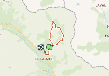

5,2 km | 12,8 km-effort


Benutzer


Kostenlosegpshiking-Anwendung
 SityTrail
IGN / Geografische Institute
SityTrail World
Die Welt öffnet sich für Sie
Tour Wandern von 9,4 km verfügbar auf Provence-Alpes-Côte d'Azur, Hochalpen, Le Monêtier-les-Bains. Diese Tour wird von cron vorgeschlagen.
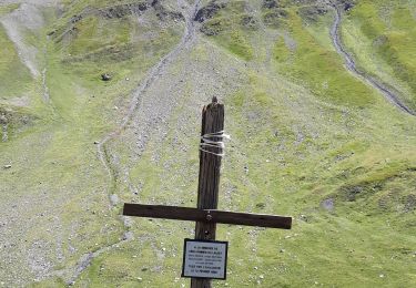
A noter : l'itinéraire emprunte à la montée un passage en falaise assez raide mais entièrement équipé d'une main courante (câble).

Wandern

Skiwanderen

Skiwanderen

Wandern

Wandern

Wandern

Wandern
Wandern

Klettersteig