


15,5 km | 30 km-effort

Benutzer


Kostenlosegpshiking-Anwendung
 SityTrail
IGN / Geografische Institute
SityTrail World
Die Welt öffnet sich für Sie
Tour Wandern von 12,7 km verfügbar auf Provence-Alpes-Côte d'Azur, Seealpen, Saint-Dalmas-le-Selvage. Diese Tour wird von bozo1970 vorgeschlagen.
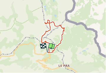
Départ du Camp des Fourches en boucle
Col des Fourches
Balise 37 direction le Pas de la Cavale en 1h30' D 600m et4km800
Fabuleux Pas de la Cavale ! un des plus beau de la région !
Direction plein ouest en contournant la Tête Carrée
Quelques Cairns et encore beaucoup de neige pour la saison
Direction la Tête de Pelouse avec son cairn sommital bien visible
Contourner les premières barres rocheuses et monter dans le vallon en direction d'un petit col
Atteindre le sommet par la face et la crête Sud du Pelouse
4h14' D 1100 et 8km
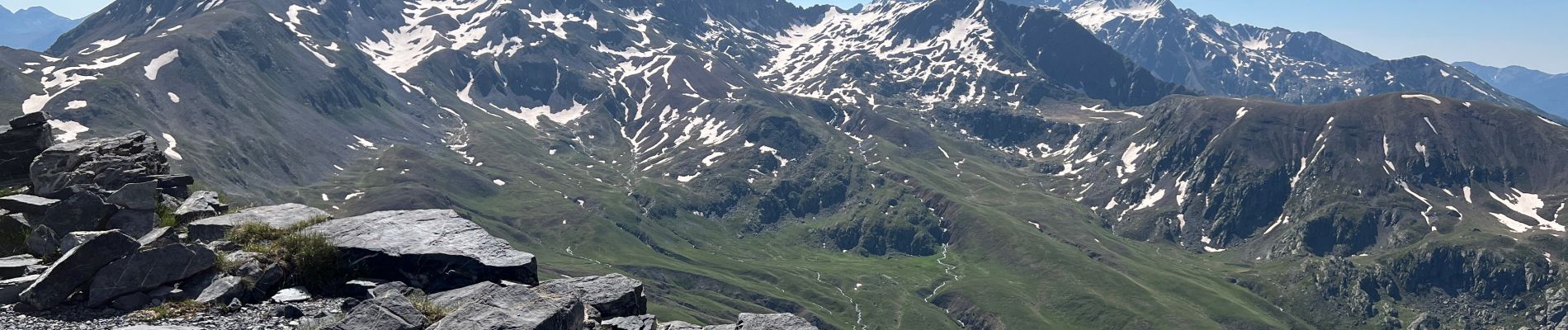
Vue Féérique à 360
Le Matto et le Viso au nord/ouest
Redescendre dans le vallon et longer les parois rocheuses jusqu'au Pas de la Petite Cavale en 5h10' D 1300 et 9km200
Très beau Cairn visible de très loin
Descente droit dans la pente toujours dans la neige pour récupérer le sentier du col de Pelouse
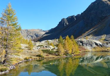
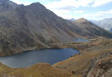
Lac de Pelouse sur la droite
Bifurcation vers le col de Pelousette en 6h50' D 1500 et 11km500
Descente droit jusqu'à récupérer le sentier qui rejoint le Camp des Fourches
Boucle en 7h28' D 1520 et 14km
Très éprouvant, surtout avec la neige
Sortie Exceptionnelle


29 Fotos insgesamt. Klicken Sie auf ein Foto, um sie alle in der Galerie zu sehen.

Wandern

Wandern

Wandern

Zu Fuß

Zu Fuß

Zu Fuß

Wandern
Wandern
Wandern