


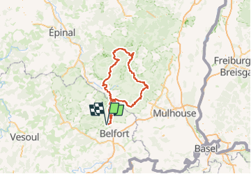

8,8 km | 10,8 km-effort


Benutzer


Kostenlosegpshiking-Anwendung
 SityTrail
IGN / Geografische Institute
SityTrail World
Die Welt öffnet sich für Sie
Tour Motorrad von 195 km verfügbar auf Burgund und Freigrafschaft, Territoire-de-Belfort, Évette-Salbert. Diese Tour wird von Bart2015 vorgeschlagen.
Petite halte à la ferme auberge du Haag : excellent, réservation conseillée.
Bonne balade, soyez prudent ...


Wandern
Wandern
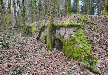
Wandern
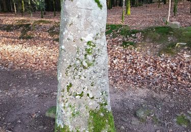
Wandern
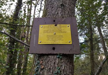
Wandern
Wandern
Wandern

Reiten
Wandern