


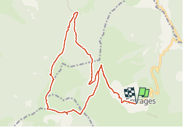

15,4 km | 29 km-effort


Benutzer


Kostenlosegpshiking-Anwendung
 SityTrail
IGN / Geografische Institute
SityTrail World
Die Welt öffnet sich für Sie
Tour Wandern von 12,2 km verfügbar auf Provence-Alpes-Côte d'Azur, Alpes-de-Haute-Provence, Entrages. Diese Tour wird von Danielle Nemond vorgeschlagen.
15 km 723m - 724m
Sortie Les Mées n°20
Entrée de Dignes, à droite Les Thermes
Suivre D 20
Tourner à droite ENTRAGES = PK

Wandern
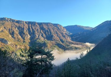
Wandern

Wandern

Wandern
Wandern
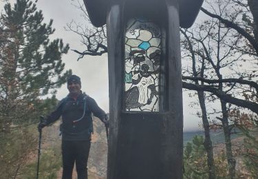
Wandern

Wandern

Wandern
Wandern