![](/images/other/stat-length.png)
![Tour Wandern Camors - Petit tour d'1h40 facile entre étangs, forêt et menhir - Photo](https://media.geolcdn.com/t/1900/400/ext.pjpeg?maxdim=2&url=https%3A%2F%2Fmedia.geolcdn.com%2Ff%2F10e5ab03-cf10-4ae2-85ff-d3168d71a3af.jpg)
Petit tour d'1h40 facile entre étangs, forêt et menhir
LPBS56
Benutzer
![Länge](/images/other/stat-length.png)
Länge
6,7 km
![Maximale Höhe](https://static1.geolcdn.com/siteimages/upload/files/1508320355ic_sort_altitude_max_24dp.png)
Maximale Höhe
134 m
![Positive Höhendifferenz](https://static1.geolcdn.com/siteimages/upload/files/1508320355ic_sort_den_pos_24dp.png)
Positive Höhendifferenz
101 m
![Km-Effort](/images/other/stat-length.png)
Km-Effort
8,1 km
![Min. Höhe](https://static1.geolcdn.com/siteimages/upload/files/1508320355ic_sort_altitude_min_24dp.png)
Min. Höhe
72 m
![Negative Höhendifferenz](https://static1.geolcdn.com/siteimages/upload/files/1508320355ic_sort_den_neg_24dp.png)
Negative Höhendifferenz
101 m
![Boucle](https://static1.geolcdn.com/siteimages/upload/files/16400158638029165_repeat_loop_refresh_sync_direction_icon.png)
Boucle
Ja
Erstellungsdatum :
2024-06-14 10:31:06.085
Letzte Änderung :
2024-06-14 10:53:57.143
![Wandern](https://static1.geolcdn.com/sitytour/trail-icons/101.png)
1h50
Schwierigkeit : Medium
![Scannen Sie diesen QR-Code, um die Tour in der SityTrail-Anwendung zu öffnen](https://capi.geolives.com/qq0zvz2zws4bq2lad0pu/sitytour/trails/4090349/qr.png?size=200)
Kostenlosegpshiking-Anwendung
Über SityTrail
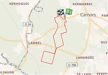
Tour Wandern von 6,7 km verfügbar auf Bretagne, Morbihan, Camors. Diese Tour wird von LPBS56 vorgeschlagen.
Beschreibung
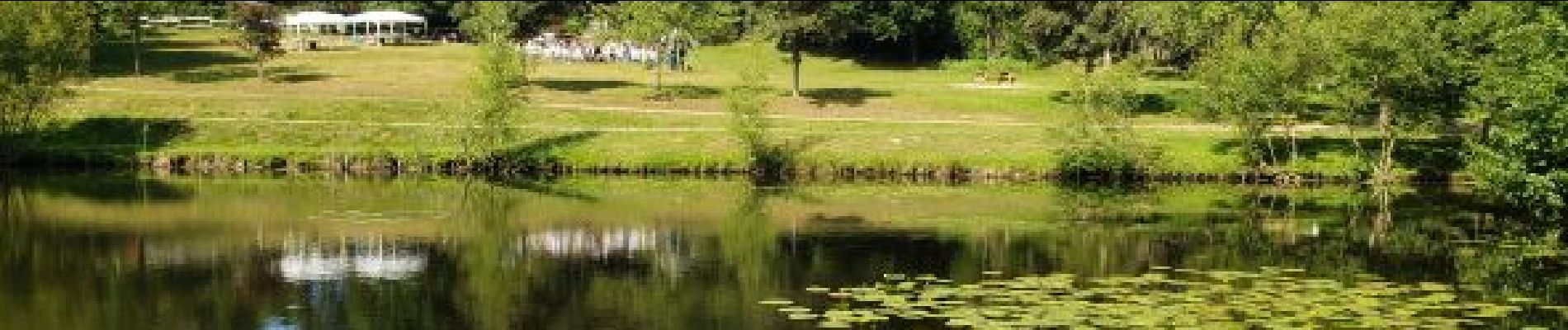
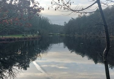
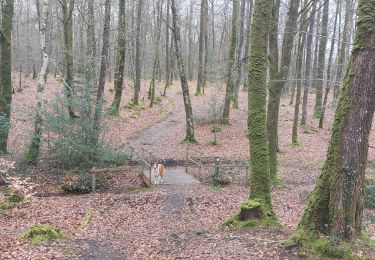
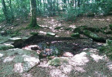
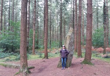
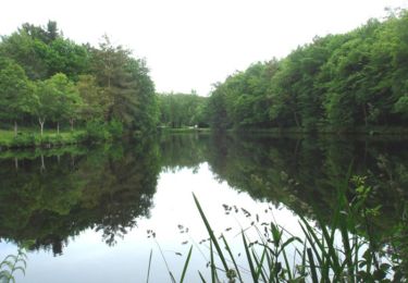
En partant du camping vous pouvez voir les étangs du petit bois, les vestiges du château de Comorre, le moulin de la Motte, le menhir Braz et Le menhir Bihan.
L'ensemble de la randonnée se fait à l'ombre de la forêt domaniale de Camors.
Ort
Land:
France
Region :
Bretagne
Abteilung/Provinz :
Morbihan
Kommune :
Camors
Standort:
Unknown
Gehen Sie:(Dec)
Gehen Sie:(UTM)
498998 ; 5299184 (30T) N.
Kommentare
Touren in der Umgebung
![Tour Wandern Camors - PR_56_Camors_CA_03_Circuit1b_Tro-Bourk_20240126 - Photo](https://media.geolcdn.com/t/375/260/ext.jpg?maxdim=2&url=https%3A%2F%2Fmedia.geolcdn.com%2Ff%2Fb5439ab5-6fb5-4321-891c-f40916bb8e7c.jpg)
![Wandern Wandern](https://static1.geolcdn.com/sitytour/trail-icons/101.png)
PR_56_Camors_CA_03_Circuit1b_Tro-Bourk_20240126
Wandern
Einfach
Camors,
Bretagne,
Morbihan,
France
![](/images/other/stat-length.png)
11 km | 13,8 km-effort
3h 8min
![](https://static1.geolcdn.com/siteimages/upload/files/16400158638029165_repeat_loop_refresh_sync_direction_icon.png)
Ja
![Tour Wandern Camors - PR_56_Camors_BA_02_Circuit1b_De-L-Eau_20230218 - Photo](https://media.geolcdn.com/t/375/260/ext.jpg?maxdim=2&url=https%3A%2F%2Fmedia.geolcdn.com%2Ff%2F26c2393c-1d30-463e-8549-a7f32bee2231.jpg)
![Wandern Wandern](https://static1.geolcdn.com/sitytour/trail-icons/101.png)
PR_56_Camors_BA_02_Circuit1b_De-L-Eau_20230218
Wandern
Einfach
Camors,
Bretagne,
Morbihan,
France
![](/images/other/stat-length.png)
12,7 km | 15,2 km-effort
2h 49min
![](https://static1.geolcdn.com/siteimages/upload/files/16400158638029165_repeat_loop_refresh_sync_direction_icon.png)
Ja
![Tour Wandern Camors - PR_56_Camors_AA_01_Circuit1b_De-L'Etoile_20200726 - Photo](https://media.geolcdn.com/t/375/260/ext.jpg?maxdim=2&url=https%3A%2F%2Fmedia.geolcdn.com%2Ff%2F82aaeae4-747d-41a7-86e5-cd57c6a620aa.jpg)
![Wandern Wandern](https://static1.geolcdn.com/sitytour/trail-icons/101.png)
PR_56_Camors_AA_01_Circuit1b_De-L'Etoile_20200726
Wandern
Einfach
Camors,
Bretagne,
Morbihan,
France
![](/images/other/stat-length.png)
9,8 km | 11,8 km-effort
2h 28min
![](https://static1.geolcdn.com/siteimages/upload/files/16400158638029165_repeat_loop_refresh_sync_direction_icon.png)
Ja
![Tour Wandern Camors - Circuit de l'Étoile.(forêt de Camors).11-07-16. - Photo](https://media.geolcdn.com/t/375/260/ext.jpg?maxdim=2&url=https%3A%2F%2Fservices.sitytrail.com%2FGeolivesWS%2FDownloadMedia.ashx%3FTrailID%3D596594%26Media%3Dfix__20160711170349.jpg)
![Wandern Wandern](https://static1.geolcdn.com/sitytour/trail-icons/101.png)
Circuit de l'Étoile.(forêt de Camors).11-07-16.
Wandern
Einfach
Camors,
Bretagne,
Morbihan,
France
![](/images/other/stat-length.png)
10,9 km | 13 km-effort
2h 40min
![](https://static1.geolcdn.com/siteimages/upload/files/16400158638029165_repeat_loop_refresh_sync_direction_icon.png)
Ja
![Tour Fahrrad Baud - Baud et la forêt de Camors - Photo](https://media.geolcdn.com/t/375/260/ext.jpg?maxdim=2&url=https%3A%2F%2Fservices.sitytrail.com%2FGeolivesWS%2FDownloadMedia.ashx%3FTrailID%3D832584%26Media%3Dfix__20170920114455.jpg)
![Fahrrad Fahrrad](https://static1.geolcdn.com/sitytour/trail-icons/200.png)
Baud et la forêt de Camors
Fahrrad
Medium
Baud,
Bretagne,
Morbihan,
France
![](/images/other/stat-length.png)
18,9 km | 23 km-effort
1h 19min
![](https://static1.geolcdn.com/siteimages/upload/files/16400158638029165_repeat_loop_refresh_sync_direction_icon.png)
Ja
![Tour Wandern Camors - Tro Bourk - Camors - Photo](https://media.geolcdn.com/t/375/260/ext.jpg?maxdim=2&url=https%3A%2F%2Fservices.sitytrail.com%2FGeolivesWS%2FDownloadMedia.ashx%3FTrailID%3D316653%26Media%3D17520_2.jpg)
![Wandern Wandern](https://static1.geolcdn.com/sitytour/trail-icons/101.png)
Tro Bourk - Camors
Wandern
Medium
(1)
Camors,
Bretagne,
Morbihan,
France
![](/images/other/stat-length.png)
10,1 km | 12,7 km-effort
2h 45min
![](https://static1.geolcdn.com/siteimages/upload/files/16400158638029165_repeat_loop_refresh_sync_direction_icon.png)
Ja
![Tour Mountainbike Camors - Espace VTT FFC La vallée du Blavet - Le circuit de l'eau en forêt de Camors - Photo](https://media.geolcdn.com/t/375/260/ext.jpg?maxdim=2&url=https%3A%2F%2Fservices.sitytrail.com%2FGeolivesWS%2FDownloadMedia.ashx%3FTrailID%3D101724%26Media%3D1968_1.jpg)
![Mountainbike Mountainbike](https://static1.geolcdn.com/sitytour/trail-icons/202.png)
Espace VTT FFC La vallée du Blavet - Le circuit de l'eau en forêt de Camors
Mountainbike
Medium
Camors,
Bretagne,
Morbihan,
France
![](/images/other/stat-length.png)
11,3 km | 13,6 km-effort
1h 0min
![](https://static1.geolcdn.com/siteimages/upload/files/16400158638029165_repeat_loop_refresh_sync_direction_icon.png)
Ja
![Tour Wandern Camors - Espace VTT FFC La vallée du Blavet - Le circuit de l'eau en forêt de Camors - Photo](https://media.geolcdn.com/t/375/260/ext.jpg?maxdim=2&url=https%3A%2F%2Fservices.sitytrail.com%2FGeolivesWS%2FDownloadMedia.ashx%3FTrailID%3D101723%26Media%3D1968_1.jpg)
![Wandern Wandern](https://static1.geolcdn.com/sitytour/trail-icons/101.png)
Espace VTT FFC La vallée du Blavet - Le circuit de l'eau en forêt de Camors
Wandern
Medium
Camors,
Bretagne,
Morbihan,
France
![](/images/other/stat-length.png)
11,3 km | 13,6 km-effort
2h 10min
![](https://static1.geolcdn.com/siteimages/upload/files/16400158638029165_repeat_loop_refresh_sync_direction_icon.png)
Ja
![Tour sport Camors - M - Photo](https://media.geolcdn.com/t/375/260/ext.jpg?maxdim=2&url=https%3A%2F%2Fmedia.geolcdn.com%2Ff%2Fad7d5461-0e70-4f75-b943-b3472a85a1e9.jpg)