


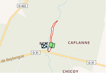

7 km | 7,9 km-effort

Pignada nous voilà


Kostenlosegpshiking-Anwendung
 SityTrail
IGN / Geografische Institute
SityTrail World
Die Welt öffnet sich für Sie
Tour Wandern von 879 m verfügbar auf Neu-Aquitanien, Landes, Rion-des-Landes. Diese Tour wird von les randonneurs rionnais vorgeschlagen.
- trajet aller par parcelles 1 & 2
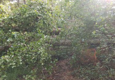
- retour hors parcelles Prit (chemin à nettoyer à la machine débrousailleuse et grand sécateur)
Wandern

Wandern
Wandern
Wandern
Wandern
Wandern
Wandern
Wandern
Wandern