![](/images/other/stat-length.png)
![Tour Wandern Clohars-Carnoët - Séjour 2024 GR 34 Le Pouldu camping Boucle Doelan - Photo](https://media.geolcdn.com/t/1900/400/ext.pjpeg?maxdim=2&url=https%3A%2F%2Fstatic1.geolcdn.com%2Fsiteimages%2Fupload%2Ffiles%2F1553511878bg_sport_marche.png)
Séjour 2024 GR 34 Le Pouldu camping Boucle Doelan
chessyca
Benutzer GUIDE
![Länge](/images/other/stat-length.png)
Länge
24 km
![Maximale Höhe](https://static1.geolcdn.com/siteimages/upload/files/1508320355ic_sort_altitude_max_24dp.png)
Maximale Höhe
51 m
![Positive Höhendifferenz](https://static1.geolcdn.com/siteimages/upload/files/1508320355ic_sort_den_pos_24dp.png)
Positive Höhendifferenz
254 m
![Km-Effort](/images/other/stat-length.png)
Km-Effort
27 km
![Min. Höhe](https://static1.geolcdn.com/siteimages/upload/files/1508320355ic_sort_altitude_min_24dp.png)
Min. Höhe
0 m
![Negative Höhendifferenz](https://static1.geolcdn.com/siteimages/upload/files/1508320355ic_sort_den_neg_24dp.png)
Negative Höhendifferenz
254 m
![Boucle](https://static1.geolcdn.com/siteimages/upload/files/16400158638029165_repeat_loop_refresh_sync_direction_icon.png)
Boucle
Ja
Erstellungsdatum :
2024-06-07 06:24:11.34
Letzte Änderung :
2024-06-09 15:39:32.915
![Wandern](https://static1.geolcdn.com/sitytour/trail-icons/101.png)
6h11
Schwierigkeit : Sehr leicht
![Scannen Sie diesen QR-Code, um die Tour in der SityTrail-Anwendung zu öffnen](https://capi.geolives.com/qq0zvz2zws4bq2lad0pu/sitytour/trails/4082931/qr.png?size=200)
Kostenlosegpshiking-Anwendung
Über SityTrail
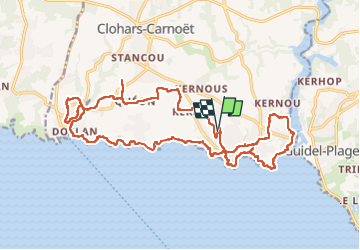
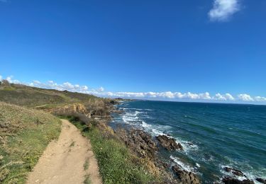
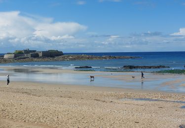
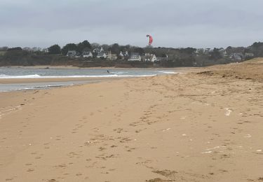
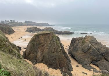
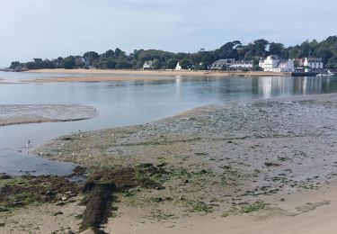
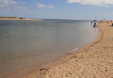
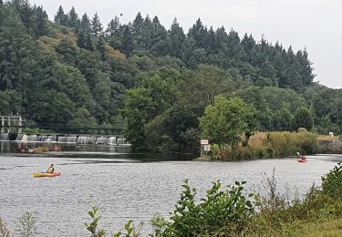
Tour Wandern von 24 km verfügbar auf Bretagne, Finistère, Clohars-Carnoët. Diese Tour wird von chessyca vorgeschlagen.
Beschreibung
Départ du camping du kérou et boucle sur le 34
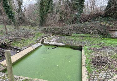
Attention dans la partie terre, de nombreux passages en propriété privée nécessitent un accord des propriétaires.
Les cartes ffr sont à mettre à jour
Ort
Land:
France
Region :
Bretagne
Abteilung/Provinz :
Finistère
Kommune :
Clohars-Carnoët
Standort:
Unknown
Gehen Sie:(Dec)
Gehen Sie:(UTM)
458225 ; 5291111 (30T) N.
Kommentare
Touren in der Umgebung
![Tour Wandern Clohars-Carnoët - Le Pouldu - Photo](https://media.geolcdn.com/t/375/260/1a38db66-97d5-4b5b-9eac-2a7eff6538ed.jpg&format=jpg&maxdim=2)
![Wandern Wandern](https://static1.geolcdn.com/sitytour/trail-icons/101.png)
![Tour Wandern Guidel - PR_56_Guidel_CA_03_Circuit3a_Autour-De-L-Etang-De-Lannenec_20240428 - Photo](https://media.geolcdn.com/t/375/260/6e0f082b-d9fc-4937-a2ef-b1992f251e56.jpg&format=jpg&maxdim=2)
![Wandern Wandern](https://static1.geolcdn.com/sitytour/trail-icons/101.png)
PR_56_Guidel_CA_03_Circuit3a_Autour-De-L-Etang-De-Lannenec_20240428
Wandern
Einfach
Guidel,
Bretagne,
Morbihan,
France
![](/images/other/stat-length.png)
10,2 km | 11,7 km-effort
2h 39min
![](https://static1.geolcdn.com/siteimages/upload/files/16400158638029165_repeat_loop_refresh_sync_direction_icon.png)
Nein
![Tour Wandern Guidel - Guidel plage 7,6 km - Photo](https://media.geolcdn.com/t/375/260/ea313e26-3f1c-4186-89bc-ac39bff3fa8a.jpg&format=jpg&maxdim=2)
![Wandern Wandern](https://static1.geolcdn.com/sitytour/trail-icons/101.png)
Guidel plage 7,6 km
Wandern
Einfach
Guidel,
Bretagne,
Morbihan,
France
![](/images/other/stat-length.png)
7,6 km | 8,5 km-effort
2h 11min
![](https://static1.geolcdn.com/siteimages/upload/files/16400158638029165_repeat_loop_refresh_sync_direction_icon.png)
Ja
![Tour Wandern Clohars-Carnoët - Pouldu port peintres 6,3 km - Photo](https://media.geolcdn.com/t/375/260/d878685e-3577-4835-a424-00b6066e1383.jpg&format=jpg&maxdim=2)
![Wandern Wandern](https://static1.geolcdn.com/sitytour/trail-icons/101.png)
Pouldu port peintres 6,3 km
Wandern
Einfach
Clohars-Carnoët,
Bretagne,
Finistère,
France
![](/images/other/stat-length.png)
6,3 km | 7,2 km-effort
2h 12min
![](https://static1.geolcdn.com/siteimages/upload/files/16400158638029165_repeat_loop_refresh_sync_direction_icon.png)
Ja
![Tour Wandern Clohars-Carnoët - Pouldu Roche Percée et retour 9,5 km - Photo](https://media.geolcdn.com/t/375/260/9c185896-328f-4e1d-8063-56e555ea4d34.jpg&format=jpg&maxdim=2)
![Wandern Wandern](https://static1.geolcdn.com/sitytour/trail-icons/101.png)
Pouldu Roche Percée et retour 9,5 km
Wandern
Medium
Clohars-Carnoët,
Bretagne,
Finistère,
France
![](/images/other/stat-length.png)
9,5 km | 10,7 km-effort
2h 46min
![](https://static1.geolcdn.com/siteimages/upload/files/16400158638029165_repeat_loop_refresh_sync_direction_icon.png)
Ja
![Tour Wandern Guidel - PR_56_Guidel_BA_02_Circuit3b_Entre-Loch-Et-Laita_20231004 - Photo](https://media.geolcdn.com/t/375/260/c4260127-a5b9-4007-9324-09ddf3ba24ca.jpg&format=jpg&maxdim=2)
![Wandern Wandern](https://static1.geolcdn.com/sitytour/trail-icons/101.png)
PR_56_Guidel_BA_02_Circuit3b_Entre-Loch-Et-Laita_20231004
Wandern
Einfach
Guidel,
Bretagne,
Morbihan,
France
![](/images/other/stat-length.png)
13,4 km | 15,7 km-effort
3h 34min
![](https://static1.geolcdn.com/siteimages/upload/files/16400158638029165_repeat_loop_refresh_sync_direction_icon.png)
Ja
![Tour Wandern Guidel - laita - Photo](https://media.geolcdn.com/t/375/260/d2fc7529-c784-40ff-828a-4079bf6b08e9.jpg&format=jpg&maxdim=2)
![Wandern Wandern](https://static1.geolcdn.com/sitytour/trail-icons/101.png)
![Tour Elektrofahrrad Clohars-Carnoët - Moelans Pontivy par les berges du Blavet - Photo](https://media.geolcdn.com/t/375/260/02b1cea7-157d-417f-bb92-c1bdb0f96c6e.jpg&format=jpg&maxdim=2)
![Elektrofahrrad Elektrofahrrad](https://static1.geolcdn.com/sitytour/trail-icons/205.png)
Moelans Pontivy par les berges du Blavet
Elektrofahrrad
Sehr leicht
Clohars-Carnoët,
Bretagne,
Finistère,
France
![](/images/other/stat-length.png)
81 km | 94 km-effort
4h 43min
![](https://static1.geolcdn.com/siteimages/upload/files/16400158638029165_repeat_loop_refresh_sync_direction_icon.png)
Nein
![Tour Wandern Guidel - PR_56_Guidel_AA_01_Circuit3b_Autour-Du-Loc'h_20220120 - Photo](https://media.geolcdn.com/t/375/260/d0aa8b77-81ab-4782-b792-dad3ac7c6e42.jpg&format=jpg&maxdim=2)
![Wandern Wandern](https://static1.geolcdn.com/sitytour/trail-icons/101.png)
PR_56_Guidel_AA_01_Circuit3b_Autour-Du-Loc'h_20220120
Wandern
Medium
Guidel,
Bretagne,
Morbihan,
France
![](/images/other/stat-length.png)
9,8 km | 11,2 km-effort
2h 16min
![](https://static1.geolcdn.com/siteimages/upload/files/16400158638029165_repeat_loop_refresh_sync_direction_icon.png)
Ja