![](/images/other/stat-length.png)
![Tour Wandern Mazet-Saint-Voy - Le Mazet HL Tour du Lizieux J2 - Photo](https://media.geolcdn.com/t/1900/400/ext.pjpeg?maxdim=2&url=https%3A%2F%2Fstatic1.geolcdn.com%2Fsiteimages%2Fupload%2Ffiles%2F1553511878bg_sport_marche.png)
Le Mazet HL Tour du Lizieux J2
pascalmilpas
Benutzer
![Länge](/images/other/stat-length.png)
Länge
15,4 km
![Maximale Höhe](https://static1.geolcdn.com/siteimages/upload/files/1508320355ic_sort_altitude_max_24dp.png)
Maximale Höhe
1375 m
![Positive Höhendifferenz](https://static1.geolcdn.com/siteimages/upload/files/1508320355ic_sort_den_pos_24dp.png)
Positive Höhendifferenz
428 m
![Km-Effort](/images/other/stat-length.png)
Km-Effort
21 km
![Min. Höhe](https://static1.geolcdn.com/siteimages/upload/files/1508320355ic_sort_altitude_min_24dp.png)
Min. Höhe
1012 m
![Negative Höhendifferenz](https://static1.geolcdn.com/siteimages/upload/files/1508320355ic_sort_den_neg_24dp.png)
Negative Höhendifferenz
432 m
![Boucle](https://static1.geolcdn.com/siteimages/upload/files/16400158638029165_repeat_loop_refresh_sync_direction_icon.png)
Boucle
Ja
Erstellungsdatum :
2024-05-29 07:42:35.428
Letzte Änderung :
2024-05-29 13:57:08.407
![Wandern](https://static1.geolcdn.com/sitytour/trail-icons/101.png)
5h43
Schwierigkeit : Sehr schwierig
![Scannen Sie diesen QR-Code, um die Tour in der SityTrail-Anwendung zu öffnen](https://capi.geolives.com/qq0zvz2zws4bq2lad0pu/sitytour/trails/4072471/qr.png?size=200)
Kostenlosegpshiking-Anwendung
Über SityTrail
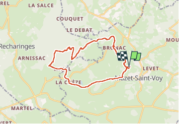
Tour Wandern von 15,4 km verfügbar auf Auvergne-Rhone-Alpen, Haute-Loire, Mazet-Saint-Voy. Diese Tour wird von pascalmilpas vorgeschlagen.
Beschreibung
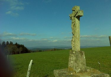
Boucle de 15 kms au départ de l'exceptionnelle Chapelle Saint Voy au dessus du Mazet
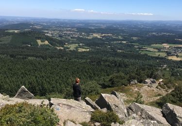
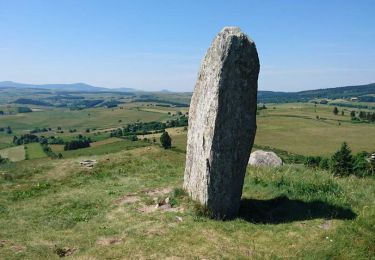
Montée au Lizieux tres raide par face NE
Descente un peu plus facile par face SO
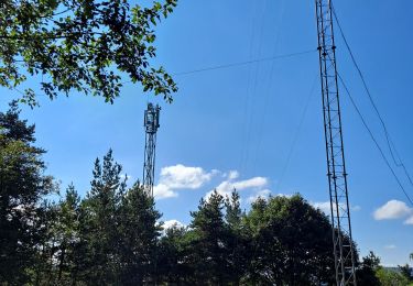
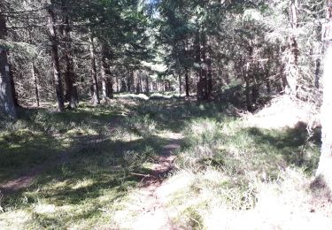
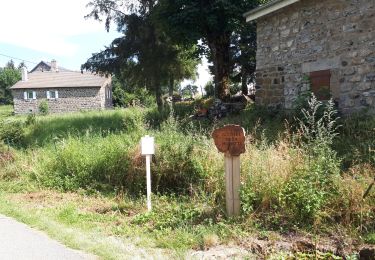
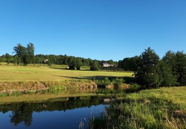
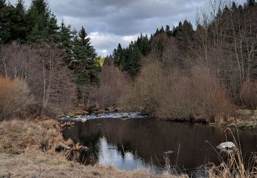
Beaux chemins, forêt splendide
Ort
Land:
France
Region :
Auvergne-Rhone-Alpen
Abteilung/Provinz :
Haute-Loire
Kommune :
Mazet-Saint-Voy
Standort:
Unknown
Gehen Sie:(Dec)
Gehen Sie:(UTM)
597502 ; 4989520 (31T) N.
Kommentare
Touren in der Umgebung
![Tour Wandern Araules - Suc de Lizieux - Photo](https://media.geolcdn.com/t/375/260/3244aa12-5792-460e-ba20-16eff7ba3ca0.jpg&format=jpg&maxdim=2)
![Wandern Wandern](https://static1.geolcdn.com/sitytour/trail-icons/101.png)
Suc de Lizieux
Wandern
Medium
Araules,
Auvergne-Rhone-Alpen,
Haute-Loire,
France
![](/images/other/stat-length.png)
4,6 km | 6,9 km-effort
1h 38min
![](https://static1.geolcdn.com/siteimages/upload/files/16400158638029165_repeat_loop_refresh_sync_direction_icon.png)
Ja
![Tour Wandern Mazet-Saint-Voy - Volamont - Photo](https://media.geolcdn.com/t/375/260/c9dbf91a-f16e-4cab-801b-bd884d3b8b0a.jpg&format=jpg&maxdim=2)
![Wandern Wandern](https://static1.geolcdn.com/sitytour/trail-icons/101.png)
Volamont
Wandern
Einfach
Mazet-Saint-Voy,
Auvergne-Rhone-Alpen,
Haute-Loire,
France
![](/images/other/stat-length.png)
5 km | 6,7 km-effort
2h 32min
![](https://static1.geolcdn.com/siteimages/upload/files/16400158638029165_repeat_loop_refresh_sync_direction_icon.png)
Ja
![Tour Wandern Araules - le sentier de Bonas - Photo](https://media.geolcdn.com/t/375/260/d68ee2be-74cb-4667-89e5-08e6c8a501e3.jpg&format=jpg&maxdim=2)
![Wandern Wandern](https://static1.geolcdn.com/sitytour/trail-icons/101.png)
le sentier de Bonas
Wandern
Einfach
Araules,
Auvergne-Rhone-Alpen,
Haute-Loire,
France
![](/images/other/stat-length.png)
6,8 km | 9,5 km-effort
1h 57min
![](https://static1.geolcdn.com/siteimages/upload/files/16400158638029165_repeat_loop_refresh_sync_direction_icon.png)
Ja
![Tour Wandern Les Vastres - Villelonge-Les Vastres PR - Photo](https://media.geolcdn.com/t/375/260/5deb3f17-9dda-4268-91eb-d498c615cc80.jpg&format=jpg&maxdim=2)
![Wandern Wandern](https://static1.geolcdn.com/sitytour/trail-icons/101.png)
Villelonge-Les Vastres PR
Wandern
Sehr leicht
Les Vastres,
Auvergne-Rhone-Alpen,
Haute-Loire,
France
![](/images/other/stat-length.png)
14 km | 17 km-effort
3h 47min
![](https://static1.geolcdn.com/siteimages/upload/files/16400158638029165_repeat_loop_refresh_sync_direction_icon.png)
Nein
![Tour Wandern Mazet-Saint-Voy - Baignade du moulin de Boyer - Photo](https://media.geolcdn.com/t/375/260/af6c2a74-4729-449d-ba55-588030a8ac48.jpg&format=jpg&maxdim=2)
![Wandern Wandern](https://static1.geolcdn.com/sitytour/trail-icons/101.png)
Baignade du moulin de Boyer
Wandern
Sehr leicht
Mazet-Saint-Voy,
Auvergne-Rhone-Alpen,
Haute-Loire,
France
![](/images/other/stat-length.png)
3,7 km | 4,8 km-effort
1h 29min
![](https://static1.geolcdn.com/siteimages/upload/files/16400158638029165_repeat_loop_refresh_sync_direction_icon.png)
Ja
![Tour Wandern Araules - Tence-170620 - PicLisieux - Photo](https://media.geolcdn.com/t/375/260/ext.jpg?maxdim=2&url=https%3A%2F%2Fservices.sitytrail.com%2FGeolivesWS%2FDownloadMedia.ashx%3FTrailID%3D776323%26Media%3D23dfef1f-c30a-4947-bbbf-c2a486ff054a.jpg)
![Wandern Wandern](https://static1.geolcdn.com/sitytour/trail-icons/101.png)
Tence-170620 - PicLisieux
Wandern
Medium
Araules,
Auvergne-Rhone-Alpen,
Haute-Loire,
France
![](/images/other/stat-length.png)
5,2 km | 7,6 km-effort
1h 50min
![](https://static1.geolcdn.com/siteimages/upload/files/16400158638029165_repeat_loop_refresh_sync_direction_icon.png)
Ja
![Tour Mountainbike Saint-Jeures - Les champs de St Jeures - Photo](https://media.geolcdn.com/t/375/260/ext.jpg?maxdim=2&url=https%3A%2F%2Fservices.sitytrail.com%2FGeolivesWS%2FDownloadMedia.ashx%3FTrailID%3D129689%26Media%3D13222_4.jpg)
![Mountainbike Mountainbike](https://static1.geolcdn.com/sitytour/trail-icons/202.png)
Les champs de St Jeures
Mountainbike
Einfach
Saint-Jeures,
Auvergne-Rhone-Alpen,
Haute-Loire,
France
![](/images/other/stat-length.png)
11,6 km | 15,2 km-effort
1h 30min
![](https://static1.geolcdn.com/siteimages/upload/files/16400158638029165_repeat_loop_refresh_sync_direction_icon.png)
Ja
![Tour Wandern Saint-Jeures - Les champs de St Jeures - Photo](https://media.geolcdn.com/t/375/260/ext.jpg?maxdim=2&url=https%3A%2F%2Fservices.sitytrail.com%2FGeolivesWS%2FDownloadMedia.ashx%3FTrailID%3D129688%26Media%3D13222_4.jpg)
![Wandern Wandern](https://static1.geolcdn.com/sitytour/trail-icons/101.png)
Les champs de St Jeures
Wandern
Einfach
Saint-Jeures,
Auvergne-Rhone-Alpen,
Haute-Loire,
France
![](/images/other/stat-length.png)
11,6 km | 15,2 km-effort
2h 30min
![](https://static1.geolcdn.com/siteimages/upload/files/16400158638029165_repeat_loop_refresh_sync_direction_icon.png)
Ja
![Tour Wandern Mazet-Saint-Voy - Salettes et Mazalibran - Photo](https://media.geolcdn.com/t/375/260/42cfbe72-4434-4356-970f-aa668c703a3b.jpg&format=jpg&maxdim=2)
![Wandern Wandern](https://static1.geolcdn.com/sitytour/trail-icons/101.png)
Salettes et Mazalibran
Wandern
Medium
Mazet-Saint-Voy,
Auvergne-Rhone-Alpen,
Haute-Loire,
France
![](/images/other/stat-length.png)
8,8 km | 11,9 km-effort
2h 30min
![](https://static1.geolcdn.com/siteimages/upload/files/16400158638029165_repeat_loop_refresh_sync_direction_icon.png)
Ja