


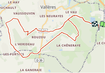

4,9 km | 5,7 km-effort


Benutzer


Kostenlosegpshiking-Anwendung
 SityTrail
IGN / Geografische Institute
SityTrail World
Die Welt öffnet sich für Sie
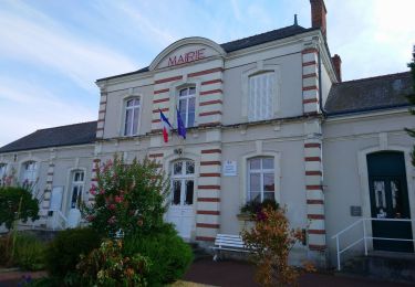
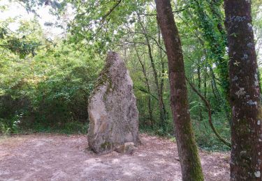
Tour Reiten von 13,7 km verfügbar auf Zentrum-Loiretal, Indre-et-Loire. Diese Tour wird von roi vorgeschlagen.
Rando seule. Bcp de chemin. De forêt. Des superbes lignes pour de l’allure. Passe à côté du ball-trap. Que des chemins connus mais agréables.

Wandern
Wandern
Wandern

Wandern

Wandern

Wandern
Wandern
Wandern
Wandern