


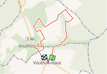

7,7 km | 9,3 km-effort

Benutzer


Kostenlosegpshiking-Anwendung
 SityTrail
IGN / Geografische Institute
SityTrail World
Die Welt öffnet sich für Sie
Tour Wandern von 8,2 km verfügbar auf Großer Osten, Meuse, Vouthon-Haut. Diese Tour wird von CDSM 55 vorgeschlagen.
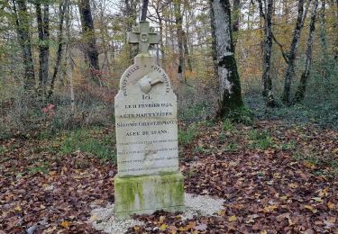
Au départ de Vouthon Haut pour une visite au monument entre les deux Vouthon d'Isabelle de Vouthon, dite Romée mère de Jeanne d'Arc et dans le bois du Saussy, une autre martyre, la stèle de Sidonie Collot à sa mémoire et enterrée au cimetière d'Amanty


Wandern
Wandern
Wandern
Wandern

Wandern

Mountainbike
Mountainbike
Wandern
Rennrad
une belle base pour commencer