![](/images/other/stat-length.png)
![Tour Wandern Grand'Rivière - martinique : grand rivière - anse couleuvre - Photo](https://media.geolcdn.com/t/1900/400/ext.pjpeg?maxdim=2&url=https%3A%2F%2Fstatic1.geolcdn.com%2Fsiteimages%2Fupload%2Ffiles%2F1553511878bg_sport_marche.png)
martinique : grand rivière - anse couleuvre
lebarbe_b@hotmail.fr
Benutzer
![Länge](/images/other/stat-length.png)
Länge
16,1 km
![Maximale Höhe](https://static1.geolcdn.com/siteimages/upload/files/1508320355ic_sort_altitude_max_24dp.png)
Maximale Höhe
369 m
![Positive Höhendifferenz](https://static1.geolcdn.com/siteimages/upload/files/1508320355ic_sort_den_pos_24dp.png)
Positive Höhendifferenz
932 m
![Km-Effort](/images/other/stat-length.png)
Km-Effort
28 km
![Min. Höhe](https://static1.geolcdn.com/siteimages/upload/files/1508320355ic_sort_altitude_min_24dp.png)
Min. Höhe
0 m
![Negative Höhendifferenz](https://static1.geolcdn.com/siteimages/upload/files/1508320355ic_sort_den_neg_24dp.png)
Negative Höhendifferenz
915 m
![Boucle](https://static1.geolcdn.com/siteimages/upload/files/16400158638029165_repeat_loop_refresh_sync_direction_icon.png)
Boucle
Nein
Erstellungsdatum :
2024-04-30 12:34:05.479
Letzte Änderung :
2024-04-30 21:40:29.897
![Wandern](https://static1.geolcdn.com/sitytour/trail-icons/101.png)
4h18
Schwierigkeit : Medium
![Scannen Sie diesen QR-Code, um die Tour in der SityTrail-Anwendung zu öffnen](https://capi.geolives.com/qq0zvz2zws4bq2lad0pu/sitytour/trails/4035430/qr.png?size=200)
Kostenlosegpshiking-Anwendung
Über SityTrail
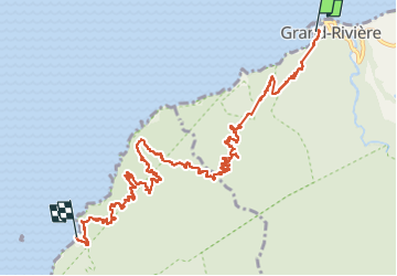
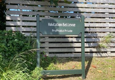
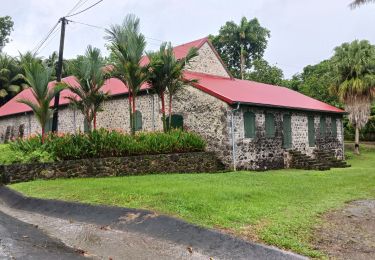
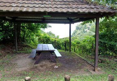
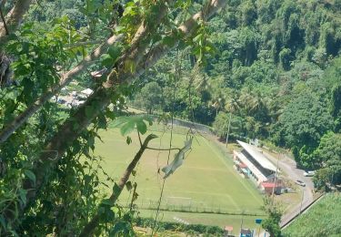
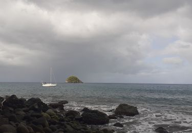
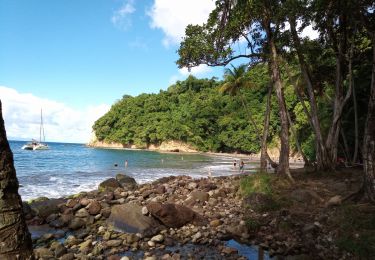
Tour Wandern von 16,1 km verfügbar auf Martinique, Unbekannt, Grand'Rivière. Diese Tour wird von lebarbe_b@hotmail.fr vorgeschlagen.
Beschreibung
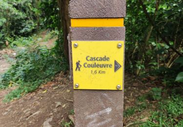
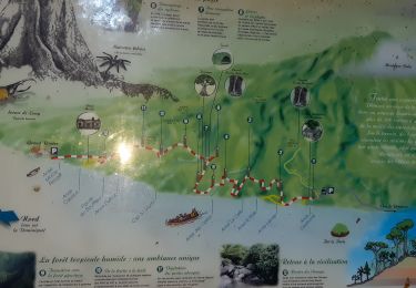
aller pêcheur omer couleuvre -grand riviere
trajet 15 km sans difficultés particulieres
prévoir 2 -3 l' eau mini
Ort
Land:
France
Region :
Martinique
Abteilung/Provinz :
Unbekannt
Kommune :
Grand'Rivière
Standort:
Unknown
Gehen Sie:(Dec)
Gehen Sie:(UTM)
695599 ; 1645113 (20P) N.
Kommentare
Touren in der Umgebung
![Tour Wandern Le Prêcheur - Cascade de l'anse Couleuvre, depuis anse Céron en aller-retour ! - Photo](https://media.geolcdn.com/t/375/260/ff48832d-783c-4c07-9e47-af4b338818d4.jpg&format=jpg&maxdim=2)
![Wandern Wandern](https://static1.geolcdn.com/sitytour/trail-icons/101.png)
Cascade de l'anse Couleuvre, depuis anse Céron en aller-retour !
Wandern
Schwierig
(1)
Le Prêcheur,
Martinique,
Unbekannt,
France
![](/images/other/stat-length.png)
3,6 km | 7,2 km-effort
2h 0min
![](https://static1.geolcdn.com/siteimages/upload/files/16400158638029165_repeat_loop_refresh_sync_direction_icon.png)
Nein
![Tour Wandern Grand'Rivière - Boucle Malakoff - Grand-Riviere - Photo](https://media.geolcdn.com/t/375/260/ac668fce-59c4-46c5-9559-31e72441e5de.jpg&format=jpg&maxdim=2)
![Wandern Wandern](https://static1.geolcdn.com/sitytour/trail-icons/101.png)
Boucle Malakoff - Grand-Riviere
Wandern
Medium
Grand'Rivière,
Martinique,
Unbekannt,
France
![](/images/other/stat-length.png)
9,2 km | 13,9 km-effort
5h 56min
![](https://static1.geolcdn.com/siteimages/upload/files/16400158638029165_repeat_loop_refresh_sync_direction_icon.png)
Ja
![Tour Wandern Le Prêcheur - Traces des Anses - Photo](https://media.geolcdn.com/t/375/260/4d197444-d36c-4b2a-9067-e0613a54cd7e.jpg&format=jpg&maxdim=2)
![Wandern Wandern](https://static1.geolcdn.com/sitytour/trail-icons/101.png)
Traces des Anses
Wandern
Einfach
Le Prêcheur,
Martinique,
Unbekannt,
France
![](/images/other/stat-length.png)
4,7 km | 7,2 km-effort
2h 0min
![](https://static1.geolcdn.com/siteimages/upload/files/16400158638029165_repeat_loop_refresh_sync_direction_icon.png)
Ja
![Tour sport Macouba - Boucle Macouba (habitation Bellevue) - Photo](https://media.geolcdn.com/t/375/260/3626c4e3-2e17-4d1d-84a9-6fddff1152eb.jpg&format=jpg&maxdim=2)
Boucle Macouba (habitation Bellevue)
sport
Sehr leicht
Macouba,
Martinique,
Unbekannt,
France
![](/images/other/stat-length.png)
6,3 km | 8,9 km-effort
Unbekannt
![](https://static1.geolcdn.com/siteimages/upload/files/16400158638029165_repeat_loop_refresh_sync_direction_icon.png)
Ja
![Tour Wandern Macouba - Boucle Macouba 3 - Photo](https://media.geolcdn.com/t/375/260/3f6ece05-8d1d-40e9-a775-58018ef6d410.jpg&format=jpg&maxdim=2)
![Wandern Wandern](https://static1.geolcdn.com/sitytour/trail-icons/101.png)
Boucle Macouba 3
Wandern
Medium
Macouba,
Martinique,
Unbekannt,
France
![](/images/other/stat-length.png)
10,6 km | 15,2 km-effort
4h 8min
![](https://static1.geolcdn.com/siteimages/upload/files/16400158638029165_repeat_loop_refresh_sync_direction_icon.png)
Ja
![Tour Wandern Grand'Rivière - PRÊCHEUR - PRÊCHEUR - Photo](https://media.geolcdn.com/t/375/260/0278fcc5-cf33-4ac9-8463-a9031b62d3ff.jpg&format=jpg&maxdim=2)
![Wandern Wandern](https://static1.geolcdn.com/sitytour/trail-icons/101.png)
PRÊCHEUR - PRÊCHEUR
Wandern
Schwierig
Grand'Rivière,
Martinique,
Unbekannt,
France
![](/images/other/stat-length.png)
6,5 km | 11,8 km-effort
2h 6min
![](https://static1.geolcdn.com/siteimages/upload/files/16400158638029165_repeat_loop_refresh_sync_direction_icon.png)
Ja
![Tour Wandern Grand'Rivière - Grand Rivière/boucle de fond potiche - Photo](https://media.geolcdn.com/t/375/260/7797c9ed-c4c4-4527-beed-488b970a4c51.jpg&format=jpg&maxdim=2)
![Wandern Wandern](https://static1.geolcdn.com/sitytour/trail-icons/101.png)
Grand Rivière/boucle de fond potiche
Wandern
Medium
Grand'Rivière,
Martinique,
Unbekannt,
France
![](/images/other/stat-length.png)
6 km | 8,6 km-effort
2h 43min
![](https://static1.geolcdn.com/siteimages/upload/files/16400158638029165_repeat_loop_refresh_sync_direction_icon.png)
Ja
![Tour Wandern Le Prêcheur - Anse couleuvre Grand Rivière - Photo](https://media.geolcdn.com/t/375/260/8a9ab88b-af19-4f18-8759-0b49cb1a1f91.jpg&format=jpg&maxdim=2)
![Wandern Wandern](https://static1.geolcdn.com/sitytour/trail-icons/101.png)
Anse couleuvre Grand Rivière
Wandern
Sehr schwierig
Le Prêcheur,
Martinique,
Unbekannt,
France
![](/images/other/stat-length.png)
15,8 km | 28 km-effort
6h 0min
![](https://static1.geolcdn.com/siteimages/upload/files/16400158638029165_repeat_loop_refresh_sync_direction_icon.png)
Nein
![Tour Wandern Le Prêcheur - Cascade Couleuvre - Photo](https://media.geolcdn.com/t/375/260/12703f70-97a6-4c73-afea-ac5ba35ae2e8.jpg&format=jpg&maxdim=2)
![Wandern Wandern](https://static1.geolcdn.com/sitytour/trail-icons/101.png)
Cascade Couleuvre
Wandern
Sehr leicht
Le Prêcheur,
Martinique,
Unbekannt,
France
![](/images/other/stat-length.png)
5,9 km | 10,1 km-effort
6h 1min
![](https://static1.geolcdn.com/siteimages/upload/files/16400158638029165_repeat_loop_refresh_sync_direction_icon.png)
Ja