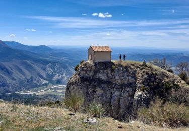
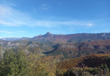
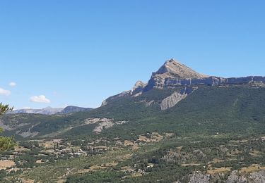
Tour Reiten Digne-les-Bains - digne_gap_oct-2023 - Photo
 aeldin
aeldin

Benutzer

© OpenStreetMap contributors
Länge
Länge
132 km
Maximale Höhe
Maximale Höhe
1041 m
Positive Höhendifferenz
3301 m
Km-Effort
Km-Effort  
176 km
Min. Höhe
Min. Höhe
423 m
Negative Höhendifferenz
3183 m
Boucle
Boucle
Nein
Erstellungsdatum :
2024-04-26 09:07:26.303
Letzte Änderung :
2024-09-16 20:21:40.996

(0 Nachricht)

Reiten
Reiten
23h06
Schwierigkeit : Sehr schwierig

Scannen Sie diesen QR-Code, um die Tour in der SityTrail-Anwendung zu öffnen

Kostenlosegpshiking-Anwendung

Logo SityTrail SityTrail

IGN / Geografische Institute

SityTrail aus dem App Store herunterladen SityTrail von Google Play herunterladen

Logo SityTrail SityTrail World

Die Welt öffnet sich für Sie

SityTrail aus dem App Store herunterladen SityTrail von Google Play herunterladen SityTrail auf Huawei AppGallery herunterladen

Über SityTrail

Tour Reiten von 132 km verfügbar auf Provence-Alpes-Côte d'Azur, Alpes-de-Haute-Provence, Digne-les-Bains. Diese Tour wird von aeldin vorgeschlagen.

Höhenprofil

POIs

POI Digne-les-Bains - Camping les Eaux Chaudes - Photo
aeldin
DIGNE-LES-BAINS 
POI Digne-les-Bains - Accueil chevaux chez Michel - Photo
aeldin
POI Mirabeau - L'Estival - Photo
aeldin
MIRABEAU 
POI Volonne - Camping L'Hippocampe - Photo
aeldin
POI Val-Buëch-Méouge - Ecuries Le Peyron - Photo
aeldin
VAL-BUËCH-MÉOUGE 
POI Val-Buëch-Méouge - Le bar du Nord - Photo
aeldin
VAL-BUËCH-MÉOUGE 
POI Val-Buëch-Méouge - Gîte les Iscles - Photo
aeldin
VAL-BUËCH-MÉOUGE 
POI Val-Buëch-Méouge - Gîte du Boissillon - Photo
aeldin
VAL-BUËCH-MÉOUGE 
POI Ventavon - Le Relais du Terrail - Photo
aeldin
POI La Saulce - Le Petit Chariot - Photo
aeldin
LA SAULCE 
POI Gap - Variante Alex - Photo
aeldin

Ort

Land:
France
Region :
Provence-Alpes-Côte d'Azur
Abteilung/Provinz :
Alpes-de-Haute-Provence
Kommune :
Digne-les-Bains
Standort:
Unknown
Gehen Sie:(UTM)
278271 ; 4885628 (32T) N.

Touren in der Umgebung

Tour Wandern Digne-les-Bains - Le Cousson - Photo
Wandern
GUIDE
Marco05

Wandern

Schwierig
(1)
Digne-les-Bains, Provence-Alpes-Côte d'Azur, Alpes-de-Haute-Provence, France
15,4 km | 29 km-effort
6h 39min
Ja
Tour Wandern Digne-les-Bains - Autour de Courbons - Digne les Bains - Photo
Wandern
tracegps

Wandern

Medium
(1)
Digne-les-Bains, Provence-Alpes-Côte d'Azur, Alpes-de-Haute-Provence, France
12,6 km | 18,4 km-effort
5h 0min
Ja
Tour Wandern Digne-les-Bains - Chapelle St Pancrace 18.11.23 - Photo
Wandern
GUIDE
fredetpascale

Wandern

Einfach
Digne-les-Bains, Provence-Alpes-Côte d'Azur, Alpes-de-Haute-Provence, France
5,2 km | 8,3 km-effort
1h 50min
Ja
Tour Wandern Digne-les-Bains - 65bis-Digne- Cousson N et S- Caramantran- Digne  - Photo
Wandern
dumotier

Wandern

Medium
(1)
Digne-les-Bains, Provence-Alpes-Côte d'Azur, Alpes-de-Haute-Provence, France
17,4 km | 32 km-effort
3h 49min
Ja
Tour Mountainbike Digne-les-Bains - Terres Noires 2011 (50km) - Photo
Mountainbike
tracegps

Mountainbike

Schwierig
(2)
Digne-les-Bains, Provence-Alpes-Côte d'Azur, Alpes-de-Haute-Provence, France
46 km | 63 km-effort
5h 0min
Ja
Tour Wandern Entrages - Tour du Cousson - Photo
Wandern
Migueldefrance

Wandern

Medium
Entrages, Provence-Alpes-Côte d'Azur, Alpes-de-Haute-Provence, France
12,6 km | 22 km-effort
6h 19min
Ja
Tour Wandern Marcoux - Marcoux crete de liman 950m 15kms  - Photo
Wandern
GUIDE
Danielba

Wandern

Medium
Marcoux, Provence-Alpes-Côte d'Azur, Alpes-de-Haute-Provence, France
14,7 km | 25 km-effort
7h 31min
Nein
Tour Wandern Entrages - Le Cousson 19.11.23 - Photo
Wandern
GUIDE
fredetpascale

Wandern

Medium
Entrages, Provence-Alpes-Côte d'Azur, Alpes-de-Haute-Provence, France
12,5 km | 22 km-effort
4h 30min
Ja
Tour Wandern Digne-les-Bains - Rando Col de Peipin Courbons - Photo
Wandern
Marchopier

Wandern

Medium
Digne-les-Bains, Provence-Alpes-Côte d'Azur, Alpes-de-Haute-Provence, France
18,5 km | 27 km-effort
5h 55min
Ja


Schließen
Meine Abonnements