![](/images/other/stat-length.png)
![Tour Wandern Estagel - ESTAGEL Chapelle St Laurent MARDI FAIT - Photo](https://media.geolcdn.com/t/1900/400/14957312-1764-401b-980d-e06b9de6af18.jpg&format=pjpeg&maxdim=2)
ESTAGEL Chapelle St Laurent MARDI FAIT
MarcOBRECHT
Benutzer
![Länge](/images/other/stat-length.png)
![Maximale Höhe](https://static1.geolcdn.com/siteimages/upload/files/1508320355ic_sort_altitude_max_24dp.png)
![Positive Höhendifferenz](https://static1.geolcdn.com/siteimages/upload/files/1508320355ic_sort_den_pos_24dp.png)
![Km-Effort](/images/other/stat-length.png)
![Min. Höhe](https://static1.geolcdn.com/siteimages/upload/files/1508320355ic_sort_altitude_min_24dp.png)
![Negative Höhendifferenz](https://static1.geolcdn.com/siteimages/upload/files/1508320355ic_sort_den_neg_24dp.png)
![Boucle](https://static1.geolcdn.com/siteimages/upload/files/16400158638029165_repeat_loop_refresh_sync_direction_icon.png)
![Wandern](https://static1.geolcdn.com/sitytour/trail-icons/101.png)
3h26
Schwierigkeit : Medium
![Scannen Sie diesen QR-Code, um die Tour in der SityTrail-Anwendung zu öffnen](https://capi.geolives.com/qq0zvz2zws4bq2lad0pu/sitytour/trails/4024456/qr.png?size=200)
Kostenlosegpshiking-Anwendung
Über SityTrail
Tour Wandern von 12,2 km verfügbar auf Okzitanien, Ostpyrenäen, Estagel. Diese Tour wird von MarcOBRECHT vorgeschlagen.
Beschreibung
Départ parking place De Gaulle, tilleuls.
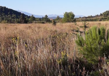
Partir par église puis rue Sauvy, bd Victor Hugo, Michelet, route de Montner.
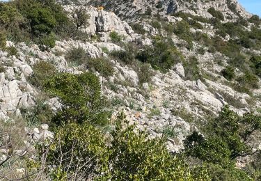
El Linas, montée sur colline avec vue sur Montner et Força Réal.
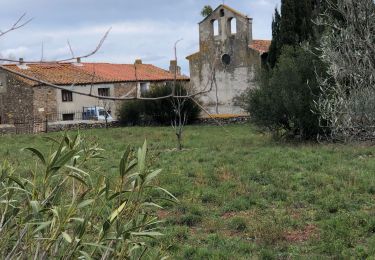
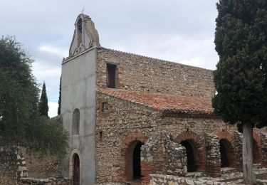
Descente dans correc, sentier balisé, route, puis suivre Chapelle St Laurent.
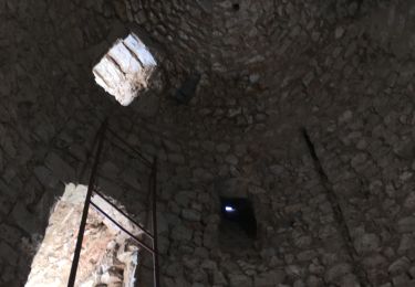
Arrive route, à gauche, carrière à dr jusqu'à sommet colline , descente par chapelle.
Ort
Kommentare
Touren in der Umgebung
![Tour Wandern Tautavel - Tautavel chemin des bacs - Photo](https://media.geolcdn.com/t/375/260/4347d338-087b-4ab9-a23d-b90780ad37c2.jpg&format=jpg&maxdim=2)
![Wandern Wandern](https://static1.geolcdn.com/sitytour/trail-icons/101.png)
Wandern
![](/images/other/stat-length.png)
![](https://static1.geolcdn.com/siteimages/upload/files/16400158638029165_repeat_loop_refresh_sync_direction_icon.png)
![Tour Wandern Montner - Montner Força Réal et château de Caladroy - Photo](https://media.geolcdn.com/t/375/260/00644a8b-4507-46ff-9b0c-bf2cb54055bf.jpg&format=jpg&maxdim=2)
![Wandern Wandern](https://static1.geolcdn.com/sitytour/trail-icons/101.png)
Wandern
![](/images/other/stat-length.png)
![](https://static1.geolcdn.com/siteimages/upload/files/16400158638029165_repeat_loop_refresh_sync_direction_icon.png)
![Tour Wandern Latour-de-France - Latour de France 08/12/2021 - Photo](https://media.geolcdn.com/t/375/260/645a3cd7-e5af-42b0-b7e0-83164582f13a.jpg&format=jpg&maxdim=2)
![Wandern Wandern](https://static1.geolcdn.com/sitytour/trail-icons/101.png)
Wandern
![](/images/other/stat-length.png)
![](https://static1.geolcdn.com/siteimages/upload/files/16400158638029165_repeat_loop_refresh_sync_direction_icon.png)
![Tour Wandern Tautavel - TAUTAVEL la Tour del Far A/R - Photo](https://media.geolcdn.com/t/375/260/7315cb9e-35b2-46c7-8732-adf6f85e9975.jpg&format=jpg&maxdim=2)
![Wandern Wandern](https://static1.geolcdn.com/sitytour/trail-icons/101.png)
Wandern
![](/images/other/stat-length.png)
![](https://static1.geolcdn.com/siteimages/upload/files/16400158638029165_repeat_loop_refresh_sync_direction_icon.png)
![Tour Wandern Tautavel - Tautavel -Torre del Far - Photo](https://media.geolcdn.com/t/375/260/f1e44f1c-1dc1-496a-9f67-a9c732e79842.jpg&format=jpg&maxdim=2)
![Wandern Wandern](https://static1.geolcdn.com/sitytour/trail-icons/101.png)
Wandern
![](/images/other/stat-length.png)
![](https://static1.geolcdn.com/siteimages/upload/files/16400158638029165_repeat_loop_refresh_sync_direction_icon.png)
![Tour Wandern Tautavel - La torre del far Tautavel - Photo](https://media.geolcdn.com/t/375/260/cad1b594-a886-41a2-af0e-3786c0c41b8c.jpg&format=jpg&maxdim=2)
![Wandern Wandern](https://static1.geolcdn.com/sitytour/trail-icons/101.png)
Wandern
![](/images/other/stat-length.png)
![](https://static1.geolcdn.com/siteimages/upload/files/16400158638029165_repeat_loop_refresh_sync_direction_icon.png)
![Tour Wandern Estagel - 20201216 Estagel - Calce - Photo](https://media.geolcdn.com/t/375/260/37828b1c-a727-4fa4-95e5-15b013f51adc.jpg&format=jpg&maxdim=2)
![Wandern Wandern](https://static1.geolcdn.com/sitytour/trail-icons/101.png)
Wandern
![](/images/other/stat-length.png)
![](https://static1.geolcdn.com/siteimages/upload/files/16400158638029165_repeat_loop_refresh_sync_direction_icon.png)
![Tour Wandern Tautavel - tautavel - Photo](https://media.geolcdn.com/t/375/260/f34f6986-d4b4-4e63-abd4-eb0d36e51368.jpg&format=jpg&maxdim=2)
![Wandern Wandern](https://static1.geolcdn.com/sitytour/trail-icons/101.png)
Wandern
![](/images/other/stat-length.png)
![](https://static1.geolcdn.com/siteimages/upload/files/16400158638029165_repeat_loop_refresh_sync_direction_icon.png)
![Tour Wandern Latour-de-France - 66 LATOUR-DE-FRANCE, visite du village, massif de Tourèze et vallée de l'Agly - Photo](https://media.geolcdn.com/t/375/260/ext.jpg?maxdim=2&url=https%3A%2F%2Fservices.sitytrail.com%2FGeolivesWS%2FDownloadMedia.ashx%3FTrailID%3D485378%26Media%3D20151023161024.jpg)
![Wandern Wandern](https://static1.geolcdn.com/sitytour/trail-icons/101.png)
Wandern
![](/images/other/stat-length.png)
![](https://static1.geolcdn.com/siteimages/upload/files/16400158638029165_repeat_loop_refresh_sync_direction_icon.png)