![](/images/other/stat-length.png)
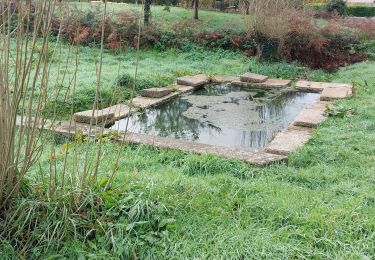
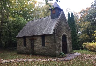
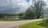
![Tour Wandern Brandivy - PR_56_Brandivy_AA_01_Circuit1b_Etang-De-La-Foret_20240417 - Photo](https://media.geolcdn.com/t/1900/400/f012be88-dcc5-4226-b968-d91382331630.jpg&format=pjpeg&maxdim=2)
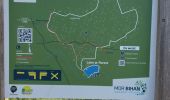
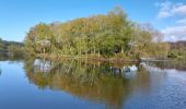
PR_56_Brandivy_AA_01_Circuit1b_Etang-De-La-Foret_20240417
patrickdanilo
Benutzer
![Länge](/images/other/stat-length.png)
Länge
9,8 km
![Maximale Höhe](https://static1.geolcdn.com/siteimages/upload/files/1508320355ic_sort_altitude_max_24dp.png)
Maximale Höhe
157 m
![Positive Höhendifferenz](https://static1.geolcdn.com/siteimages/upload/files/1508320355ic_sort_den_pos_24dp.png)
Positive Höhendifferenz
170 m
![Km-Effort](/images/other/stat-length.png)
Km-Effort
12,1 km
![Min. Höhe](https://static1.geolcdn.com/siteimages/upload/files/1508320355ic_sort_altitude_min_24dp.png)
Min. Höhe
43 m
![Negative Höhendifferenz](https://static1.geolcdn.com/siteimages/upload/files/1508320355ic_sort_den_neg_24dp.png)
Negative Höhendifferenz
169 m
![Boucle](https://static1.geolcdn.com/siteimages/upload/files/16400158638029165_repeat_loop_refresh_sync_direction_icon.png)
Boucle
Ja
Erstellungsdatum :
2024-04-17 07:43:48.476
Letzte Änderung :
2024-04-18 10:03:50.768
![Wandern](https://static1.geolcdn.com/sitytour/trail-icons/101.png)
2h00
Schwierigkeit : Einfach
![Scannen Sie diesen QR-Code, um die Tour in der SityTrail-Anwendung zu öffnen](https://capi.geolives.com/qq0zvz2zws4bq2lad0pu/sitytour/trails/4019481/qr.png?size=200)
Kostenlosegpshiking-Anwendung
Über SityTrail
Tour Wandern von 9,8 km verfügbar auf Bretagne, Morbihan, Brandivy. Diese Tour wird von patrickdanilo vorgeschlagen.
Beschreibung
Randonnée Marche de 9,8 km à découvrir à Bretagne, Morbihan, Brandivy. Cette randonnée est proposée par patrickdanilo.
Ort
Land:
France
Region :
Bretagne
Abteilung/Provinz :
Morbihan
Kommune :
Brandivy
Standort:
Unknown
Gehen Sie:(Dec)
Gehen Sie:(UTM)
506390 ; 5293491 (30T) N.
Kommentare
Touren in der Umgebung
![Tour Wandern Moustoir-Ac - PR_56_Moustoir-Ac_AA_01_Circuit1b_Au-Fil-De-L-Eau_20231014 - Photo](https://media.geolcdn.com/t/375/260/62c4e28a-3d63-4091-87cb-444e8bd5027a.jpg&format=jpg&maxdim=2)
![Wandern Wandern](https://static1.geolcdn.com/sitytour/trail-icons/101.png)
PR_56_Moustoir-Ac_AA_01_Circuit1b_Au-Fil-De-L-Eau_20231014
Wandern
Einfach
Moustoir-Ac,
Bretagne,
Morbihan,
France
![](/images/other/stat-length.png)
8,8 km | 10,6 km-effort
1h 51min
![](https://static1.geolcdn.com/siteimages/upload/files/16400158638029165_repeat_loop_refresh_sync_direction_icon.png)
Ja
![Tour Wandern Grand-Champ - PR_56_Grand-Champ_AA_01_Circuit1b_Tro-Gregam-10km_20221126 - Photo](https://media.geolcdn.com/t/375/260/308e3c8b-f9f7-4bb3-a1e1-042a275e2b0b.jpg&format=jpg&maxdim=2)
![Wandern Wandern](https://static1.geolcdn.com/sitytour/trail-icons/101.png)
PR_56_Grand-Champ_AA_01_Circuit1b_Tro-Gregam-10km_20221126
Wandern
Einfach
Grand-Champ,
Bretagne,
Morbihan,
France
![](/images/other/stat-length.png)
10,6 km | 12,3 km-effort
2h 18min
![](https://static1.geolcdn.com/siteimages/upload/files/16400158638029165_repeat_loop_refresh_sync_direction_icon.png)
Ja
![Tour Nordic Walking Grand-Champ - Ste Brigitte - Photo](https://media.geolcdn.com/t/375/260/681a2e4b-552f-4d97-95a0-370cd3c0eda9.jpg&format=jpg&maxdim=2)
![Nordic Walking Nordic Walking](https://static1.geolcdn.com/sitytour/trail-icons/102.png)
Ste Brigitte
Nordic Walking
Einfach
Grand-Champ,
Bretagne,
Morbihan,
France
![](/images/other/stat-length.png)
11,6 km | 13,7 km-effort
2h 56min
![](https://static1.geolcdn.com/siteimages/upload/files/16400158638029165_repeat_loop_refresh_sync_direction_icon.png)
Ja
![Tour Elektrofahrrad Pluvigner - Boucle dans la forêt de Florange à partir de Bieuzy Lanvaux - Photo](https://media.geolcdn.com/t/375/260/e95706c8-7099-4df3-a669-cb85bc5ffa79.jpg&format=jpg&maxdim=2)
![Elektrofahrrad Elektrofahrrad](https://static1.geolcdn.com/sitytour/trail-icons/205.png)
Boucle dans la forêt de Florange à partir de Bieuzy Lanvaux
Elektrofahrrad
Medium
(1)
Pluvigner,
Bretagne,
Morbihan,
France
![](/images/other/stat-length.png)
18,3 km | 23 km-effort
1h 38min
![](https://static1.geolcdn.com/siteimages/upload/files/16400158638029165_repeat_loop_refresh_sync_direction_icon.png)
Ja
![Tour Wandern Brandivy - Forêt de Floranges - Photo](https://media.geolcdn.com/t/375/260/ext.jpg?maxdim=2&url=https%3A%2F%2Fstatic1.geolcdn.com%2Fsiteimages%2Fupload%2Ffiles%2F1553511878bg_sport_marche.png)
![Wandern Wandern](https://static1.geolcdn.com/sitytour/trail-icons/101.png)
Forêt de Floranges
Wandern
Sehr leicht
(1)
Brandivy,
Bretagne,
Morbihan,
France
![](/images/other/stat-length.png)
6 km | 7,4 km-effort
1h 37min
![](https://static1.geolcdn.com/siteimages/upload/files/16400158638029165_repeat_loop_refresh_sync_direction_icon.png)
Ja
![Tour Wandern Grand-Champ - zer - Photo](https://media.geolcdn.com/t/375/260/7db17bf5-601e-4064-89f3-46e1cbe800fb.jpg&format=jpg&maxdim=2)
![Wandern Wandern](https://static1.geolcdn.com/sitytour/trail-icons/101.png)
zer
Wandern
Sehr schwierig
Grand-Champ,
Bretagne,
Morbihan,
France
![](/images/other/stat-length.png)
197 km | 213 km-effort
24h 0min
![](https://static1.geolcdn.com/siteimages/upload/files/16400158638029165_repeat_loop_refresh_sync_direction_icon.png)
Nein
![Tour sport Camors - M - Photo](https://media.geolcdn.com/t/375/260/ad7d5461-0e70-4f75-b943-b3472a85a1e9.jpg&format=jpg&maxdim=2)
![Tour Wandern Grand-Champ - Coran Champ - Photo](https://media.geolcdn.com/t/375/260/ext.jpg?maxdim=2&url=https%3A%2F%2Fstatic1.geolcdn.com%2Fsiteimages%2Fupload%2Ffiles%2F1553511878bg_sport_marche.png)
![Wandern Wandern](https://static1.geolcdn.com/sitytour/trail-icons/101.png)
Coran Champ
Wandern
Medium
Grand-Champ,
Bretagne,
Morbihan,
France
![](/images/other/stat-length.png)
9 km | 10,5 km-effort
2h 38min
![](https://static1.geolcdn.com/siteimages/upload/files/16400158638029165_repeat_loop_refresh_sync_direction_icon.png)
Nein
![Tour Zu Fuß Brandivy - Circuit de l'étang, Brandivy - Photo](https://media.geolcdn.com/t/375/260/ext.jpg?maxdim=2&url=https%3A%2F%2Fstatic1.geolcdn.com%2Fsiteimages%2Fupload%2Ffiles%2F1545311037marcheuse_200dpi.jpg)
![Zu Fuß Zu Fuß](https://static1.geolcdn.com/sitytour/trail-icons/100.png)
Circuit de l'étang, Brandivy
Zu Fuß
Sehr leicht
Brandivy,
Bretagne,
Morbihan,
France
![](/images/other/stat-length.png)
10 km | 12,6 km-effort
Unbekannt
![](https://static1.geolcdn.com/siteimages/upload/files/16400158638029165_repeat_loop_refresh_sync_direction_icon.png)
Ja