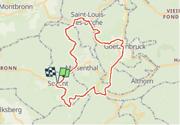
![](/images/other/stat-length.png)
![Tour Wandern Sucht - Soucht - sentier des Verriers - Photo](https://media.geolcdn.com/t/1900/400/558f5a0a-a9e5-4d8c-82af-b4a03431303e.jpg&format=pjpeg&maxdim=2)
Soucht - sentier des Verriers
Bart2015
Benutzer
![Länge](/images/other/stat-length.png)
![Maximale Höhe](https://static1.geolcdn.com/siteimages/upload/files/1508320355ic_sort_altitude_max_24dp.png)
![Positive Höhendifferenz](https://static1.geolcdn.com/siteimages/upload/files/1508320355ic_sort_den_pos_24dp.png)
![Km-Effort](/images/other/stat-length.png)
![Min. Höhe](https://static1.geolcdn.com/siteimages/upload/files/1508320355ic_sort_altitude_min_24dp.png)
![Negative Höhendifferenz](https://static1.geolcdn.com/siteimages/upload/files/1508320355ic_sort_den_neg_24dp.png)
![Boucle](https://static1.geolcdn.com/siteimages/upload/files/16400158638029165_repeat_loop_refresh_sync_direction_icon.png)
![Wandern](https://static1.geolcdn.com/sitytour/trail-icons/101.png)
5h18
Schwierigkeit : Sehr schwierig
![Scannen Sie diesen QR-Code, um die Tour in der SityTrail-Anwendung zu öffnen](https://capi.geolives.com/qq0zvz2zws4bq2lad0pu/sitytour/trails/4016086/qr.png?size=200)
Kostenlosegpshiking-Anwendung
Über SityTrail
Tour Wandern von 17,2 km verfügbar auf Großer Osten, Mosel, Sucht. Diese Tour wird von Bart2015 vorgeschlagen.
Beschreibung
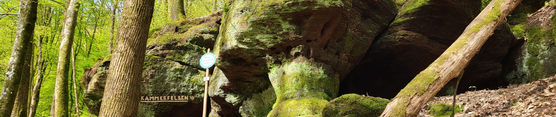
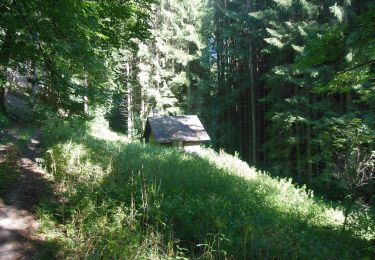
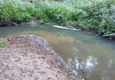
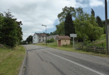
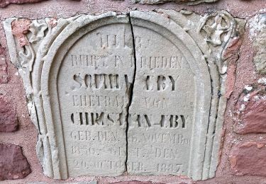
Belle randonnée dans de magnifiques forêts au travers de l'histoire des verreries. Une première partie dans l'histoire avec la petite grotte du Kammerfelsen, les Rochers Gravés, la pierre des 12 Apôtres. Passage par les villages de Goezenbruck, St Louis-les-Bitche et Meisenthal qui portent les métiers de la verrerie.
Bonne rando ...
Ort
Kommentare
Touren in der Umgebung
![Tour Wandern Münzthal-St.Louis - Saint-Louis-Lès-Bitche et le pays du verre et du cristal - Photo](https://media.geolcdn.com/t/375/260/ext.jpg?maxdim=2&url=https%3A%2F%2Fservices.sitytrail.com%2FGeolivesWS%2FDownloadMedia.ashx%3FTrailID%3D317570%26Media%3D16827_6.jpg)
![Wandern Wandern](https://static1.geolcdn.com/sitytour/trail-icons/101.png)
Wandern
![](/images/other/stat-length.png)
![](https://static1.geolcdn.com/siteimages/upload/files/16400158638029165_repeat_loop_refresh_sync_direction_icon.png)
![Tour Reiten Sucht - suuntoapp-HorsebackRiding-2024-11-10T08-15-44Z - Photo](https://media.geolcdn.com/t/375/260/d294c360-1d28-4f9f-ab80-3f1d986cc1d0.jpg&format=jpg&maxdim=2)
![Reiten Reiten](https://static1.geolcdn.com/sitytour/trail-icons/301.png)
Reiten
![](/images/other/stat-length.png)
![](https://static1.geolcdn.com/siteimages/upload/files/16400158638029165_repeat_loop_refresh_sync_direction_icon.png)
![Tour Reiten Sucht - suuntoapp-HorsebackRiding-2024-11-09T08-23-34Z - Photo](https://media.geolcdn.com/t/375/260/0bfc4fa4-827c-4487-84af-819b72092ea6.jpg&format=jpg&maxdim=2)
![Reiten Reiten](https://static1.geolcdn.com/sitytour/trail-icons/301.png)
Reiten
![](/images/other/stat-length.png)
![](https://static1.geolcdn.com/siteimages/upload/files/16400158638029165_repeat_loop_refresh_sync_direction_icon.png)
![Tour Zu Fuß Mombronn - Wegkreuze-Rundwanderweg #4 - Photo](https://media.geolcdn.com/t/375/260/a7b9a56e-05f0-4134-ac47-01c83168e22f.jpeg&format=jpg&maxdim=2)
![Zu Fuß Zu Fuß](https://static1.geolcdn.com/sitytour/trail-icons/100.png)
Zu Fuß
![](/images/other/stat-length.png)
![](https://static1.geolcdn.com/siteimages/upload/files/16400158638029165_repeat_loop_refresh_sync_direction_icon.png)
![Tour Zu Fuß Butten - Anneau bleu - Photo](https://media.geolcdn.com/t/375/260/81231655-9cac-4d3c-8b6a-5b23a7072ecc.jpeg&format=jpg&maxdim=2)
![Zu Fuß Zu Fuß](https://static1.geolcdn.com/sitytour/trail-icons/100.png)
Zu Fuß
![](/images/other/stat-length.png)
![](https://static1.geolcdn.com/siteimages/upload/files/16400158638029165_repeat_loop_refresh_sync_direction_icon.png)
![Tour Zu Fuß Butten - Anneau rouge - Photo](https://media.geolcdn.com/t/375/260/81231655-9cac-4d3c-8b6a-5b23a7072ecc.jpeg&format=jpg&maxdim=2)
![Zu Fuß Zu Fuß](https://static1.geolcdn.com/sitytour/trail-icons/100.png)
Zu Fuß
![](/images/other/stat-length.png)
![](https://static1.geolcdn.com/siteimages/upload/files/16400158638029165_repeat_loop_refresh_sync_direction_icon.png)
![Tour Zu Fuß Volksberg - Losange vert - Photo](https://media.geolcdn.com/t/375/260/40af32f9-2f69-4f07-9a93-cacfd66f615c.jpeg&format=jpg&maxdim=2)
![Zu Fuß Zu Fuß](https://static1.geolcdn.com/sitytour/trail-icons/100.png)
Zu Fuß
![](/images/other/stat-length.png)
![](https://static1.geolcdn.com/siteimages/upload/files/16400158638029165_repeat_loop_refresh_sync_direction_icon.png)
![Tour Zu Fuß Volksberg - Anneau vert - Photo](https://media.geolcdn.com/t/375/260/e2590e39-af6c-4003-9899-64cc7064b496.jpeg&format=jpg&maxdim=2)
![Zu Fuß Zu Fuß](https://static1.geolcdn.com/sitytour/trail-icons/100.png)
Zu Fuß
![](/images/other/stat-length.png)
![](https://static1.geolcdn.com/siteimages/upload/files/16400158638029165_repeat_loop_refresh_sync_direction_icon.png)
![Tour Zu Fuß Puberg - Disque vert - Photo](https://media.geolcdn.com/t/375/260/038b5fbd-ad7d-4d8f-a6b9-4f60e8eebeb8.jpeg&format=jpg&maxdim=2)
![Zu Fuß Zu Fuß](https://static1.geolcdn.com/sitytour/trail-icons/100.png)
Zu Fuß
![](/images/other/stat-length.png)
![](https://static1.geolcdn.com/siteimages/upload/files/16400158638029165_repeat_loop_refresh_sync_direction_icon.png)