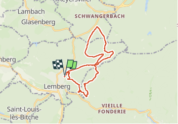
![](/images/other/stat-length.png)
![Tour Wandern Lemberg - Lemberg - cascade des Ondines - sentiers des grottes et des étangs - Photo](https://media.geolcdn.com/t/1900/400/92bd7652-38a6-4154-9756-74f2145e4ba4.jpg&format=pjpeg&maxdim=2)
Lemberg - cascade des Ondines - sentiers des grottes et des étangs
Bart2015
Benutzer
![Länge](/images/other/stat-length.png)
![Maximale Höhe](https://static1.geolcdn.com/siteimages/upload/files/1508320355ic_sort_altitude_max_24dp.png)
![Positive Höhendifferenz](https://static1.geolcdn.com/siteimages/upload/files/1508320355ic_sort_den_pos_24dp.png)
![Km-Effort](/images/other/stat-length.png)
![Min. Höhe](https://static1.geolcdn.com/siteimages/upload/files/1508320355ic_sort_altitude_min_24dp.png)
![Negative Höhendifferenz](https://static1.geolcdn.com/siteimages/upload/files/1508320355ic_sort_den_neg_24dp.png)
![Boucle](https://static1.geolcdn.com/siteimages/upload/files/16400158638029165_repeat_loop_refresh_sync_direction_icon.png)
![Wandern](https://static1.geolcdn.com/sitytour/trail-icons/101.png)
4h20
Schwierigkeit : Sehr schwierig
![Scannen Sie diesen QR-Code, um die Tour in der SityTrail-Anwendung zu öffnen](https://capi.geolives.com/qq0zvz2zws4bq2lad0pu/sitytour/trails/4014854/qr.png?size=200)
Kostenlosegpshiking-Anwendung
Über SityTrail
Tour Wandern von 14,4 km verfügbar auf Großer Osten, Mosel, Lemberg. Diese Tour wird von Bart2015 vorgeschlagen.
Beschreibung
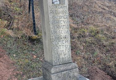
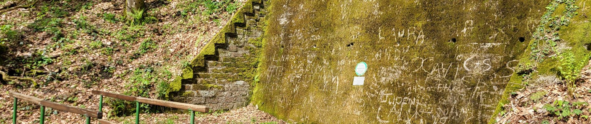
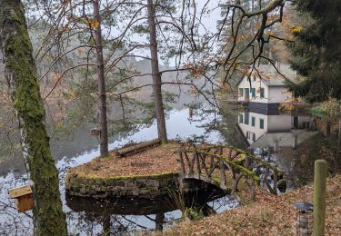
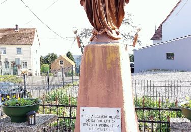
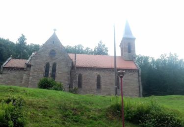
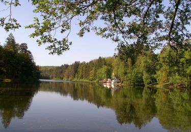
Belle randonnée depuis le village de Lemberg, départ au Chalet du club vosgien. Première étape le lavoir et la petite cascade des Ondines. Ensuite passage par les grottes (encore habitées) du Hasslingerfelsen, du Chorfelsen et du Krippenfelsen. La seconde partie longe une série d'étangs avant de revenir à Lemberg.
Bonne rando ...
Ort
Kommentare
Touren in der Umgebung
![Tour Wandern Bitsch - Etang de Hasselfurth et Hochkopf - Bitche - Photo](https://media.geolcdn.com/t/375/260/ext.jpg?maxdim=2&url=https%3A%2F%2Fservices.sitytrail.com%2FGeolivesWS%2FDownloadMedia.ashx%3FTrailID%3D317857%26Media%3D17240_6.jpg)
![Wandern Wandern](https://static1.geolcdn.com/sitytour/trail-icons/101.png)
Wandern
![](/images/other/stat-length.png)
![](https://static1.geolcdn.com/siteimages/upload/files/16400158638029165_repeat_loop_refresh_sync_direction_icon.png)
![Tour Wandern Münzthal-St.Louis - Saint-Louis-Lès-Bitche et le pays du verre et du cristal - Photo](https://media.geolcdn.com/t/375/260/ext.jpg?maxdim=2&url=https%3A%2F%2Fservices.sitytrail.com%2FGeolivesWS%2FDownloadMedia.ashx%3FTrailID%3D317570%26Media%3D16827_6.jpg)
![Wandern Wandern](https://static1.geolcdn.com/sitytour/trail-icons/101.png)
Wandern
![](/images/other/stat-length.png)
![](https://static1.geolcdn.com/siteimages/upload/files/16400158638029165_repeat_loop_refresh_sync_direction_icon.png)
![Tour Wandern Bitsch - Étang Hasselfurth 250112 - Photo](https://media.geolcdn.com/t/375/260/3662900e-8205-4856-9f76-ac80e91a6fa5.jpg&format=jpg&maxdim=2)
![Wandern Wandern](https://static1.geolcdn.com/sitytour/trail-icons/101.png)
Wandern
![](/images/other/stat-length.png)
![](https://static1.geolcdn.com/siteimages/upload/files/16400158638029165_repeat_loop_refresh_sync_direction_icon.png)
![Tour Reiten Lemberg - suuntoapp-HorsebackRiding-2024-11-11T08-51-25Z - Photo](https://media.geolcdn.com/t/375/260/ea9311dd-1d9e-48ba-a2e2-24731aca39a9.jpg&format=jpg&maxdim=2)
![Reiten Reiten](https://static1.geolcdn.com/sitytour/trail-icons/301.png)
Reiten
![](/images/other/stat-length.png)
![](https://static1.geolcdn.com/siteimages/upload/files/16400158638029165_repeat_loop_refresh_sync_direction_icon.png)
![Tour Zu Fuß Meisenthal - Auf den Spuren von Glaskristall-. Künstlern und Holzschuhmachern - Rundweg #2 - Photo](https://media.geolcdn.com/t/375/260/6caab5bb-203b-4360-b4ea-26455e163371.jpeg&format=jpg&maxdim=2)
![Zu Fuß Zu Fuß](https://static1.geolcdn.com/sitytour/trail-icons/100.png)
Zu Fuß
![](/images/other/stat-length.png)
![](https://static1.geolcdn.com/siteimages/upload/files/16400158638029165_repeat_loop_refresh_sync_direction_icon.png)
![Tour Zu Fuß Götzenbrück - (Wasch-)Brunnenweg rund um Götzenbrück - Photo](https://media.geolcdn.com/t/375/260/32d4f88d-fe9b-486d-8b31-2d18471e7ec7.jpeg&format=jpg&maxdim=2)
![Zu Fuß Zu Fuß](https://static1.geolcdn.com/sitytour/trail-icons/100.png)
Zu Fuß
![](/images/other/stat-length.png)
![](https://static1.geolcdn.com/siteimages/upload/files/16400158638029165_repeat_loop_refresh_sync_direction_icon.png)
![Tour Zu Fuß Mutterhausen - Gelbes Kreuz - Photo](https://media.geolcdn.com/t/375/260/aaa04aca-0f7b-4b8c-9cba-2f4a0cf60bff.jpeg&format=jpg&maxdim=2)
![Zu Fuß Zu Fuß](https://static1.geolcdn.com/sitytour/trail-icons/100.png)
Zu Fuß
![](/images/other/stat-length.png)
![](https://static1.geolcdn.com/siteimages/upload/files/16400158638029165_repeat_loop_refresh_sync_direction_icon.png)
![Tour Zu Fuß Lemberg - Blaues Dreieck - Photo](https://media.geolcdn.com/t/375/260/4728c46a-5534-4d4c-a2d5-aeb4236cb3e1.jpeg&format=jpg&maxdim=2)
![Zu Fuß Zu Fuß](https://static1.geolcdn.com/sitytour/trail-icons/100.png)
Zu Fuß
![](/images/other/stat-length.png)
![](https://static1.geolcdn.com/siteimages/upload/files/16400158638029165_repeat_loop_refresh_sync_direction_icon.png)
![Tour Zu Fuß Lemberg - Blauer Ring - Photo](https://media.geolcdn.com/t/375/260/b1064c1c-fa8f-4421-8664-f1631d4d3040.jpeg&format=jpg&maxdim=2)
![Zu Fuß Zu Fuß](https://static1.geolcdn.com/sitytour/trail-icons/100.png)