![](/images/other/stat-length.png)
![Tour Wandern Choloy-Ménillot - Cholloy-Ménillot 14 150m +335m - Photo](https://media.geolcdn.com/t/1900/400/ext.pjpeg?maxdim=2&url=https%3A%2F%2Fstatic1.geolcdn.com%2Fsiteimages%2Fupload%2Ffiles%2F1553511878bg_sport_marche.png)
Cholloy-Ménillot 14 150m +335m
DanielROLLET
Benutzer
![Länge](/images/other/stat-length.png)
Länge
14,2 km
![Maximale Höhe](https://static1.geolcdn.com/siteimages/upload/files/1508320355ic_sort_altitude_max_24dp.png)
Maximale Höhe
395 m
![Positive Höhendifferenz](https://static1.geolcdn.com/siteimages/upload/files/1508320355ic_sort_den_pos_24dp.png)
Positive Höhendifferenz
336 m
![Km-Effort](/images/other/stat-length.png)
Km-Effort
18,6 km
![Min. Höhe](https://static1.geolcdn.com/siteimages/upload/files/1508320355ic_sort_altitude_min_24dp.png)
Min. Höhe
241 m
![Negative Höhendifferenz](https://static1.geolcdn.com/siteimages/upload/files/1508320355ic_sort_den_neg_24dp.png)
Negative Höhendifferenz
336 m
![Boucle](https://static1.geolcdn.com/siteimages/upload/files/16400158638029165_repeat_loop_refresh_sync_direction_icon.png)
Boucle
Ja
Erstellungsdatum :
2024-04-09 06:51:25.653
Letzte Änderung :
2024-04-09 16:51:41.11
![Wandern](https://static1.geolcdn.com/sitytour/trail-icons/101.png)
3h30
Schwierigkeit : Schwierig
![Scannen Sie diesen QR-Code, um die Tour in der SityTrail-Anwendung zu öffnen](https://capi.geolives.com/qq0zvz2zws4bq2lad0pu/sitytour/trails/4010104/qr.png?size=200)
Kostenlosegpshiking-Anwendung
Über SityTrail
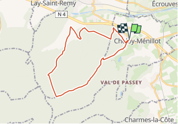
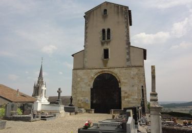
Tour Wandern von 14,2 km verfügbar auf Großer Osten, Mörthe und Mosel, Choloy-Ménillot. Diese Tour wird von DanielROLLET vorgeschlagen.
Beschreibung
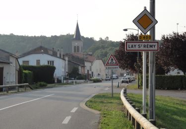
2024 04 09 - 8h50 à 12h20 - avec Marie
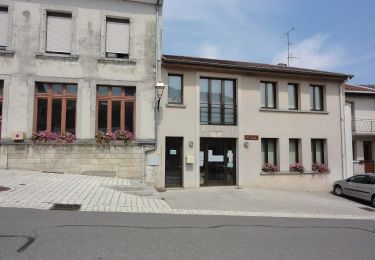
Départ/retour parking mairie
Petite pluie au départ puis temps couvert avec légère brise.
Du muguet (en boutons) sur tout le plateau
Ort
Land:
France
Region :
Großer Osten
Abteilung/Provinz :
Mörthe und Mosel
Kommune :
Choloy-Ménillot
Standort:
Unknown
Gehen Sie:(Dec)
Gehen Sie:(UTM)
707243 ; 5393795 (31U) N.
Kommentare
Touren in der Umgebung
![Tour Zu Fuß Bruley - Circuit de la Petite Linotte - Photo](https://media.geolcdn.com/t/375/260/c8d38300-38c0-4b90-af2c-ff730d2ffb15.jpeg&format=jpg&maxdim=2)
![Zu Fuß Zu Fuß](https://static1.geolcdn.com/sitytour/trail-icons/100.png)
Circuit de la Petite Linotte
Zu Fuß
Einfach
Bruley,
Großer Osten,
Mörthe und Mosel,
France
![](/images/other/stat-length.png)
9,2 km | 12 km-effort
2h 43min
![](https://static1.geolcdn.com/siteimages/upload/files/16400158638029165_repeat_loop_refresh_sync_direction_icon.png)
Nein
![Tour Mountainbike Écrouves - 1 ère rando VTT - Photo](https://media.geolcdn.com/t/375/260/ext.jpg?maxdim=2&url=https%3A%2F%2Fstatic1.geolcdn.com%2Fsiteimages%2Fupload%2Ffiles%2F1524743154velo.jpg)
![Mountainbike Mountainbike](https://static1.geolcdn.com/sitytour/trail-icons/202.png)
1 ère rando VTT
Mountainbike
Sehr leicht
(1)
Écrouves,
Großer Osten,
Mörthe und Mosel,
France
![](/images/other/stat-length.png)
7,5 km | 9,5 km-effort
Unbekannt
![](https://static1.geolcdn.com/siteimages/upload/files/16400158638029165_repeat_loop_refresh_sync_direction_icon.png)
Ja
![Tour Zu Fuß Foug - Circuit de Grammont - Photo](https://media.geolcdn.com/t/375/260/d7a9625f-1b4f-4d64-86f5-7a590416d8ca.jpeg&format=jpg&maxdim=2)
![Zu Fuß Zu Fuß](https://static1.geolcdn.com/sitytour/trail-icons/100.png)
Circuit de Grammont
Zu Fuß
Einfach
Foug,
Großer Osten,
Mörthe und Mosel,
France
![](/images/other/stat-length.png)
15,6 km | 19,3 km-effort
4h 23min
![](https://static1.geolcdn.com/siteimages/upload/files/16400158638029165_repeat_loop_refresh_sync_direction_icon.png)
Nein
![Tour Zu Fuß Choloy-Ménillot - Boucle des Sources - Photo](https://media.geolcdn.com/t/375/260/ac86fb3f-3e84-4c34-b460-6a4b9dab63b7.jpeg&format=jpg&maxdim=2)
![Zu Fuß Zu Fuß](https://static1.geolcdn.com/sitytour/trail-icons/100.png)
Boucle des Sources
Zu Fuß
Einfach
Choloy-Ménillot,
Großer Osten,
Mörthe und Mosel,
France
![](/images/other/stat-length.png)
10,4 km | 11,9 km-effort
2h 42min
![](https://static1.geolcdn.com/siteimages/upload/files/16400158638029165_repeat_loop_refresh_sync_direction_icon.png)
Nein
![Tour Zu Fuß Lay-Saint-Remy - Circuit des Tunnels - Photo](https://media.geolcdn.com/t/375/260/5be59ff7-d470-4d08-b9ab-b50f0bd2cb66.jpeg&format=jpg&maxdim=2)
![Zu Fuß Zu Fuß](https://static1.geolcdn.com/sitytour/trail-icons/100.png)
Circuit des Tunnels
Zu Fuß
Einfach
Lay-Saint-Remy,
Großer Osten,
Mörthe und Mosel,
France
![](/images/other/stat-length.png)
11,1 km | 14,2 km-effort
3h 14min
![](https://static1.geolcdn.com/siteimages/upload/files/16400158638029165_repeat_loop_refresh_sync_direction_icon.png)
Nein
![Tour Zu Fuß Laneuveville-derrière-Foug - Circuit du Point du Jour - Photo](https://media.geolcdn.com/t/375/260/b1cded44-ffa4-4904-97ef-f463ee03586b.jpeg&format=jpg&maxdim=2)
![Zu Fuß Zu Fuß](https://static1.geolcdn.com/sitytour/trail-icons/100.png)
Circuit du Point du Jour
Zu Fuß
Einfach
Laneuveville-derrière-Foug,
Großer Osten,
Mörthe und Mosel,
France
![](/images/other/stat-length.png)
6,8 km | 8 km-effort
1h 49min
![](https://static1.geolcdn.com/siteimages/upload/files/16400158638029165_repeat_loop_refresh_sync_direction_icon.png)
Nein
![Tour Zu Fuß Pagney-derrière-Barine - Circuit du Val des Nonnes - Photo](https://media.geolcdn.com/t/375/260/28138f5d-da0e-42a4-ae9a-44f0da4e84a1.jpeg&format=jpg&maxdim=2)
![Zu Fuß Zu Fuß](https://static1.geolcdn.com/sitytour/trail-icons/100.png)
Circuit du Val des Nonnes
Zu Fuß
Einfach
Pagney-derrière-Barine,
Großer Osten,
Mörthe und Mosel,
France
![](/images/other/stat-length.png)
14,9 km | 19 km-effort
4h 19min
![](https://static1.geolcdn.com/siteimages/upload/files/16400158638029165_repeat_loop_refresh_sync_direction_icon.png)
Ja
![Tour Zu Fuß Écrouves - Sentier Toul-Thiaucourt - Photo](https://media.geolcdn.com/t/375/260/8c08f13d-12b2-412f-bc0c-d39ed7e3214d.jpeg&format=jpg&maxdim=2)
![Zu Fuß Zu Fuß](https://static1.geolcdn.com/sitytour/trail-icons/100.png)
Sentier Toul-Thiaucourt
Zu Fuß
Medium
Écrouves,
Großer Osten,
Mörthe und Mosel,
France
![](/images/other/stat-length.png)
22 km | 24 km-effort
5h 28min
![](https://static1.geolcdn.com/siteimages/upload/files/16400158638029165_repeat_loop_refresh_sync_direction_icon.png)
Nein
![Tour Zu Fuß Écrouves - Chemin des Chanottes - Photo](https://media.geolcdn.com/t/375/260/45f12027-0931-42b2-85f6-104557e433ca.jpeg&format=jpg&maxdim=2)
![Zu Fuß Zu Fuß](https://static1.geolcdn.com/sitytour/trail-icons/100.png)
Chemin des Chanottes
Zu Fuß
Einfach
Écrouves,
Großer Osten,
Mörthe und Mosel,
France
![](/images/other/stat-length.png)
5,6 km | 6,4 km-effort
1h 27min
![](https://static1.geolcdn.com/siteimages/upload/files/16400158638029165_repeat_loop_refresh_sync_direction_icon.png)
Nein