![](/images/other/stat-length.png)
![Tour Wandern Vallées-d'Antraigues-Asperjoc - 07_antraigues_7km400m - Photo](https://media.geolcdn.com/t/1900/400/465c52aa-adc5-4c16-841e-26a118bc0cec.jpg&format=pjpeg&maxdim=2)
07_antraigues_7km400m
SyMA
Benutzer
![Länge](/images/other/stat-length.png)
Länge
8,6 km
![Maximale Höhe](https://static1.geolcdn.com/siteimages/upload/files/1508320355ic_sort_altitude_max_24dp.png)
Maximale Höhe
672 m
![Positive Höhendifferenz](https://static1.geolcdn.com/siteimages/upload/files/1508320355ic_sort_den_pos_24dp.png)
Positive Höhendifferenz
348 m
![Km-Effort](/images/other/stat-length.png)
Km-Effort
13,2 km
![Min. Höhe](https://static1.geolcdn.com/siteimages/upload/files/1508320355ic_sort_altitude_min_24dp.png)
Min. Höhe
406 m
![Negative Höhendifferenz](https://static1.geolcdn.com/siteimages/upload/files/1508320355ic_sort_den_neg_24dp.png)
Negative Höhendifferenz
345 m
![Boucle](https://static1.geolcdn.com/siteimages/upload/files/16400158638029165_repeat_loop_refresh_sync_direction_icon.png)
Boucle
Ja
Erstellungsdatum :
2024-04-06 08:15:06.752
Letzte Änderung :
2024-04-15 15:45:30.183
![Wandern](https://static1.geolcdn.com/sitytour/trail-icons/101.png)
3h07
Schwierigkeit : Einfach
![Scannen Sie diesen QR-Code, um die Tour in der SityTrail-Anwendung zu öffnen](https://capi.geolives.com/qq0zvz2zws4bq2lad0pu/sitytour/trails/4006299/qr.png?size=200)
Kostenlosegpshiking-Anwendung
Über SityTrail
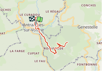
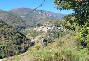
Tour Wandern von 8,6 km verfügbar auf Auvergne-Rhone-Alpen, Ardèche, Vallées-d'Antraigues-Asperjoc. Diese Tour wird von SyMA vorgeschlagen.
Beschreibung
impossible de prendre les sentiers privatisés!!
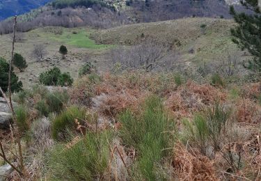
autour de Volcan de Craux et chemins après par les chataigniers AOP meme en période printemps !!
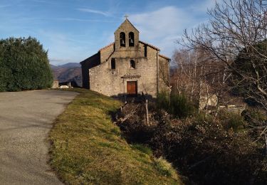
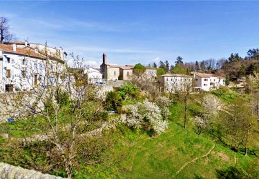
Musée et tombe de Jean Ferrat
Ort
Land:
France
Region :
Auvergne-Rhone-Alpen
Abteilung/Provinz :
Ardèche
Kommune :
Vallées-d'Antraigues-Asperjoc
Standort:
Antraigues-sur-Volane
Gehen Sie:(Dec)
Gehen Sie:(UTM)
607614 ; 4952676 (31T) N.
Kommentare
Touren in der Umgebung
![Tour Wandern Labastide-sur-Bésorgues - 2022-02-01_15h56m32_Les granges de Sausses 14,5km.GPX.xml - Photo](https://media.geolcdn.com/t/375/260/f7fbac7a-11f7-4ce8-b0bf-02f788ab9e07.jpg&format=jpg&maxdim=2)
![Wandern Wandern](https://static1.geolcdn.com/sitytour/trail-icons/101.png)
2022-02-01_15h56m32_Les granges de Sausses 14,5km.GPX.xml
Wandern
Schwierig
(1)
Labastide-sur-Bésorgues,
Auvergne-Rhone-Alpen,
Ardèche,
France
![](/images/other/stat-length.png)
14,1 km | 24 km-effort
5h 37min
![](https://static1.geolcdn.com/siteimages/upload/files/16400158638029165_repeat_loop_refresh_sync_direction_icon.png)
Ja
![Tour Wandern Vallées-d'Antraigues-Asperjoc - 07 antraigues - Photo](https://media.geolcdn.com/t/375/260/59713960-36e0-4cc2-a246-618043d58544.jpg&format=jpg&maxdim=2)
![Wandern Wandern](https://static1.geolcdn.com/sitytour/trail-icons/101.png)
07 antraigues
Wandern
Schwierig
Vallées-d'Antraigues-Asperjoc,
Auvergne-Rhone-Alpen,
Ardèche,
France
![](/images/other/stat-length.png)
14,4 km | 24 km-effort
7h 0min
![](https://static1.geolcdn.com/siteimages/upload/files/16400158638029165_repeat_loop_refresh_sync_direction_icon.png)
Ja
![Tour Wandern Vallées-d'Antraigues-Asperjoc - Antraïgues 14km - Photo](https://media.geolcdn.com/t/375/260/ext.jpg?maxdim=2&url=https%3A%2F%2Fstatic1.geolcdn.com%2Fsiteimages%2Fupload%2Ffiles%2F1553511878bg_sport_marche.png)
![Wandern Wandern](https://static1.geolcdn.com/sitytour/trail-icons/101.png)
Antraïgues 14km
Wandern
Medium
(1)
Vallées-d'Antraigues-Asperjoc,
Auvergne-Rhone-Alpen,
Ardèche,
France
![](/images/other/stat-length.png)
14,4 km | 22 km-effort
4h 56min
![](https://static1.geolcdn.com/siteimages/upload/files/16400158638029165_repeat_loop_refresh_sync_direction_icon.png)
Ja
![Tour Wandern Saint-Joseph-des-Bancs - 07 st joseph les bancs - Photo](https://media.geolcdn.com/t/375/260/7e9021ed-61a8-43c1-8ba0-cf3b13c5f55b.jpg&format=jpg&maxdim=2)
![Wandern Wandern](https://static1.geolcdn.com/sitytour/trail-icons/101.png)
07 st joseph les bancs
Wandern
Einfach
Saint-Joseph-des-Bancs,
Auvergne-Rhone-Alpen,
Ardèche,
France
![](/images/other/stat-length.png)
18,4 km | 29 km-effort
7h 47min
![](https://static1.geolcdn.com/siteimages/upload/files/16400158638029165_repeat_loop_refresh_sync_direction_icon.png)
Ja
![Tour Wandern Aizac - SityTrail - 2231069 - aizacxmal-combexla-bastide-sur-besorgue- - Photo](https://media.geolcdn.com/t/375/260/ext.jpg?maxdim=2&url=https%3A%2F%2Fstatic1.geolcdn.com%2Fsiteimages%2Fupload%2Ffiles%2F1553511878bg_sport_marche.png)
![Wandern Wandern](https://static1.geolcdn.com/sitytour/trail-icons/101.png)
SityTrail - 2231069 - aizacxmal-combexla-bastide-sur-besorgue-
Wandern
Schwierig
(1)
Aizac,
Auvergne-Rhone-Alpen,
Ardèche,
France
![](/images/other/stat-length.png)
10,3 km | 17,4 km-effort
3h 57min
![](https://static1.geolcdn.com/siteimages/upload/files/16400158638029165_repeat_loop_refresh_sync_direction_icon.png)
Ja
![Tour Wandern Aizac - Aizac et la coupe d'Aizac - Photo](https://media.geolcdn.com/t/375/260/ext.jpg?maxdim=2&url=https%3A%2F%2Fstatic1.geolcdn.com%2Fsiteimages%2Fupload%2Ffiles%2F1553511878bg_sport_marche.png)
![Wandern Wandern](https://static1.geolcdn.com/sitytour/trail-icons/101.png)
Aizac et la coupe d'Aizac
Wandern
Einfach
(1)
Aizac,
Auvergne-Rhone-Alpen,
Ardèche,
France
![](/images/other/stat-length.png)
4,5 km | 7,5 km-effort
1h 24min
![](https://static1.geolcdn.com/siteimages/upload/files/16400158638029165_repeat_loop_refresh_sync_direction_icon.png)
Ja
![Tour Wandern Saint-Andéol-de-Vals - 07 st Andeol de vals - Photo](https://media.geolcdn.com/t/375/260/a317618f-c6db-4fe3-a756-43f4ecdf49ea.jpg&format=jpg&maxdim=2)
![Wandern Wandern](https://static1.geolcdn.com/sitytour/trail-icons/101.png)
07 st Andeol de vals
Wandern
Einfach
Saint-Andéol-de-Vals,
Auvergne-Rhone-Alpen,
Ardèche,
France
![](/images/other/stat-length.png)
15,3 km | 24 km-effort
6h 3min
![](https://static1.geolcdn.com/siteimages/upload/files/16400158638029165_repeat_loop_refresh_sync_direction_icon.png)
Ja
![Tour Wandern Vallées-d'Antraigues-Asperjoc - attribués sur volane - Photo](https://media.geolcdn.com/t/375/260/66f09833-ed62-4afc-bf56-380f58350a41.jpg&format=jpg&maxdim=2)
![Wandern Wandern](https://static1.geolcdn.com/sitytour/trail-icons/101.png)
attribués sur volane
Wandern
Einfach
Vallées-d'Antraigues-Asperjoc,
Auvergne-Rhone-Alpen,
Ardèche,
France
![](/images/other/stat-length.png)
9,1 km | 13,8 km-effort
5h 25min
![](https://static1.geolcdn.com/siteimages/upload/files/16400158638029165_repeat_loop_refresh_sync_direction_icon.png)
Nein
![Tour Wandern Saint-Joseph-des-Bancs - St- Joseph-des-Bancs 18km. - Photo](https://media.geolcdn.com/t/375/260/4e7ec61c-d77e-47ec-9334-4c052f40153e.jpg&format=jpg&maxdim=2)
![Wandern Wandern](https://static1.geolcdn.com/sitytour/trail-icons/101.png)
St- Joseph-des-Bancs 18km.
Wandern
Schwierig
Saint-Joseph-des-Bancs,
Auvergne-Rhone-Alpen,
Ardèche,
France
![](/images/other/stat-length.png)
17,9 km | 28 km-effort
5h 30min
![](https://static1.geolcdn.com/siteimages/upload/files/16400158638029165_repeat_loop_refresh_sync_direction_icon.png)
Ja