3,3 km | 7,1 km-effort
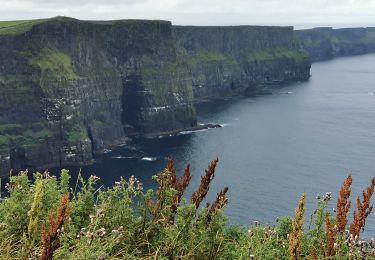
Cliffs of Moher
Lobin
Benutzer
Länge
12 km
Maximale Höhe
171 m
Positive Höhendifferenz
659 m
Km-Effort
21 km
Min. Höhe
51 m
Negative Höhendifferenz
660 m
Boucle
Ja
Erstellungsdatum :
2024-04-02 14:04:44.0
Letzte Änderung :
2024-04-02 18:01:14.475
2h52
Schwierigkeit : Medium
Kostenlosegpshiking-Anwendung
Über SityTrail
Tour Wandern von 12 km verfügbar auf Unbekannt, County Clare, West Clare Municipal District. Diese Tour wird von Lobin vorgeschlagen.
Beschreibung
Départ du parking Liscannor walk (payant) en aller-retour vers le visiter centre et la tour.
Ort
Land:
Ireland
Region :
Unbekannt
Abteilung/Provinz :
County Clare
Kommune :
West Clare Municipal District
Standort:
Ballysteen
Gehen Sie:(Dec)
Gehen Sie:(UTM)
469474 ; 5866081 (29U) N.
Kommentare
Touren in der Umgebung
Centre visiteurs Falaises de Moher - 3 km
Wandern
Medium
West Clare Municipal District,
Unbekannt,
County Clare,
Ireland
1h 36min
Ja
Mon parcours
Wandern
Schwierig
(1)
West Clare Municipal District,
Unbekannt,
County Clare,
Ireland
9,8 km | 18,6 km-effort
3h 42min
Ja
Cliffs of Moher
Wandern
Medium
(1)
West Clare Municipal District,
Unbekannt,
County Clare,
Ireland
12,4 km | 22 km-effort
3h 43min
Ja
falaise moher
Wandern
Medium
West Clare Municipal District,
Unbekannt,
County Clare,
Ireland
7,5 km | 11,9 km-effort
2h 5min
Nein
j04-2
Auto
Sehr leicht
West Clare Municipal District,
Unbekannt,
County Clare,
Ireland
88 km | 98 km-effort
2h 34min
Nein