![](/images/other/stat-length.png)
![Tour Wandern Luxemburg - Itinérant Luxembourg Jour 1 : Visite de Luxembourg Ville - Photo](https://media.geolcdn.com/t/1900/400/35d80b54-5540-4eaf-ab66-fd3323c5eeb0.jpg&format=pjpeg&maxdim=2)
Itinérant Luxembourg Jour 1 : Visite de Luxembourg Ville
chessyca
Benutzer GUIDE
![Länge](/images/other/stat-length.png)
Länge
15,6 km
![Maximale Höhe](https://static1.geolcdn.com/siteimages/upload/files/1508320355ic_sort_altitude_max_24dp.png)
Maximale Höhe
327 m
![Positive Höhendifferenz](https://static1.geolcdn.com/siteimages/upload/files/1508320355ic_sort_den_pos_24dp.png)
Positive Höhendifferenz
437 m
![Km-Effort](/images/other/stat-length.png)
Km-Effort
21 km
![Min. Höhe](https://static1.geolcdn.com/siteimages/upload/files/1508320355ic_sort_altitude_min_24dp.png)
Min. Höhe
239 m
![Negative Höhendifferenz](https://static1.geolcdn.com/siteimages/upload/files/1508320355ic_sort_den_neg_24dp.png)
Negative Höhendifferenz
432 m
![Boucle](https://static1.geolcdn.com/siteimages/upload/files/16400158638029165_repeat_loop_refresh_sync_direction_icon.png)
Boucle
Ja
Erstellungsdatum :
2024-04-02 10:33:30.403
Letzte Änderung :
2024-04-10 21:24:31.296
![Wandern](https://static1.geolcdn.com/sitytour/trail-icons/101.png)
3h45
Schwierigkeit : Einfach
![Scannen Sie diesen QR-Code, um die Tour in der SityTrail-Anwendung zu öffnen](https://capi.geolives.com/qq0zvz2zws4bq2lad0pu/sitytour/trails/4002188/qr.png?size=200)
Kostenlosegpshiking-Anwendung
Über SityTrail
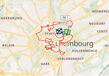
Tour Wandern von 15,6 km verfügbar auf Unbekannt, Kanton Luxemburg, Luxemburg. Diese Tour wird von chessyca vorgeschlagen.
Beschreibung
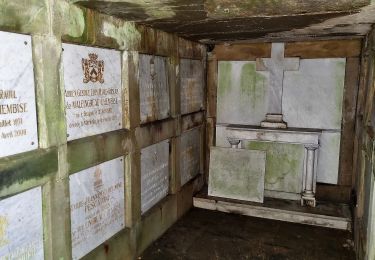
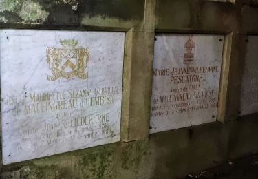
Découverte ou redécouverte des principaux lieux touristiques de la ville
Petit tour en Tram et funiculaire (retirer environ 3 km du trajet vers le quartier europe)
Hébergement hotel de jeunesse Luxembourg Ville
Ort
Land:
Luxembourg
Region :
Unbekannt
Abteilung/Provinz :
Kanton Luxemburg
Kommune :
Luxemburg
Standort:
Pfaffenthal
Gehen Sie:(Dec)
Gehen Sie:(UTM)
293253 ; 5499536 (32U) N.
Kommentare
Touren in der Umgebung
![Tour Zu Fuß Luxemburg - Spazierweg Ahorn - Photo](https://media.geolcdn.com/t/375/260/a23d593d-2772-4b4d-9b30-c01313559189.jpeg&format=jpg&maxdim=2)
![Zu Fuß Zu Fuß](https://static1.geolcdn.com/sitytour/trail-icons/100.png)
Spazierweg Ahorn
Zu Fuß
Einfach
Luxemburg,
Unbekannt,
Kanton Luxemburg,
Luxembourg
![](/images/other/stat-length.png)
4,7 km | 6 km-effort
1h 21min
![](https://static1.geolcdn.com/siteimages/upload/files/16400158638029165_repeat_loop_refresh_sync_direction_icon.png)
Ja
![Tour Zu Fuß Walferdingen - Auto-Pédestre Bereldange - Photo](https://media.geolcdn.com/t/375/260/9ffb96c9-8ee3-4baa-8f73-3ae3b0006373.jpeg&format=jpg&maxdim=2)
![Zu Fuß Zu Fuß](https://static1.geolcdn.com/sitytour/trail-icons/100.png)
Auto-Pédestre Bereldange
Zu Fuß
Einfach
Walferdingen,
Unbekannt,
Kanton Luxemburg,
Luxembourg
![](/images/other/stat-length.png)
6,5 km | 9 km-effort
2h 2min
![](https://static1.geolcdn.com/siteimages/upload/files/16400158638029165_repeat_loop_refresh_sync_direction_icon.png)
Ja
![Tour Zu Fuß Leudelingen - Auto-Pédestre Roedgen - Photo](https://media.geolcdn.com/t/375/260/4387dfb8-6c80-4acc-9a37-ef44c95f5b0e.jpeg&format=jpg&maxdim=2)
![Zu Fuß Zu Fuß](https://static1.geolcdn.com/sitytour/trail-icons/100.png)
Auto-Pédestre Roedgen
Zu Fuß
Einfach
Leudelingen,
Unbekannt,
Kanton Esch an der Alzette,
Luxembourg
![](/images/other/stat-length.png)
9,7 km | 11,9 km-effort
2h 42min
![](https://static1.geolcdn.com/siteimages/upload/files/16400158638029165_repeat_loop_refresh_sync_direction_icon.png)
Ja
![Tour Zu Fuß Luxemburg - Eule Spazierwege - Photo](https://media.geolcdn.com/t/375/260/b315718c-907d-46e0-8a6a-fbd567016707.jpeg&format=jpg&maxdim=2)
![Zu Fuß Zu Fuß](https://static1.geolcdn.com/sitytour/trail-icons/100.png)
Eule Spazierwege
Zu Fuß
Einfach
Luxemburg,
Unbekannt,
Kanton Luxemburg,
Luxembourg
![](/images/other/stat-length.png)
7,7 km | 9,9 km-effort
2h 14min
![](https://static1.geolcdn.com/siteimages/upload/files/16400158638029165_repeat_loop_refresh_sync_direction_icon.png)
Ja
![Tour Zu Fuß Luxemburg - Crosslauf Strecke - Photo](https://media.geolcdn.com/t/375/260/e3e160d8-098a-430f-a621-d8ccdea5d783.jpeg&format=jpg&maxdim=2)
![Zu Fuß Zu Fuß](https://static1.geolcdn.com/sitytour/trail-icons/100.png)
Crosslauf Strecke
Zu Fuß
Einfach
Luxemburg,
Unbekannt,
Kanton Luxemburg,
Luxembourg
![](/images/other/stat-length.png)
4,9 km | 6,3 km-effort
1h 26min
![](https://static1.geolcdn.com/siteimages/upload/files/16400158638029165_repeat_loop_refresh_sync_direction_icon.png)
Ja
![Tour Wandern Hesperingen - Autopedestres : Hesperange - Photo](https://media.geolcdn.com/t/375/260/ext.jpg?maxdim=2&url=https%3A%2F%2Fstatic1.geolcdn.com%2Fsiteimages%2Fupload%2Ffiles%2F1553511878bg_sport_marche.png)
![Wandern Wandern](https://static1.geolcdn.com/sitytour/trail-icons/101.png)
Autopedestres : Hesperange
Wandern
Sehr leicht
(1)
Hesperingen,
Unbekannt,
Kanton Luxemburg,
Luxembourg
![](/images/other/stat-length.png)
4,9 km | 6,2 km-effort
Unbekannt
![](https://static1.geolcdn.com/siteimages/upload/files/16400158638029165_repeat_loop_refresh_sync_direction_icon.png)
Ja
![Nordic Walking Nordic Walking](https://static1.geolcdn.com/sitytour/trail-icons/102.png)
Bertrange - Marche nordique
Nordic Walking
Sehr leicht
Bartringen,
Unbekannt,
Kanton Luxemburg,
Luxembourg
![](/images/other/stat-length.png)
15,9 km | 18,1 km-effort
Unbekannt
![](https://static1.geolcdn.com/siteimages/upload/files/16400158638029165_repeat_loop_refresh_sync_direction_icon.png)
Nein
![Tour Zu Fuß Hesperingen - Sentier Naturel autour de Dupont - Photo](https://media.geolcdn.com/t/375/260/cb2d487a-93ce-469b-9ded-5420f82a3cee.jpeg&format=jpg&maxdim=2)
![Zu Fuß Zu Fuß](https://static1.geolcdn.com/sitytour/trail-icons/100.png)
Sentier Naturel autour de Dupont
Zu Fuß
Einfach
Hesperingen,
Unbekannt,
Kanton Luxemburg,
Luxembourg
![](/images/other/stat-length.png)
4 km | 4,9 km-effort
1h 6min
![](https://static1.geolcdn.com/siteimages/upload/files/16400158638029165_repeat_loop_refresh_sync_direction_icon.png)
Ja
![Tour Zu Fuß Hesperingen - Fleche Bleu Itzig - Photo](https://media.geolcdn.com/t/375/260/27fd8cdd-3072-452f-936e-8661113f01e6.jpeg&format=jpg&maxdim=2)
![Zu Fuß Zu Fuß](https://static1.geolcdn.com/sitytour/trail-icons/100.png)
Fleche Bleu Itzig
Zu Fuß
Einfach
Hesperingen,
Unbekannt,
Kanton Luxemburg,
Luxembourg
![](/images/other/stat-length.png)
8,3 km | 10,7 km-effort
2h 26min
![](https://static1.geolcdn.com/siteimages/upload/files/16400158638029165_repeat_loop_refresh_sync_direction_icon.png)
Ja