![](/images/other/stat-length.png)
![Tour Wandern Marsillargues - marsillargues_ aymargues - Photo](https://media.geolcdn.com/t/1900/400/faef4918-60c0-4239-aa57-7ff47852ddac.jpg&format=pjpeg&maxdim=2)
marsillargues_ aymargues
v.rabot
Benutzer
![Länge](/images/other/stat-length.png)
![Maximale Höhe](https://static1.geolcdn.com/siteimages/upload/files/1508320355ic_sort_altitude_max_24dp.png)
![Positive Höhendifferenz](https://static1.geolcdn.com/siteimages/upload/files/1508320355ic_sort_den_pos_24dp.png)
![Km-Effort](/images/other/stat-length.png)
![Min. Höhe](https://static1.geolcdn.com/siteimages/upload/files/1508320355ic_sort_altitude_min_24dp.png)
![Negative Höhendifferenz](https://static1.geolcdn.com/siteimages/upload/files/1508320355ic_sort_den_neg_24dp.png)
![Boucle](https://static1.geolcdn.com/siteimages/upload/files/16400158638029165_repeat_loop_refresh_sync_direction_icon.png)
![Wandern](https://static1.geolcdn.com/sitytour/trail-icons/101.png)
3h21
Schwierigkeit : Medium
![Scannen Sie diesen QR-Code, um die Tour in der SityTrail-Anwendung zu öffnen](https://capi.geolives.com/qq0zvz2zws4bq2lad0pu/sitytour/trails/4000894/qr.png?size=200)
Kostenlosegpshiking-Anwendung
Über SityTrail
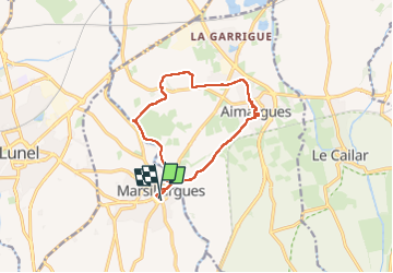
Tour Wandern von 12,3 km verfügbar auf Okzitanien, Hérault, Marsillargues. Diese Tour wird von v.rabot vorgeschlagen.
Beschreibung
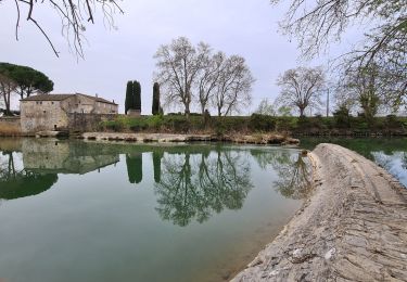
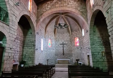
Petit parcours sans aucune difficulté, qui peut être allongé en parcourant les rues des villages qui ont toutes un détail architectural bien caché. On pourra admirer Liberté Egalité Fraternité sur le fronton de l’église Saint Saturnin qui est généralement ouverte et contient les reliques de Sainte Artimidora ainsi qu'un tableau d'inspiration religieuse représentant Jésus portant sa croix, peint en 1548.
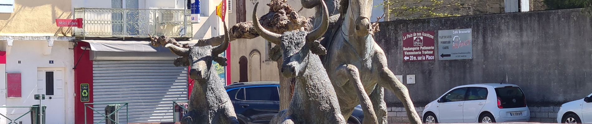
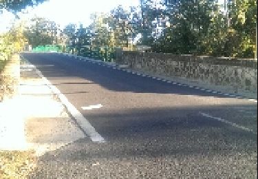
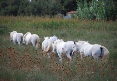
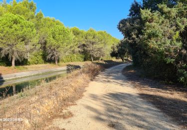
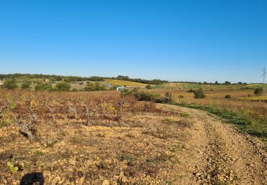
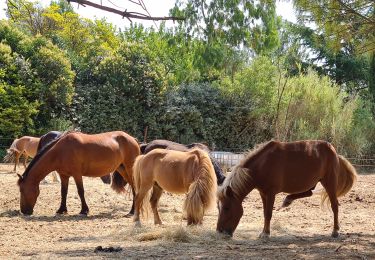
Le lon,g du parcours vous aurez des moulins, quelques ponts de l'ancienne voie ferrée, une capitelle et un lavoir à Aymargues, peut être verrez vous les longues cornes. des moutons, des chevaux, des taureaux qui animeront le pauysage.
Attention aux passages sur la route goudronnée, si sur la départementale les conducteurs ont été attentifs et respectueux de notre présence, sur les petits chemins certains se croient sur un rallye.
Ort
Kommentare
Touren in der Umgebung
![Tour Wandern Marsillargues - vidourle et marsillargues - Photo](https://media.geolcdn.com/t/375/260/ext.jpg?maxdim=2&url=https%3A%2F%2Fservices.sitytrail.com%2FGeolivesWS%2FDownloadMedia.ashx%3FTrailID%3D231197%26Media%3Dfix__20131106161342.jpg)
![Wandern Wandern](https://static1.geolcdn.com/sitytour/trail-icons/101.png)
Wandern
![](/images/other/stat-length.png)
![](https://static1.geolcdn.com/siteimages/upload/files/16400158638029165_repeat_loop_refresh_sync_direction_icon.png)
![Tour Wandern Lunel - Le canal de Lunel - l'échappée belle au coeur des marais - Photo](https://media.geolcdn.com/t/375/260/ext.jpg?maxdim=2&url=https%3A%2F%2Fservices.sitytrail.com%2FGeolivesWS%2FDownloadMedia.ashx%3FTrailID%3D111904%26Media%3D8907_2.jpg)
![Wandern Wandern](https://static1.geolcdn.com/sitytour/trail-icons/101.png)
Wandern
![](/images/other/stat-length.png)
![](https://static1.geolcdn.com/siteimages/upload/files/16400158638029165_repeat_loop_refresh_sync_direction_icon.png)
![Tour Wandern Lunel - lunel_tour_de_farge - Photo](https://media.geolcdn.com/t/375/260/b70d97a3-9eda-4743-80e9-10a2f0f582c3.jpg&format=jpg&maxdim=2)
![Wandern Wandern](https://static1.geolcdn.com/sitytour/trail-icons/101.png)
Wandern
![](/images/other/stat-length.png)
![](https://static1.geolcdn.com/siteimages/upload/files/16400158638029165_repeat_loop_refresh_sync_direction_icon.png)
![Tour Wandern Marsillargues - Marsillargues_Aimargues - Photo](https://media.geolcdn.com/t/375/260/02888644-e4c6-41ed-ae9d-2ee4b172d42e.jpg&format=jpg&maxdim=2)
![Wandern Wandern](https://static1.geolcdn.com/sitytour/trail-icons/101.png)
Wandern
![](/images/other/stat-length.png)
![](https://static1.geolcdn.com/siteimages/upload/files/16400158638029165_repeat_loop_refresh_sync_direction_icon.png)
![Tour Wandern Lunel - Lunel-Verargues-StChristol et retour - Photo](https://media.geolcdn.com/t/375/260/b23ff5e4-3fcb-449e-b3ef-4d32c8fb33b5.jpg&format=jpg&maxdim=2)
![Wandern Wandern](https://static1.geolcdn.com/sitytour/trail-icons/101.png)
Wandern
![](/images/other/stat-length.png)
![](https://static1.geolcdn.com/siteimages/upload/files/16400158638029165_repeat_loop_refresh_sync_direction_icon.png)
![Tour Wandern Lunel - lunel-st_Christol - Photo](https://media.geolcdn.com/t/375/260/fc14cec8-e55c-4499-9e51-69c8e21a5270.jpg&format=jpg&maxdim=2)
![Wandern Wandern](https://static1.geolcdn.com/sitytour/trail-icons/101.png)
Wandern
![](/images/other/stat-length.png)
![](https://static1.geolcdn.com/siteimages/upload/files/16400158638029165_repeat_loop_refresh_sync_direction_icon.png)
![Tour Wandern Lunel - Verargues - Photo](https://media.geolcdn.com/t/375/260/868aeef0-79d2-4145-967e-0321effcab8a.jpg&format=jpg&maxdim=2)
![Wandern Wandern](https://static1.geolcdn.com/sitytour/trail-icons/101.png)
![Tour Wandern Lunel - Lunel-Villetelle-Ambrussum - Photo](https://media.geolcdn.com/t/375/260/76124925-ffa0-4a6c-9d55-ce854785c813.jpg&format=jpg&maxdim=2)
![Wandern Wandern](https://static1.geolcdn.com/sitytour/trail-icons/101.png)
Wandern
![](/images/other/stat-length.png)
![](https://static1.geolcdn.com/siteimages/upload/files/16400158638029165_repeat_loop_refresh_sync_direction_icon.png)
![Tour Wandern Le Cailar - cailar-costieres-camargues - Photo](https://media.geolcdn.com/t/375/260/a9e966b9-9cc8-45d5-8aba-8fc28d450985.jpg&format=jpg&maxdim=2)
![Wandern Wandern](https://static1.geolcdn.com/sitytour/trail-icons/101.png)
Wandern
![](/images/other/stat-length.png)
![](https://static1.geolcdn.com/siteimages/upload/files/16400158638029165_repeat_loop_refresh_sync_direction_icon.png)