![](/images/other/stat-length.png)
![Tour Wandern Civry-en-Montagne - Civet en montagne - Photo](https://media.geolcdn.com/t/1900/400/dd662309-f8c4-4a8d-9db5-5b89765dbfc9.jpg&format=pjpeg&maxdim=2)
Civet en montagne
eric.guyard21
Benutzer
![Länge](/images/other/stat-length.png)
Länge
10,9 km
![Maximale Höhe](https://static1.geolcdn.com/siteimages/upload/files/1508320355ic_sort_altitude_max_24dp.png)
Maximale Höhe
534 m
![Positive Höhendifferenz](https://static1.geolcdn.com/siteimages/upload/files/1508320355ic_sort_den_pos_24dp.png)
Positive Höhendifferenz
229 m
![Km-Effort](/images/other/stat-length.png)
Km-Effort
13,9 km
![Min. Höhe](https://static1.geolcdn.com/siteimages/upload/files/1508320355ic_sort_altitude_min_24dp.png)
Min. Höhe
378 m
![Negative Höhendifferenz](https://static1.geolcdn.com/siteimages/upload/files/1508320355ic_sort_den_neg_24dp.png)
Negative Höhendifferenz
225 m
![Boucle](https://static1.geolcdn.com/siteimages/upload/files/16400158638029165_repeat_loop_refresh_sync_direction_icon.png)
Boucle
Ja
Erstellungsdatum :
2024-03-25 13:33:30.0
Letzte Änderung :
2024-03-29 19:32:19.963
![Wandern](https://static1.geolcdn.com/sitytour/trail-icons/101.png)
2h56
Schwierigkeit : Unbekannt
![Scannen Sie diesen QR-Code, um die Tour in der SityTrail-Anwendung zu öffnen](https://capi.geolives.com/qq0zvz2zws4bq2lad0pu/sitytour/trails/3998076/qr.png?size=200)
Kostenlosegpshiking-Anwendung
Über SityTrail
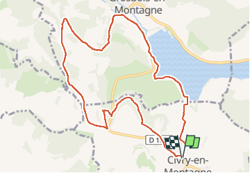
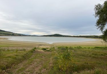
Tour Wandern von 10,9 km verfügbar auf Burgund und Freigrafschaft, Côte-d'Or, Civry-en-Montagne. Diese Tour wird von eric.guyard21 vorgeschlagen.
Beschreibung
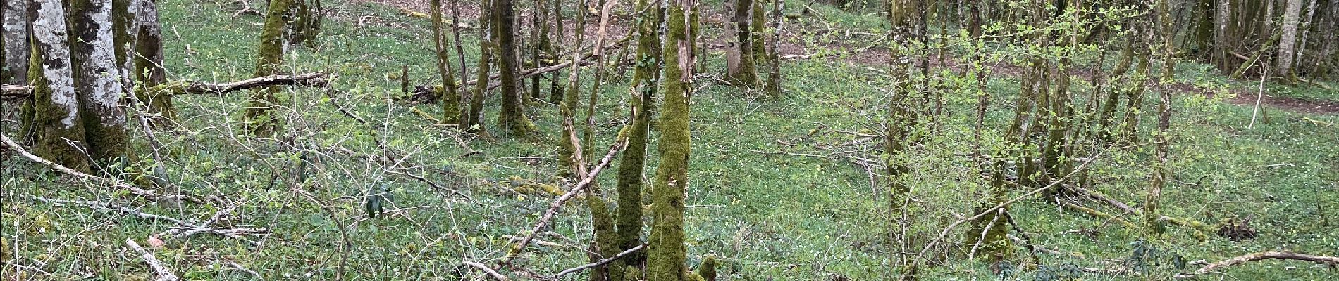
Randonnée tranquille, mais à part faire après la pluie car très boueux
Ort
Land:
France
Region :
Burgund und Freigrafschaft
Abteilung/Provinz :
Côte-d'Or
Kommune :
Civry-en-Montagne
Standort:
Unknown
Gehen Sie:(Dec)
Gehen Sie:(UTM)
621735 ; 5238946 (31T) N.
Kommentare
Touren in der Umgebung
![Tour Zu Fuß Montoillot - Boucle des Trois Châteaux - Photo](https://media.geolcdn.com/t/375/260/2cd4cd43-eb70-46bd-8967-9dc616d3cc69.jpeg&format=jpg&maxdim=2)
![Zu Fuß Zu Fuß](https://static1.geolcdn.com/sitytour/trail-icons/100.png)
Boucle des Trois Châteaux
Zu Fuß
Einfach
Montoillot,
Burgund und Freigrafschaft,
Côte-d'Or,
France
![](/images/other/stat-length.png)
8,6 km | 11,1 km-effort
2h 31min
![](https://static1.geolcdn.com/siteimages/upload/files/16400158638029165_repeat_loop_refresh_sync_direction_icon.png)
Nein
![Tour Mountainbike Montoillot - Les trois châteaux 2018.08.27 - Photo](https://media.geolcdn.com/t/375/260/ext.jpg?maxdim=2&url=https%3A%2F%2Fservices.sitytrail.com%2FGeolivesWS%2FDownloadMedia.ashx%3FTrailID%3D1029771%26Media%3D20180827131143.jpg)
![Mountainbike Mountainbike](https://static1.geolcdn.com/sitytour/trail-icons/202.png)
Les trois châteaux 2018.08.27
Mountainbike
Medium
Montoillot,
Burgund und Freigrafschaft,
Côte-d'Or,
France
![](/images/other/stat-length.png)
21 km | 25 km-effort
1h 47min
![](https://static1.geolcdn.com/siteimages/upload/files/16400158638029165_repeat_loop_refresh_sync_direction_icon.png)
Ja
![Tour Mountainbike Montoillot - Les trois châteaux 2018.08.27 - Photo](https://media.geolcdn.com/t/375/260/ext.jpg?maxdim=2&url=https%3A%2F%2Fservices.sitytrail.com%2FGeolivesWS%2FDownloadMedia.ashx%3FTrailID%3D1029756%26Media%3D20180827131143.jpg)
![Mountainbike Mountainbike](https://static1.geolcdn.com/sitytour/trail-icons/202.png)
Les trois châteaux 2018.08.27
Mountainbike
Medium
Montoillot,
Burgund und Freigrafschaft,
Côte-d'Or,
France
![](/images/other/stat-length.png)
21 km | 25 km-effort
1h 47min
![](https://static1.geolcdn.com/siteimages/upload/files/16400158638029165_repeat_loop_refresh_sync_direction_icon.png)
Ja
![Tour Wandern Pouilly-en-Auxois - Bourgogne 4L mercredi_backup - Photo](https://media.geolcdn.com/t/375/260/ext.jpg?maxdim=2&url=https%3A%2F%2Fstatic1.geolcdn.com%2Fsiteimages%2Fupload%2Ffiles%2F1553511878bg_sport_marche.png)
![Wandern Wandern](https://static1.geolcdn.com/sitytour/trail-icons/101.png)
Bourgogne 4L mercredi_backup
Wandern
Sehr leicht
(1)
Pouilly-en-Auxois,
Burgund und Freigrafschaft,
Côte-d'Or,
France
![](/images/other/stat-length.png)
191 km | 240 km-effort
6h 40min
![](https://static1.geolcdn.com/siteimages/upload/files/16400158638029165_repeat_loop_refresh_sync_direction_icon.png)
Ja
![Tour Wandern Commarin - Départ panthier - Photo](https://media.geolcdn.com/t/375/260/2b638803-4ddf-4f12-8e48-17c7401a4ed0.jpg&format=jpg&maxdim=2)
![Wandern Wandern](https://static1.geolcdn.com/sitytour/trail-icons/101.png)
Départ panthier
Wandern
Sehr schwierig
Commarin,
Burgund und Freigrafschaft,
Côte-d'Or,
France
![](/images/other/stat-length.png)
17,3 km | 22 km-effort
3h 43min
![](https://static1.geolcdn.com/siteimages/upload/files/16400158638029165_repeat_loop_refresh_sync_direction_icon.png)
Ja
![Tour Radtourismus Pouilly-en-Auxois - Pouilly en Auxois à Fleurey sur Ouche - Photo](https://media.geolcdn.com/t/375/260/3e6bba4d-ea46-4baa-b9f2-8cffb8c7fc4c.jpg&format=jpg&maxdim=2)
![Radtourismus Radtourismus](https://static1.geolcdn.com/sitytour/trail-icons/204.png)
Pouilly en Auxois à Fleurey sur Ouche
Radtourismus
Sehr schwierig
Pouilly-en-Auxois,
Burgund und Freigrafschaft,
Côte-d'Or,
France
![](/images/other/stat-length.png)
44 km | 47 km-effort
5h 7min
![](https://static1.geolcdn.com/siteimages/upload/files/16400158638029165_repeat_loop_refresh_sync_direction_icon.png)
Nein
![Tour Mountainbike Montoillot - Les trois cha^teaux 2018.08.27 - Photo](https://media.geolcdn.com/t/375/260/ext.jpg?maxdim=2&url=https%3A%2F%2Fservices.sitytrail.com%2FGeolivesWS%2FDownloadMedia.ashx%3FTrailID%3D1029723%26Media%3D20180827131143.jpg)
![Mountainbike Mountainbike](https://static1.geolcdn.com/sitytour/trail-icons/202.png)
Les trois cha^teaux 2018.08.27
Mountainbike
Einfach
Montoillot,
Burgund und Freigrafschaft,
Côte-d'Or,
France
![](/images/other/stat-length.png)
22 km | 27 km-effort
1h 47min
![](https://static1.geolcdn.com/siteimages/upload/files/16400158638029165_repeat_loop_refresh_sync_direction_icon.png)
Ja
![Tour Elektrofahrrad Pouilly-en-Auxois - Canal de Bourgogne_Etape 5 - Photo](https://media.geolcdn.com/t/375/260/ext.jpg?maxdim=2&url=https%3A%2F%2Fstatic1.geolcdn.com%2Fsiteimages%2Fupload%2Ffiles%2F1524743154velo.jpg)
![Elektrofahrrad Elektrofahrrad](https://static1.geolcdn.com/sitytour/trail-icons/205.png)
Canal de Bourgogne_Etape 5
Elektrofahrrad
Sehr leicht
Pouilly-en-Auxois,
Burgund und Freigrafschaft,
Côte-d'Or,
France
![](/images/other/stat-length.png)
37 km | 40 km-effort
Unbekannt
![](https://static1.geolcdn.com/siteimages/upload/files/16400158638029165_repeat_loop_refresh_sync_direction_icon.png)
Nein
![Tour Wandern Bellenot-sous-Pouilly - bellenot - Photo](https://media.geolcdn.com/t/375/260/ext.jpg?maxdim=2&url=https%3A%2F%2Fstatic1.geolcdn.com%2Fsiteimages%2Fupload%2Ffiles%2F1553511878bg_sport_marche.png)
![Wandern Wandern](https://static1.geolcdn.com/sitytour/trail-icons/101.png)
bellenot
Wandern
Einfach
Bellenot-sous-Pouilly,
Burgund und Freigrafschaft,
Côte-d'Or,
France
![](/images/other/stat-length.png)
4 km | 5,5 km-effort
1h 7min
![](https://static1.geolcdn.com/siteimages/upload/files/16400158638029165_repeat_loop_refresh_sync_direction_icon.png)
Ja