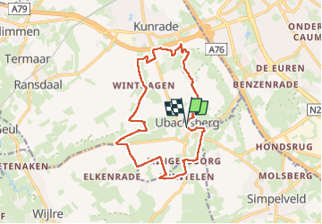
![](/images/other/stat-length.png)
![Tour Wandern Voerendaal - Ubachsberg - Photo](https://media.geolcdn.com/t/1900/400/d88cde66-eb84-4f59-9345-cf6fc456e898.jpg&format=pjpeg&maxdim=2)
Ubachsberg
Je vous emmène sur mes chemins
Par Mumu.larandonneuse
![Länge](/images/other/stat-length.png)
![Maximale Höhe](https://static1.geolcdn.com/siteimages/upload/files/1508320355ic_sort_altitude_max_24dp.png)
![Positive Höhendifferenz](https://static1.geolcdn.com/siteimages/upload/files/1508320355ic_sort_den_pos_24dp.png)
![Km-Effort](/images/other/stat-length.png)
![Min. Höhe](https://static1.geolcdn.com/siteimages/upload/files/1508320355ic_sort_altitude_min_24dp.png)
![Negative Höhendifferenz](https://static1.geolcdn.com/siteimages/upload/files/1508320355ic_sort_den_neg_24dp.png)
![Boucle](https://static1.geolcdn.com/siteimages/upload/files/16400158638029165_repeat_loop_refresh_sync_direction_icon.png)
![Wandern](https://static1.geolcdn.com/sitytour/trail-icons/101.png)
3h09
Schwierigkeit : Medium
![Scannen Sie diesen QR-Code, um die Tour in der SityTrail-Anwendung zu öffnen](https://capi.geolives.com/qq0zvz2zws4bq2lad0pu/sitytour/trails/3976010/qr.png?size=200)
Kostenlosegpshiking-Anwendung
Über SityTrail
Tour Wandern von 14 km verfügbar auf Limburg, Unbekannt, Voerendaal. Diese Tour wird von Je vous emmène sur mes chemins vorgeschlagen.
Beschreibung
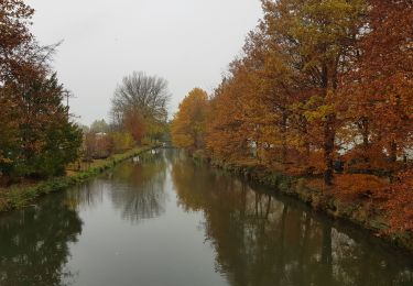
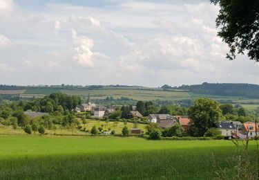
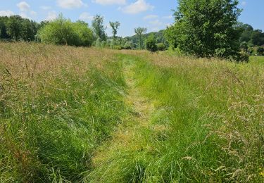
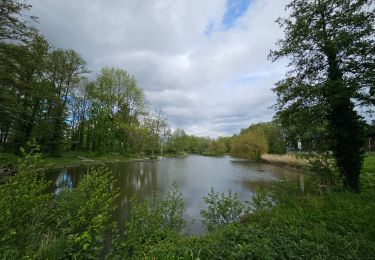
🇳🇱 Une randonnée dans la région de Voerendaal passant par le Kunderberg et plusieurs hameaux : Winthagen, Colmont, Trintelen et Mingersborg.
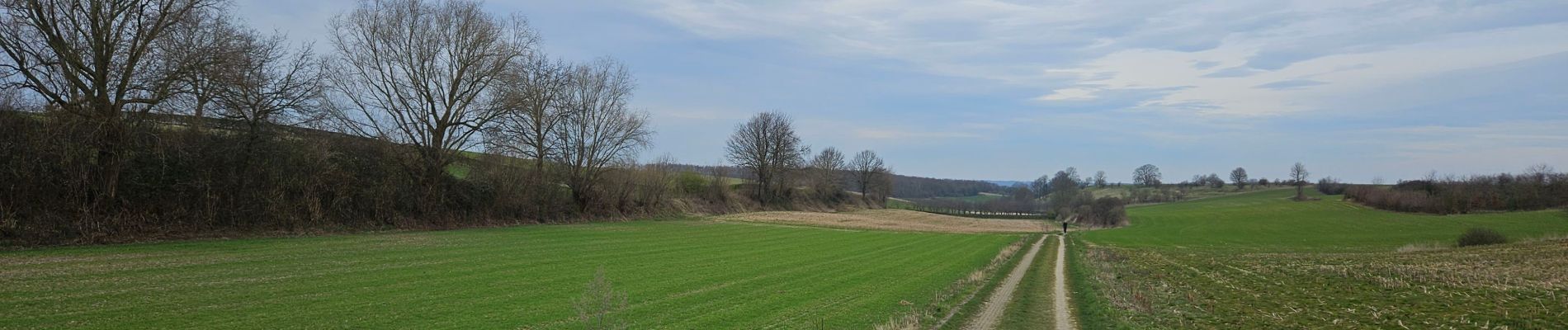
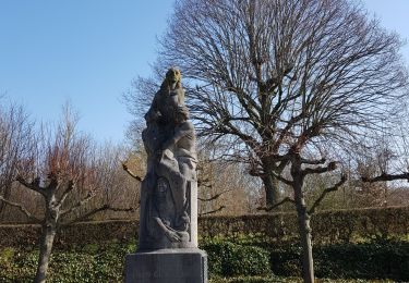
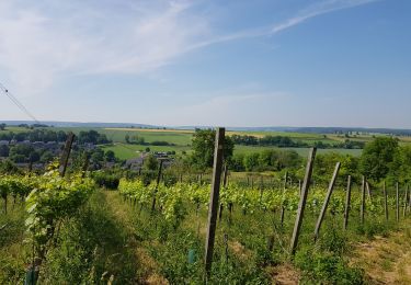
🏘 Ubachsberg est situé au milieu du "Land van Kalk", sur son propre plateau. Tout autour se trouvent des collines de prairies arides, des vignobles, des murs calcaires abrupts et des vergers fruitiers.
www.visitzuidlimburg.fr
👀 Des panoramas à 360°
Ort
Kommentare
Touren in der Umgebung
![Tour Wandern Gulpen-Wittem - 2024-07-05_10h26m55_landsrade-g4-gulpen-wittem- - Photo](https://media.geolcdn.com/t/375/260/21c97729-ea16-405b-b733-eb2ef5b79dcc.jpg&format=jpg&maxdim=2)
![Wandern Wandern](https://static1.geolcdn.com/sitytour/trail-icons/101.png)
Wandern
![](/images/other/stat-length.png)
![](https://static1.geolcdn.com/siteimages/upload/files/16400158638029165_repeat_loop_refresh_sync_direction_icon.png)
![Tour Wandern Gulpen-Wittem - 2021-11-26_14h13m03_1450 (2) - Photo](https://media.geolcdn.com/t/375/260/c6f56cbd-561d-45be-8633-9d909ae47436.jpg&format=jpg&maxdim=2)
![Wandern Wandern](https://static1.geolcdn.com/sitytour/trail-icons/101.png)
Wandern
![](/images/other/stat-length.png)
![](https://static1.geolcdn.com/siteimages/upload/files/16400158638029165_repeat_loop_refresh_sync_direction_icon.png)
![Tour Wandern Gulpen-Wittem - 2021-10-27_21h13m45_1225 - Photo](https://media.geolcdn.com/t/375/260/5eb7c815-cdad-419c-9110-728d3ac43338.jpg&format=jpg&maxdim=2)
![Wandern Wandern](https://static1.geolcdn.com/sitytour/trail-icons/101.png)
Wandern
![](/images/other/stat-length.png)
![](https://static1.geolcdn.com/siteimages/upload/files/16400158638029165_repeat_loop_refresh_sync_direction_icon.png)
![Tour Wandern Gulpen-Wittem - 2021-10-27_20h47m33_1105 - Photo](https://media.geolcdn.com/t/375/260/115742d6-93f7-467f-9808-8e4bc3de0870.jpg&format=jpg&maxdim=2)
![Wandern Wandern](https://static1.geolcdn.com/sitytour/trail-icons/101.png)
Wandern
![](/images/other/stat-length.png)
![](https://static1.geolcdn.com/siteimages/upload/files/16400158638029165_repeat_loop_refresh_sync_direction_icon.png)
![Tour Wandern Gulpen-Wittem - 2021-07-01_13h51m24_077 - Photo](https://media.geolcdn.com/t/375/260/215e9d9a-5676-4aab-b7ac-fe070e30f244.jpg&format=jpg&maxdim=2)
![Wandern Wandern](https://static1.geolcdn.com/sitytour/trail-icons/101.png)
Wandern
![](/images/other/stat-length.png)
![](https://static1.geolcdn.com/siteimages/upload/files/16400158638029165_repeat_loop_refresh_sync_direction_icon.png)
![Tour Wandern Gulpen-Wittem - 2021-06-14_21h05m37_853 - Photo](https://media.geolcdn.com/t/375/260/4793f524-5e32-489e-afec-b0432ab44946.jpg&format=jpg&maxdim=2)
![Wandern Wandern](https://static1.geolcdn.com/sitytour/trail-icons/101.png)
Wandern
![](/images/other/stat-length.png)
![](https://static1.geolcdn.com/siteimages/upload/files/16400158638029165_repeat_loop_refresh_sync_direction_icon.png)
![Tour Wandern Gulpen-Wittem - 2022-06-10_16h45m42_1555 - Photo](https://media.geolcdn.com/t/375/260/ext.jpg?maxdim=2&url=https%3A%2F%2Fstatic1.geolcdn.com%2Fsiteimages%2Fupload%2Ffiles%2F1553511878bg_sport_marche.png)
![Wandern Wandern](https://static1.geolcdn.com/sitytour/trail-icons/101.png)
Wandern
![](/images/other/stat-length.png)
![](https://static1.geolcdn.com/siteimages/upload/files/16400158638029165_repeat_loop_refresh_sync_direction_icon.png)
![Tour Wandern Gulpen-Wittem - Wijlre - Photo](https://media.geolcdn.com/t/375/260/1f37460d-555a-4cb4-9779-3e8cd2d4f315.jpg&format=jpg&maxdim=2)
![Wandern Wandern](https://static1.geolcdn.com/sitytour/trail-icons/101.png)
Wandern
![](/images/other/stat-length.png)
![](https://static1.geolcdn.com/siteimages/upload/files/16400158638029165_repeat_loop_refresh_sync_direction_icon.png)
![Tour Wandern Voerendaal - Balade des châteaux - Photo](https://media.geolcdn.com/t/375/260/429ccad7-a9a0-46f3-9f3b-59ca949a9311.jpg&format=jpg&maxdim=2)
![Wandern Wandern](https://static1.geolcdn.com/sitytour/trail-icons/101.png)
Wandern
![](/images/other/stat-length.png)
![](https://static1.geolcdn.com/siteimages/upload/files/16400158638029165_repeat_loop_refresh_sync_direction_icon.png)