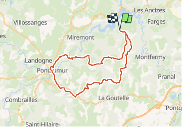
![](/images/other/stat-length.png)
![Tour Reiten Saint-Jacques-d'Ambur - St JACQUES D'AMBUR / PONTAUMUR / ST JACQUES - Photo](https://media.geolcdn.com/t/1900/400/720fba68-32de-48f4-82dd-6eb03edb21f8.jpg&format=pjpeg&maxdim=2)
St JACQUES D'AMBUR / PONTAUMUR / ST JACQUES
Gérard TIXERONT
Benutzer GUIDE
![Länge](/images/other/stat-length.png)
![Maximale Höhe](https://static1.geolcdn.com/siteimages/upload/files/1508320355ic_sort_altitude_max_24dp.png)
![Positive Höhendifferenz](https://static1.geolcdn.com/siteimages/upload/files/1508320355ic_sort_den_pos_24dp.png)
![Km-Effort](/images/other/stat-length.png)
![Min. Höhe](https://static1.geolcdn.com/siteimages/upload/files/1508320355ic_sort_altitude_min_24dp.png)
![Negative Höhendifferenz](https://static1.geolcdn.com/siteimages/upload/files/1508320355ic_sort_den_neg_24dp.png)
![Boucle](https://static1.geolcdn.com/siteimages/upload/files/16400158638029165_repeat_loop_refresh_sync_direction_icon.png)
![Reiten](https://static1.geolcdn.com/sitytour/trail-icons/301.png)
5h49
Schwierigkeit : Sehr schwierig
![Scannen Sie diesen QR-Code, um die Tour in der SityTrail-Anwendung zu öffnen](https://capi.geolives.com/qq0zvz2zws4bq2lad0pu/sitytour/trails/3971086/qr.png?size=200)
Kostenlosegpshiking-Anwendung
Über SityTrail
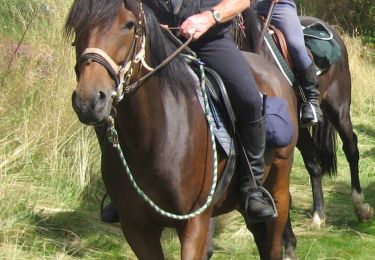
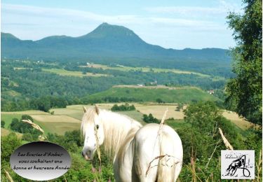
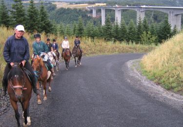
Tour Reiten von 34 km verfügbar auf Auvergne-Rhone-Alpen, Puy-de-Dôme, Saint-Jacques-d'Ambur. Diese Tour wird von Gérard TIXERONT vorgeschlagen.
Beschreibung
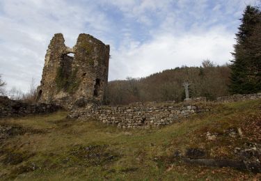
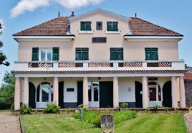
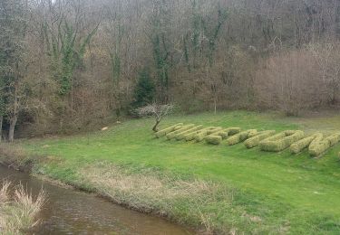
Rando Journée en boucle de 34 Kms , plusieurs dénivelés .. Plusieurs village traversés et le Bourg de Pontaumur à traverser. A voir les gorges du Moulin de Teissoux , le Sioulet , les Ruines du Moulin de Quarte. Plusieurs points d'eau pour abreuvage
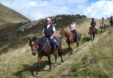
Ort
Kommentare
Touren in der Umgebung
![Reiten Reiten](https://static1.geolcdn.com/sitytour/trail-icons/301.png)
Reiten
![](/images/other/stat-length.png)
![](https://static1.geolcdn.com/siteimages/upload/files/16400158638029165_repeat_loop_refresh_sync_direction_icon.png)
![Tour Zu Fuß Saint-Jacques-d'Ambur - La Chazotte et les Sapins de Martineche - Photo](https://media.geolcdn.com/t/375/260/b1d91e9c-0a23-4e21-8eff-66a7c5d0369e.jpeg&format=jpg&maxdim=2)
![Zu Fuß Zu Fuß](https://static1.geolcdn.com/sitytour/trail-icons/100.png)
Zu Fuß
![](/images/other/stat-length.png)
![](https://static1.geolcdn.com/siteimages/upload/files/16400158638029165_repeat_loop_refresh_sync_direction_icon.png)
![Tour Zu Fuß Montfermy - Foret Domaniale de la Chartreuse - Photo](https://media.geolcdn.com/t/375/260/f8cfcc7d-f272-48ec-89ad-33d1f7e7ce75.jpeg&format=jpg&maxdim=2)
![Zu Fuß Zu Fuß](https://static1.geolcdn.com/sitytour/trail-icons/100.png)
Zu Fuß
![](/images/other/stat-length.png)
![](https://static1.geolcdn.com/siteimages/upload/files/16400158638029165_repeat_loop_refresh_sync_direction_icon.png)
![Tour Zu Fuß Chapdes-Beaufort - Sur les Pas des Chartreux - Photo](https://media.geolcdn.com/t/375/260/6a67584d-6d2a-4686-9980-b00966620a6c.jpeg&format=jpg&maxdim=2)
![Zu Fuß Zu Fuß](https://static1.geolcdn.com/sitytour/trail-icons/100.png)
Zu Fuß
![](/images/other/stat-length.png)
![](https://static1.geolcdn.com/siteimages/upload/files/16400158638029165_repeat_loop_refresh_sync_direction_icon.png)
![Tour Wandern Miremont - Miremont - Photo](https://media.geolcdn.com/t/375/260/0dac0637-e167-46bc-9034-d8c1e64a5534.jpg&format=jpg&maxdim=2)
![Wandern Wandern](https://static1.geolcdn.com/sitytour/trail-icons/101.png)
Wandern
![](/images/other/stat-length.png)
![](https://static1.geolcdn.com/siteimages/upload/files/16400158638029165_repeat_loop_refresh_sync_direction_icon.png)
![Reiten Reiten](https://static1.geolcdn.com/sitytour/trail-icons/301.png)
Reiten
![](/images/other/stat-length.png)
![](https://static1.geolcdn.com/siteimages/upload/files/16400158638029165_repeat_loop_refresh_sync_direction_icon.png)
![Tour Reiten Saint-Jacques-d'Ambur - ST JACQUES / LE ROCHER DU SOLDAT / ST JACQUES 32 KMS - Photo](https://media.geolcdn.com/t/375/260/d6b0eb37-e064-47bf-bdd4-3b51f5b7a603.jpg&format=jpg&maxdim=2)
![Reiten Reiten](https://static1.geolcdn.com/sitytour/trail-icons/301.png)
Reiten
![](/images/other/stat-length.png)
![](https://static1.geolcdn.com/siteimages/upload/files/16400158638029165_repeat_loop_refresh_sync_direction_icon.png)
![Reiten Reiten](https://static1.geolcdn.com/sitytour/trail-icons/301.png)
Reiten
![](/images/other/stat-length.png)
![](https://static1.geolcdn.com/siteimages/upload/files/16400158638029165_repeat_loop_refresh_sync_direction_icon.png)
![Tour Reiten Saint-Jacques-d'Ambur - SAINT JACQUES D'AMBUR / TIXERONT / ST JACQUES 32 kms - Photo](https://media.geolcdn.com/t/375/260/671897b3-f09f-4ab8-99bb-4ef40c30be95.jpg&format=jpg&maxdim=2)
![Reiten Reiten](https://static1.geolcdn.com/sitytour/trail-icons/301.png)
Reiten
![](/images/other/stat-length.png)
![](https://static1.geolcdn.com/siteimages/upload/files/16400158638029165_repeat_loop_refresh_sync_direction_icon.png)