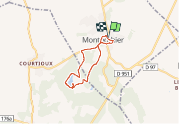
![](/images/other/stat-length.png)
![Tour Wandern Montpothier - MONTPOTHIER - Photo](https://media.geolcdn.com/t/1900/400/243edc4c-d5b0-427b-a5fd-d7965adec185.jpg&format=pjpeg&maxdim=2)
MONTPOTHIER
jeannine grandjean
Benutzer
![Länge](/images/other/stat-length.png)
![Maximale Höhe](https://static1.geolcdn.com/siteimages/upload/files/1508320355ic_sort_altitude_max_24dp.png)
![Positive Höhendifferenz](https://static1.geolcdn.com/siteimages/upload/files/1508320355ic_sort_den_pos_24dp.png)
![Km-Effort](/images/other/stat-length.png)
![Min. Höhe](https://static1.geolcdn.com/siteimages/upload/files/1508320355ic_sort_altitude_min_24dp.png)
![Negative Höhendifferenz](https://static1.geolcdn.com/siteimages/upload/files/1508320355ic_sort_den_neg_24dp.png)
![Boucle](https://static1.geolcdn.com/siteimages/upload/files/16400158638029165_repeat_loop_refresh_sync_direction_icon.png)
![Wandern](https://static1.geolcdn.com/sitytour/trail-icons/101.png)
1h24
Schwierigkeit : Medium
![Scannen Sie diesen QR-Code, um die Tour in der SityTrail-Anwendung zu öffnen](https://capi.geolives.com/qq0zvz2zws4bq2lad0pu/sitytour/trails/3966604/qr.png?size=200)
Kostenlosegpshiking-Anwendung
Über SityTrail
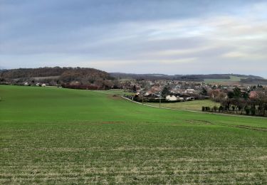
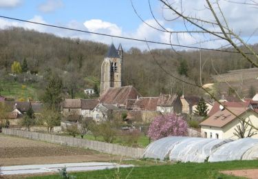
Tour Wandern von 5,2 km verfügbar auf Großer Osten, Aube, Montpothier. Diese Tour wird von jeannine grandjean vorgeschlagen.
Beschreibung
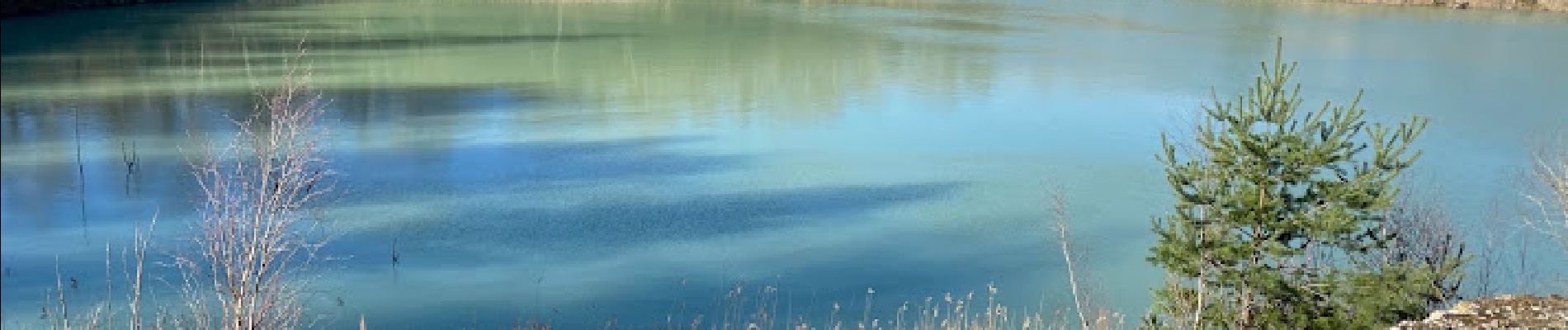
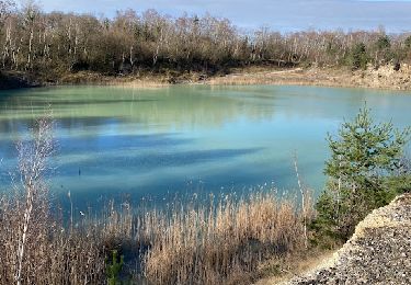
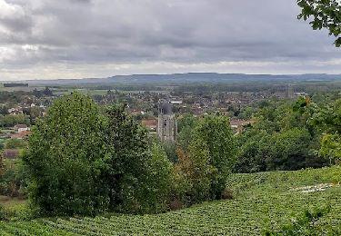
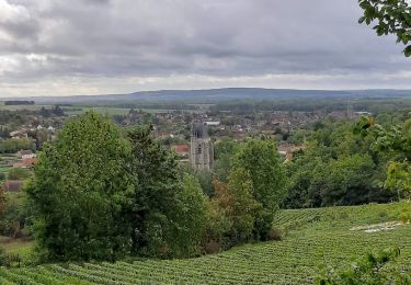
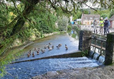
Au départ de la mairie, on rejoint le site des carrières d'argile anciennement exploitées, situé sur les territoires de Montpothier et de La Saulsotte, zone classée ZNIEFF (zone naturelle d'intérêt écologique pour sa faune et sa flore)
Ce site est une mosaïque de zones humides variées, alternant avec des milieux ouverts dénudés et secs, ce qui crée cette diversité d’habitats pour une faune et une flore rares dans la région : amateurs d'orchidées, n'hésitez pas, vous y trouverez de nombreuses espèces
Ort
Kommentare
Touren in der Umgebung
![Tour Wandern Montpothier - MONTPOTHIER, LE VILLAGE ET LES ETANGS - Photo](https://media.geolcdn.com/t/375/260/01e0c3a2-8c77-4555-836b-2b52afee3f19.jpg&format=jpg&maxdim=2)
![Wandern Wandern](https://static1.geolcdn.com/sitytour/trail-icons/101.png)
Wandern
![](/images/other/stat-length.png)
![](https://static1.geolcdn.com/siteimages/upload/files/16400158638029165_repeat_loop_refresh_sync_direction_icon.png)
![Tour Wandern La Saulsotte - Rando Santé du 27 nov. - La Saulsotte - Photo](https://media.geolcdn.com/t/375/260/d17db229-76f2-4484-8f42-b71e28113362.jpg&format=jpg&maxdim=2)
![Wandern Wandern](https://static1.geolcdn.com/sitytour/trail-icons/101.png)
Wandern
![](/images/other/stat-length.png)
![](https://static1.geolcdn.com/siteimages/upload/files/16400158638029165_repeat_loop_refresh_sync_direction_icon.png)
![Tour Wandern Villenauxe-la-Grande - VILLENAUXE LA GRANDE, village et Val de Noxe - Photo](https://media.geolcdn.com/t/375/260/f8542100-abf0-480b-b13c-e60ef02b60eb.jpg&format=jpg&maxdim=2)
![Wandern Wandern](https://static1.geolcdn.com/sitytour/trail-icons/101.png)
Wandern
![](/images/other/stat-length.png)
![](https://static1.geolcdn.com/siteimages/upload/files/16400158638029165_repeat_loop_refresh_sync_direction_icon.png)
![Tour Wandern Villenauxe-la-Grande - Villenauxe 3 - Photo](https://media.geolcdn.com/t/375/260/03986230-73df-4676-831b-4a2c9999dc20.jpg&format=jpg&maxdim=2)
![Wandern Wandern](https://static1.geolcdn.com/sitytour/trail-icons/101.png)
Wandern
![](/images/other/stat-length.png)
![](https://static1.geolcdn.com/siteimages/upload/files/16400158638029165_repeat_loop_refresh_sync_direction_icon.png)
![Tour Wandern Villenauxe-la-Grande - VILLENAUXE LA GRANDE 1 - Photo](https://media.geolcdn.com/t/375/260/54e1d98e-470e-4350-9337-6822872ca56c.jpg&format=jpg&maxdim=2)
![Wandern Wandern](https://static1.geolcdn.com/sitytour/trail-icons/101.png)
Wandern
![](/images/other/stat-length.png)
![](https://static1.geolcdn.com/siteimages/upload/files/16400158638029165_repeat_loop_refresh_sync_direction_icon.png)
![Tour Wandern Villenauxe-la-Grande - Terroirs et vignes en Val de Noxe - Photo](https://media.geolcdn.com/t/375/260/ext.jpg?maxdim=2&url=https%3A%2F%2Fstatic1.geolcdn.com%2Fsiteimages%2Fupload%2Ffiles%2F1553511878bg_sport_marche.png)
![Wandern Wandern](https://static1.geolcdn.com/sitytour/trail-icons/101.png)
Wandern
![](/images/other/stat-length.png)
![](https://static1.geolcdn.com/siteimages/upload/files/16400158638029165_repeat_loop_refresh_sync_direction_icon.png)
![Tour Wandern Villenauxe-la-Grande - Val de Noxe - Villenauxe la Grande - Photo](https://media.geolcdn.com/t/375/260/ext.jpg?maxdim=2&url=https%3A%2F%2Fservices.sitytrail.com%2FGeolivesWS%2FDownloadMedia.ashx%3FTrailID%3D317901%26Media%3D17315_5.jpg)
![Wandern Wandern](https://static1.geolcdn.com/sitytour/trail-icons/101.png)
Wandern
![](/images/other/stat-length.png)
![](https://static1.geolcdn.com/siteimages/upload/files/16400158638029165_repeat_loop_refresh_sync_direction_icon.png)
![Tour Wandern Villenauxe-la-Grande - VILLENAUXE 2 le vignoble, les bois, la rivière Noxe, le village - Photo](https://media.geolcdn.com/t/375/260/f6fbfb1d-9c0a-4a83-9328-0b76d0d7ead5.jpg&format=jpg&maxdim=2)
![Wandern Wandern](https://static1.geolcdn.com/sitytour/trail-icons/101.png)
Wandern
![](/images/other/stat-length.png)
![](https://static1.geolcdn.com/siteimages/upload/files/16400158638029165_repeat_loop_refresh_sync_direction_icon.png)
![Tour Fahrrad Villenauxe-la-Grande - Vignoble de Champagne et Vallée de la Noxe - Villenauxe la Grande - Photo](https://media.geolcdn.com/t/375/260/ext.jpg?maxdim=2&url=https%3A%2F%2Fservices.sitytrail.com%2FGeolivesWS%2FDownloadMedia.ashx%3FTrailID%3D112582%26Media%3D11029_2.jpg)
![Fahrrad Fahrrad](https://static1.geolcdn.com/sitytour/trail-icons/200.png)
Fahrrad
![](/images/other/stat-length.png)
![](https://static1.geolcdn.com/siteimages/upload/files/16400158638029165_repeat_loop_refresh_sync_direction_icon.png)