![](/images/other/stat-length.png)
![Tour Mountainbike Dommartin-aux-Bois - 2024-02-09_12h07m04_10178317_Le_Chanot_MAJ_ONF - Photo](https://media.geolcdn.com/t/1900/400/8ff85250-319f-4c54-88c7-8004cb8071fb.jpg&format=pjpeg&maxdim=2)
2024-02-09_12h07m04_10178317_Le_Chanot_MAJ_ONF
elgatolopez
Benutzer
![Länge](/images/other/stat-length.png)
Länge
31 km
![Maximale Höhe](https://static1.geolcdn.com/siteimages/upload/files/1508320355ic_sort_altitude_max_24dp.png)
Maximale Höhe
440 m
![Positive Höhendifferenz](https://static1.geolcdn.com/siteimages/upload/files/1508320355ic_sort_den_pos_24dp.png)
Positive Höhendifferenz
559 m
![Km-Effort](/images/other/stat-length.png)
Km-Effort
38 km
![Min. Höhe](https://static1.geolcdn.com/siteimages/upload/files/1508320355ic_sort_altitude_min_24dp.png)
Min. Höhe
321 m
![Negative Höhendifferenz](https://static1.geolcdn.com/siteimages/upload/files/1508320355ic_sort_den_neg_24dp.png)
Negative Höhendifferenz
559 m
![Boucle](https://static1.geolcdn.com/siteimages/upload/files/16400158638029165_repeat_loop_refresh_sync_direction_icon.png)
Boucle
Ja
Erstellungsdatum :
2024-02-09 11:07:05.988
Letzte Änderung :
2024-02-09 13:54:10.452
![Mountainbike](https://static1.geolcdn.com/sitytour/trail-icons/202.png)
2h40
Schwierigkeit : Schwierig
![Scannen Sie diesen QR-Code, um die Tour in der SityTrail-Anwendung zu öffnen](https://capi.geolives.com/qq0zvz2zws4bq2lad0pu/sitytour/trails/3944144/qr.png?size=200)
Kostenlosegpshiking-Anwendung
Über SityTrail
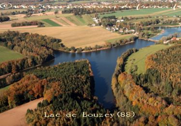
Tour Mountainbike von 31 km verfügbar auf Großer Osten, Vogesen, Dommartin-aux-Bois. Diese Tour wird von elgatolopez vorgeschlagen.
Beschreibung
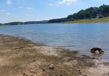
Un petit conseil pour le retour, une fois à Thiélouze restez sur la route sinon vous passerez votre temps à porter le vélo ;)
Ort
Land:
France
Region :
Großer Osten
Abteilung/Provinz :
Vogesen
Kommune :
Dommartin-aux-Bois
Standort:
Unknown
Gehen Sie:(Dec)
Gehen Sie:(UTM)
299325 ; 5334973 (32U) N.
Kommentare
Touren in der Umgebung
![Tour Wandern Chaumousey - Bouzey, côté abbaye - Photo](https://media.geolcdn.com/t/375/260/7bbec264-6140-414e-b70b-a7b14fa5a444.jpg&format=jpg&maxdim=2)
![Wandern Wandern](https://static1.geolcdn.com/sitytour/trail-icons/101.png)
Bouzey, côté abbaye
Wandern
Medium
Chaumousey,
Großer Osten,
Vogesen,
France
![](/images/other/stat-length.png)
6,1 km | 7,5 km-effort
1h 40min
![](https://static1.geolcdn.com/siteimages/upload/files/16400158638029165_repeat_loop_refresh_sync_direction_icon.png)
Ja
![Tour Wandern Sanchey - A la Découverte de BOUZEY - Photo](https://media.geolcdn.com/t/375/260/ext.jpg?maxdim=2&url=https%3A%2F%2Fservices.sitytrail.com%2FGeolivesWS%2FDownloadMedia.ashx%3FTrailID%3D370217%26Media%3Dfix__20141216154032.jpg)
![Wandern Wandern](https://static1.geolcdn.com/sitytour/trail-icons/101.png)
A la Découverte de BOUZEY
Wandern
Sehr leicht
Sanchey,
Großer Osten,
Vogesen,
France
![](/images/other/stat-length.png)
7,7 km | 9,3 km-effort
2h 4min
![](https://static1.geolcdn.com/siteimages/upload/files/16400158638029165_repeat_loop_refresh_sync_direction_icon.png)
Ja
![Tour Wandern Sanchey - Circuit du tour du Lac de Bouzey - Photo](https://media.geolcdn.com/t/375/260/ext.jpg?maxdim=2&url=https%3A%2F%2Fservices.sitytrail.com%2FGeolivesWS%2FDownloadMedia.ashx%3FTrailID%3D215026%26Media%3D15592_3.jpg)
![Wandern Wandern](https://static1.geolcdn.com/sitytour/trail-icons/101.png)
Circuit du tour du Lac de Bouzey
Wandern
Einfach
Sanchey,
Großer Osten,
Vogesen,
France
![](/images/other/stat-length.png)
7 km | 8,5 km-effort
1h 40min
![](https://static1.geolcdn.com/siteimages/upload/files/16400158638029165_repeat_loop_refresh_sync_direction_icon.png)
Ja
![Tour Mountainbike Chaumousey - Espace VTT FFC Chemins du Coeur des Vosges - circuit n°87 - Circuit de l'Abbaye - Photo](https://media.geolcdn.com/t/375/260/ext.jpg?maxdim=2&url=https%3A%2F%2Fservices.sitytrail.com%2FGeolivesWS%2FDownloadMedia.ashx%3FTrailID%3D104434%26Media%3D7678_3.jpg)
![Mountainbike Mountainbike](https://static1.geolcdn.com/sitytour/trail-icons/202.png)
Espace VTT FFC Chemins du Coeur des Vosges - circuit n°87 - Circuit de l'Abbaye
Mountainbike
Medium
(1)
Chaumousey,
Großer Osten,
Vogesen,
France
![](/images/other/stat-length.png)
11,7 km | 14,8 km-effort
1h 0min
![](https://static1.geolcdn.com/siteimages/upload/files/16400158638029165_repeat_loop_refresh_sync_direction_icon.png)
Ja
![Tour Wandern Chaumousey - bouzey - Photo](https://media.geolcdn.com/t/375/260/42b3c20c-5f10-4fa7-b249-c74aab47db2f.jpg&format=jpg&maxdim=2)
![Wandern Wandern](https://static1.geolcdn.com/sitytour/trail-icons/101.png)
![Tour Wandern Charmois-l'Orgueilleux - charmois mp 2019 - Photo](https://media.geolcdn.com/t/375/260/46a50de4-6578-4ee1-92bf-216ef78b222f.jpg&format=jpg&maxdim=2)
![Wandern Wandern](https://static1.geolcdn.com/sitytour/trail-icons/101.png)
charmois mp 2019
Wandern
Medium
Charmois-l'Orgueilleux,
Großer Osten,
Vogesen,
France
![](/images/other/stat-length.png)
21 km | 28 km-effort
4h 6min
![](https://static1.geolcdn.com/siteimages/upload/files/16400158638029165_repeat_loop_refresh_sync_direction_icon.png)
Ja
![Tour Wandern Girancourt - Circuit d''Agémont - Photo](https://media.geolcdn.com/t/375/260/ext.jpg?maxdim=2&url=https%3A%2F%2Fservices.sitytrail.com%2FGeolivesWS%2FDownloadMedia.ashx%3FTrailID%3D215262%26Media%3D15460_1.jpg)
![Wandern Wandern](https://static1.geolcdn.com/sitytour/trail-icons/101.png)
Circuit d''Agémont
Wandern
Einfach
Girancourt,
Großer Osten,
Vogesen,
France
![](/images/other/stat-length.png)
7,8 km | 10,2 km-effort
1h 19min
![](https://static1.geolcdn.com/siteimages/upload/files/16400158638029165_repeat_loop_refresh_sync_direction_icon.png)
Nein
![Tour Wandern Chaumousey - Circuit du Fort de Girancourt - Photo](https://media.geolcdn.com/t/375/260/ext.jpg?maxdim=2&url=https%3A%2F%2Fservices.sitytrail.com%2FGeolivesWS%2FDownloadMedia.ashx%3FTrailID%3D214958%26Media%3D15525_1.jpg)
![Wandern Wandern](https://static1.geolcdn.com/sitytour/trail-icons/101.png)
Circuit du Fort de Girancourt
Wandern
Einfach
Chaumousey,
Großer Osten,
Vogesen,
France
![](/images/other/stat-length.png)
5,1 km | 6,4 km-effort
1h 19min
![](https://static1.geolcdn.com/siteimages/upload/files/16400158638029165_repeat_loop_refresh_sync_direction_icon.png)
Ja
![Tour Wandern Sanchey - Circuit de Chaumousey - Photo](https://media.geolcdn.com/t/375/260/ext.jpg?maxdim=2&url=https%3A%2F%2Fservices.sitytrail.com%2FGeolivesWS%2FDownloadMedia.ashx%3FTrailID%3D214912%26Media%3D15476_2.jpg)
![Wandern Wandern](https://static1.geolcdn.com/sitytour/trail-icons/101.png)
Circuit de Chaumousey
Wandern
Medium
Sanchey,
Großer Osten,
Vogesen,
France
![](/images/other/stat-length.png)
14,7 km | 17 km-effort
2h 10min
![](https://static1.geolcdn.com/siteimages/upload/files/16400158638029165_repeat_loop_refresh_sync_direction_icon.png)
Ja