![](/images/other/stat-length.png)
![Tour Wandern Mauves-sur-Huisne - [Itinéraire] Mortous : autour des méandres de l'Huisne - Photo](https://media.geolcdn.com/t/1900/400/ext.pjpeg?maxdim=2&url=https%3A%2F%2Fstatic1.geolcdn.com%2Fsiteimages%2Fupload%2Ffiles%2F1553511878bg_sport_marche.png)
[Itinéraire] Mortous : autour des méandres de l'Huisne
ODDAD78
Benutzer
![Länge](/images/other/stat-length.png)
![Maximale Höhe](https://static1.geolcdn.com/siteimages/upload/files/1508320355ic_sort_altitude_max_24dp.png)
![Positive Höhendifferenz](https://static1.geolcdn.com/siteimages/upload/files/1508320355ic_sort_den_pos_24dp.png)
![Km-Effort](/images/other/stat-length.png)
![Min. Höhe](https://static1.geolcdn.com/siteimages/upload/files/1508320355ic_sort_altitude_min_24dp.png)
![Negative Höhendifferenz](https://static1.geolcdn.com/siteimages/upload/files/1508320355ic_sort_den_neg_24dp.png)
![Boucle](https://static1.geolcdn.com/siteimages/upload/files/16400158638029165_repeat_loop_refresh_sync_direction_icon.png)
![Wandern](https://static1.geolcdn.com/sitytour/trail-icons/101.png)
45m
Schwierigkeit : Einfach
![Scannen Sie diesen QR-Code, um die Tour in der SityTrail-Anwendung zu öffnen](https://capi.geolives.com/qq0zvz2zws4bq2lad0pu/sitytour/trails/3943708/qr.png?size=200)
Kostenlosegpshiking-Anwendung
Über SityTrail
Tour Wandern von 3 km verfügbar auf Normandie, Orne, Mauves-sur-Huisne. Diese Tour wird von ODDAD78 vorgeschlagen.
Beschreibung
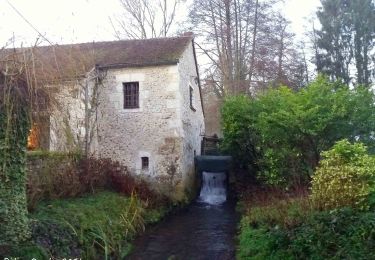
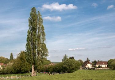
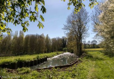
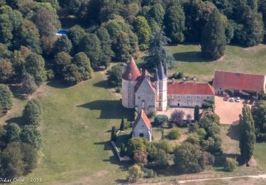
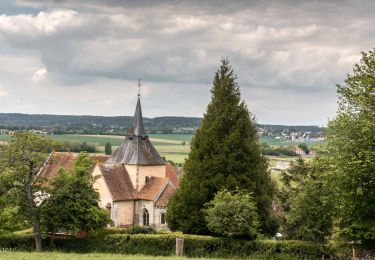
Agréable parcours en campagne qui forme une boucle autour de l'Huisne. Découverte de la faune et de la flore d'une zone humide. Panorama unique sur l'arrière du bourg de Mauves-sur-Huisne et de l'église Saint-Pierre.
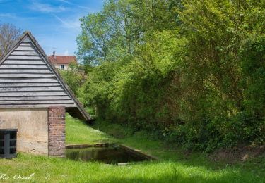
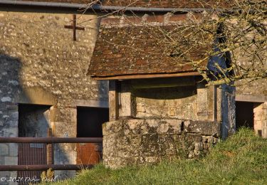
En partant d'un ancien lavoir restauré vous suivrez les méandres de l'Huisne. Vous vous trouverez au coeur d'une zone humide naturelle pour ensuite emprunter le remarquable chemin creux de Mortous. Après avoir traversé le pont Catinat construit en 1610 vous rejoindrez le village - rue de Mauves et ses alignements de maisons et d'arbres.
Pas à pas (Rando-Perche)
Départ : Mauves-sur-Huisne Arrivée : Mauves-sur-Huisne Balisage : PR
Communes : 1. Mauves-sur-Huisne
Départ place de la mairie.
1. Prendre le chemin de l'Abreuvoir puis rue de la Huchette en contrebas.
2. Passer devant le lavoir communal et emprunter le chemin en herbe à droite, le long d'un mur.
Poursuivre sur 900m.
3. A gauche, prendre la direction de Mortous (panneau).
4. Passer au dessus de l'Huisne et continuer tout droit sur le chemin creux jusqu'à Mortous.
5. Prendre le chemin empierré sur gauche et continuer jusqu'au lieu dit "Pont".
6. Prendre à gauche en empruntant la D9. Traverser l'Huisne sur le pont Catinat pour remonter
jusqu'en haut du bourg sur la rue de Mauves, jusqu'à retrouver la place de la mairie.
Ort
Kommentare
Touren in der Umgebung
![Tour Wandern La Chapelle-Montligeon - [Itinéraire] Le Mont Ligeon - Photo](https://media.geolcdn.com/t/375/260/ce92da88-fb92-411f-965d-5e4e270d0f79.jpeg&format=jpg&maxdim=2)
![Wandern Wandern](https://static1.geolcdn.com/sitytour/trail-icons/101.png)
Wandern
![](/images/other/stat-length.png)
![](https://static1.geolcdn.com/siteimages/upload/files/16400158638029165_repeat_loop_refresh_sync_direction_icon.png)
![Tour Wandern La Chapelle-Montligeon - La Chapelle-Montligeon - Longny-au-Perche via Bizou 16 km - Photo](https://media.geolcdn.com/t/375/260/5e36f740-ecc7-4760-b425-4f15cc356d54.jpg&format=jpg&maxdim=2)
![Wandern Wandern](https://static1.geolcdn.com/sitytour/trail-icons/101.png)
Wandern
![](/images/other/stat-length.png)
![](https://static1.geolcdn.com/siteimages/upload/files/16400158638029165_repeat_loop_refresh_sync_direction_icon.png)
![Tour Wandern La Chapelle-Montligeon - La Chapelle-Montligeon - Moutiers-au-Perche via Bizou 20 km - Photo](https://media.geolcdn.com/t/375/260/4094c967-a97a-44d3-924e-010e9be9049f.jpg&format=jpg&maxdim=2)
![Wandern Wandern](https://static1.geolcdn.com/sitytour/trail-icons/101.png)
Wandern
![](/images/other/stat-length.png)
![](https://static1.geolcdn.com/siteimages/upload/files/16400158638029165_repeat_loop_refresh_sync_direction_icon.png)
![Tour Wandern La Chapelle-Montligeon - La Chapelle-Montligeon - Le Mage via Bizou 18 km - Photo](https://media.geolcdn.com/t/375/260/2514d07f-ce42-4914-ba12-eb561f06fea2.jpg&format=jpg&maxdim=2)
![Wandern Wandern](https://static1.geolcdn.com/sitytour/trail-icons/101.png)
Wandern
![](/images/other/stat-length.png)
![](https://static1.geolcdn.com/siteimages/upload/files/16400158638029165_repeat_loop_refresh_sync_direction_icon.png)
![Tour Wandern Mauves-sur-Huisne - Mauves-sur-Huisne - Nocé-Courboyer 14 km - Photo](https://media.geolcdn.com/t/375/260/466f9b4c-93ba-4aca-9d1e-6d5326965a9d.jpg&format=jpg&maxdim=2)
![Wandern Wandern](https://static1.geolcdn.com/sitytour/trail-icons/101.png)
Wandern
![](/images/other/stat-length.png)
![](https://static1.geolcdn.com/siteimages/upload/files/16400158638029165_repeat_loop_refresh_sync_direction_icon.png)
![Tour Wandern La Chapelle-Montligeon - La Chapelle-Montligeon - Mauves-sur-Huisne 7,8 km - Photo](https://media.geolcdn.com/t/375/260/fe531396-d696-4b85-843a-3574d25662eb.jpg&format=jpg&maxdim=2)
![Wandern Wandern](https://static1.geolcdn.com/sitytour/trail-icons/101.png)
Wandern
![](/images/other/stat-length.png)
![](https://static1.geolcdn.com/siteimages/upload/files/16400158638029165_repeat_loop_refresh_sync_direction_icon.png)
![Tour Wandern Perche en Nocé - Le Vieux bourg 5km - Photo](https://media.geolcdn.com/t/375/260/54cf2d8e-b3dd-4aff-a487-7aa5645246e5.jpg&format=jpg&maxdim=2)
![Wandern Wandern](https://static1.geolcdn.com/sitytour/trail-icons/101.png)
Wandern
![](/images/other/stat-length.png)
![](https://static1.geolcdn.com/siteimages/upload/files/16400158638029165_repeat_loop_refresh_sync_direction_icon.png)
![Tour Wandern Mauves-sur-Huisne - Mauves-sur-Huisne - Mortagne-au-Perche 11 km - Photo](https://media.geolcdn.com/t/375/260/2520701b-de52-4bea-9db4-ad9767ef6f28.jpg&format=jpg&maxdim=2)
![Wandern Wandern](https://static1.geolcdn.com/sitytour/trail-icons/101.png)
Wandern
![](/images/other/stat-length.png)
![](https://static1.geolcdn.com/siteimages/upload/files/16400158638029165_repeat_loop_refresh_sync_direction_icon.png)
![Tour Wandern La Chapelle-Montligeon - La Chapelle-Montligeon - Tourouvre 19 km - Photo](https://media.geolcdn.com/t/375/260/a31c6835-bfa1-4431-b7fc-3b6c5f1acc90.jpg&format=jpg&maxdim=2)
![Wandern Wandern](https://static1.geolcdn.com/sitytour/trail-icons/101.png)
Wandern
![](/images/other/stat-length.png)
![](https://static1.geolcdn.com/siteimages/upload/files/16400158638029165_repeat_loop_refresh_sync_direction_icon.png)