


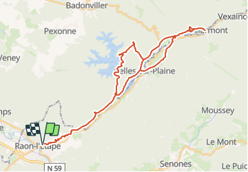

28 km | 37 km-effort


Benutzer


Kostenlosegpshiking-Anwendung
 SityTrail
IGN / Geografische Institute
SityTrail World
Die Welt öffnet sich für Sie
Tour Elektrofahrrad von 41 km verfügbar auf Großer Osten, Vogesen, Raon-l'Étape. Diese Tour wird von gmalgrase vorgeschlagen.
Raon l'Etape, Celles sur Plaine, Allarmont puis retour vers Celles sur l'autre rive de la Paine, montée vers Pierre Percée, descente vers le barrage, et retour vers Raon
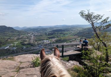
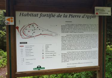
Reiten
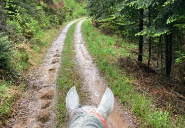
Reiten

Mountainbike

Mountainbike
Mountainbike
Mountainbike
Mountainbike
Mountainbike

Reiten