


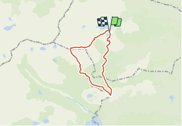

15,1 km | 24 km-effort


Benutzer


Kostenlosegpshiking-Anwendung
 SityTrail
IGN / Geografische Institute
SityTrail World
Die Welt öffnet sich für Sie
Tour Wandern von 11,4 km verfügbar auf Okzitanien, Ostpyrenäen, Formiguères. Diese Tour wird von 34christophe vorgeschlagen.
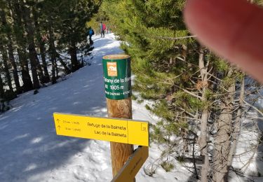
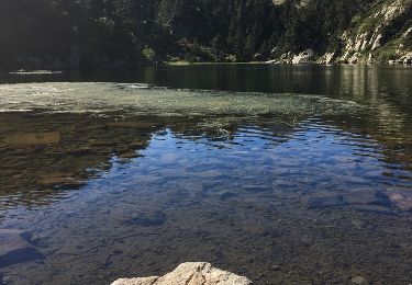
refuge, les Pérics, étang la LLosa, cabane de la Balmeta, refuge
rando programmée mais non encore réalisée : j'ignore s'il existe un sentier entre le km 3 et le km 4,7

Wandern


sport
Wandern

Wandern

Schneeschuhwandern
Wandern
Wandern
Schneeschuhwandern
Wandern