


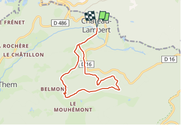


21 km | 30 km-effort


Benutzer


Kostenlosegpshiking-Anwendung
 SityTrail
IGN / Geografische Institute
SityTrail World
Die Welt öffnet sich für Sie
Tour Wandern von 7,1 km verfügbar auf Burgund und Freigrafschaft, Haute-Saône, Haut-du-Them-Château-Lambert. Diese Tour wird von Emmanuel Remy vorgeschlagen.
Un parcours comme une invitation à |'école buissonnière. À partir de ’Espace Nature et Culture une douzaine de panneaux nous font la leçon sur le granit des Ballons, les murets, la forêt, les prairies, la haute vallée de l'0gnon

Mountainbike

Zu Fuß

Wandern

Wandern

Wandern
Wandern
Wandern

Wandern
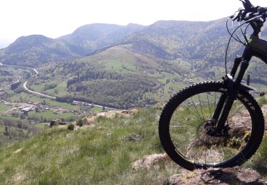
Mountainbike