![](/images/other/stat-length.png)
![Tour Wandern Houssay - Houssay - Photo](https://media.geolcdn.com/t/1900/400/ext.pjpeg?maxdim=2&url=https%3A%2F%2Fmedia.geolcdn.com%2Ff%2F3bd1239e-bd99-41e7-b552-6fe8c8fd81df.jpg)
Houssay
guydu41
Benutzer
![Länge](/images/other/stat-length.png)
Länge
11,5 km
![Maximale Höhe](https://static1.geolcdn.com/siteimages/upload/files/1508320355ic_sort_altitude_max_24dp.png)
Maximale Höhe
128 m
![Positive Höhendifferenz](https://static1.geolcdn.com/siteimages/upload/files/1508320355ic_sort_den_pos_24dp.png)
Positive Höhendifferenz
210 m
![Km-Effort](/images/other/stat-length.png)
Km-Effort
14,3 km
![Min. Höhe](https://static1.geolcdn.com/siteimages/upload/files/1508320355ic_sort_altitude_min_24dp.png)
Min. Höhe
82 m
![Negative Höhendifferenz](https://static1.geolcdn.com/siteimages/upload/files/1508320355ic_sort_den_neg_24dp.png)
Negative Höhendifferenz
210 m
![Boucle](https://static1.geolcdn.com/siteimages/upload/files/16400158638029165_repeat_loop_refresh_sync_direction_icon.png)
Boucle
Ja
Erstellungsdatum :
2023-10-05 12:06:41.944
Letzte Änderung :
2023-10-06 05:07:42.56
![Wandern](https://static1.geolcdn.com/sitytour/trail-icons/101.png)
2h36
Schwierigkeit : Medium
![Scannen Sie diesen QR-Code, um die Tour in der SityTrail-Anwendung zu öffnen](https://capi.geolives.com/qq0zvz2zws4bq2lad0pu/sitytour/trails/3829680/qr.png?size=200)
Kostenlosegpshiking-Anwendung
Über SityTrail
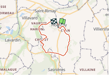
Tour Wandern von 11,5 km verfügbar auf Zentrum-Loiretal, Loir-et-Cher, Houssay. Diese Tour wird von guydu41 vorgeschlagen.
Beschreibung
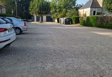
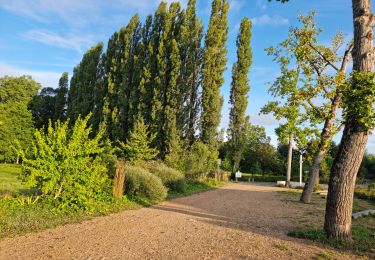
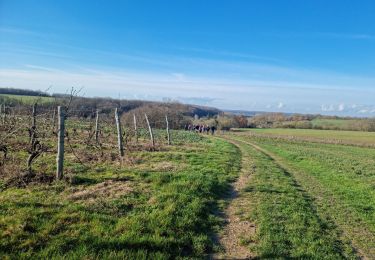
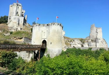
Boucle au départ du parking à Houssay.
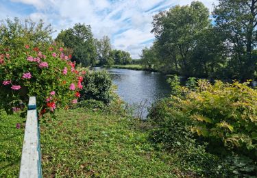
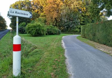
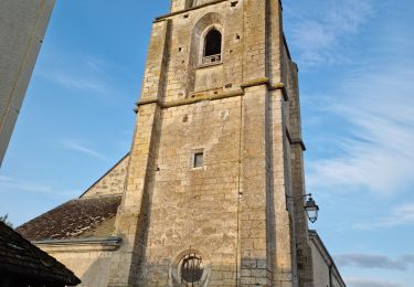
Circuit à travers bois, champs, vignes, le long d'une vallée, d'apprécier de beaux points de vue, d'admirer de jolies habitations troglodytes, etc.
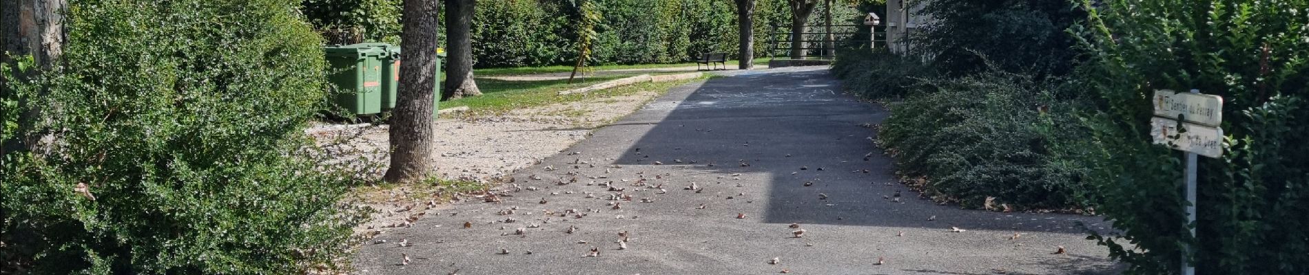
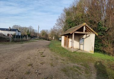
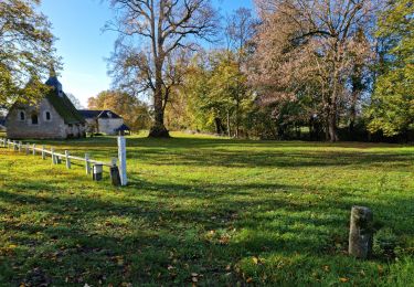
Ort
Land:
France
Region :
Zentrum-Loiretal
Abteilung/Provinz :
Loir-et-Cher
Kommune :
Houssay
Standort:
Unknown
Gehen Sie:(Dec)
Gehen Sie:(UTM)
345385 ; 5290688 (31T) N.
Kommentare
Touren in der Umgebung
![Tour Wandern Marcilly-en-Beauce - Varennes - Photo](https://media.geolcdn.com/t/375/260/ext.jpg?maxdim=2&url=https%3A%2F%2Fmedia.geolcdn.com%2Ff%2Fe5fe1065-d10c-4b43-96c8-69a926a5b2c1.jpg)
![Wandern Wandern](https://static1.geolcdn.com/sitytour/trail-icons/101.png)
Varennes
Wandern
Einfach
Marcilly-en-Beauce,
Zentrum-Loiretal,
Loir-et-Cher,
France
![](/images/other/stat-length.png)
7,9 km | 9,1 km-effort
2h 3min
![](https://static1.geolcdn.com/siteimages/upload/files/16400158638029165_repeat_loop_refresh_sync_direction_icon.png)
Ja
![Tour Wandern Lunay - Château de la Mézière - Asnières - Photo](https://media.geolcdn.com/t/375/260/ext.jpg?maxdim=2&url=https%3A%2F%2Fmedia.geolcdn.com%2Ff%2F7020eb26-114b-4b8b-93d9-05c4bb72eb01.jpg)
![Wandern Wandern](https://static1.geolcdn.com/sitytour/trail-icons/101.png)
Château de la Mézière - Asnières
Wandern
Medium
Lunay,
Zentrum-Loiretal,
Loir-et-Cher,
France
![](/images/other/stat-length.png)
7,4 km | 8,5 km-effort
1h 56min
![](https://static1.geolcdn.com/siteimages/upload/files/16400158638029165_repeat_loop_refresh_sync_direction_icon.png)
Ja
![Tour Wandern Saint-Rimay - Saint-Rimay - Photo](https://media.geolcdn.com/t/375/260/ext.jpg?maxdim=2&url=https%3A%2F%2Fmedia.geolcdn.com%2Ff%2F4102077f-f972-4a74-9982-90e370a0028d.jpg)
![Wandern Wandern](https://static1.geolcdn.com/sitytour/trail-icons/101.png)
Saint-Rimay
Wandern
Medium
Saint-Rimay,
Zentrum-Loiretal,
Loir-et-Cher,
France
![](/images/other/stat-length.png)
11,3 km | 14,2 km-effort
3h 14min
![](https://static1.geolcdn.com/siteimages/upload/files/16400158638029165_repeat_loop_refresh_sync_direction_icon.png)
Ja
![Tour Wandern Les Roches-l'Évêque - Les Roches-l'Evêque - Photo](https://media.geolcdn.com/t/375/260/ext.jpg?maxdim=2&url=https%3A%2F%2Fmedia.geolcdn.com%2Ff%2Fdca20853-d794-4c8a-9c81-2319f41b2890.jpg)
![Wandern Wandern](https://static1.geolcdn.com/sitytour/trail-icons/101.png)
Les Roches-l'Evêque
Wandern
Medium
Les Roches-l'Évêque,
Zentrum-Loiretal,
Loir-et-Cher,
France
![](/images/other/stat-length.png)
8,8 km | 11,1 km-effort
2h 31min
![](https://static1.geolcdn.com/siteimages/upload/files/16400158638029165_repeat_loop_refresh_sync_direction_icon.png)
Ja
![Tour Wandern Sasnières - Sasnières - Forêt de Prunay - Photo](https://media.geolcdn.com/t/375/260/ext.jpg?maxdim=2&url=https%3A%2F%2Fmedia.geolcdn.com%2Ff%2F4b277d69-6f27-4876-a7cb-1ef4296319a9.jpg)
![Wandern Wandern](https://static1.geolcdn.com/sitytour/trail-icons/101.png)
Sasnières - Forêt de Prunay
Wandern
Medium
Sasnières,
Zentrum-Loiretal,
Loir-et-Cher,
France
![](/images/other/stat-length.png)
10,6 km | 12,4 km-effort
2h 48min
![](https://static1.geolcdn.com/siteimages/upload/files/16400158638029165_repeat_loop_refresh_sync_direction_icon.png)
Ja
![Tour Wandern Thoré-la-Rochette - Thoré-la-Rochette - Photo](https://media.geolcdn.com/t/375/260/ext.jpg?maxdim=2&url=https%3A%2F%2Fmedia.geolcdn.com%2Ff%2Fea7d7535-a679-44f0-afe0-d955f52ecb9d.jpg)
![Wandern Wandern](https://static1.geolcdn.com/sitytour/trail-icons/101.png)
Thoré-la-Rochette
Wandern
Medium
Thoré-la-Rochette,
Zentrum-Loiretal,
Loir-et-Cher,
France
![](/images/other/stat-length.png)
9,5 km | 11,1 km-effort
2h 31min
![](https://static1.geolcdn.com/siteimages/upload/files/16400158638029165_repeat_loop_refresh_sync_direction_icon.png)
Ja
![Tour Wandern Sasnières - Sasnières Nord - Photo](https://media.geolcdn.com/t/375/260/ext.jpg?maxdim=2&url=https%3A%2F%2Fmedia.geolcdn.com%2Ff%2F284a3961-0328-4eb2-973d-94855c25ddde.jpg)
![Wandern Wandern](https://static1.geolcdn.com/sitytour/trail-icons/101.png)
Sasnières Nord
Wandern
Medium
Sasnières,
Zentrum-Loiretal,
Loir-et-Cher,
France
![](/images/other/stat-length.png)
11,5 km | 13,7 km-effort
2h 24min
![](https://static1.geolcdn.com/siteimages/upload/files/16400158638029165_repeat_loop_refresh_sync_direction_icon.png)
Ja
![Tour Wandern Houssay - Circuit Promenades et Randonnées (PR)](https://media.geolcdn.com/t/375/260/ext.jpg?maxdim=2&url=https%3A%2F%2Fmedia.geolcdn.com%2Ff%2F5ea570ff-f61f-453e-a15a-2af4ead43e67.jpg)
![Wandern Wandern](https://static1.geolcdn.com/sitytour/trail-icons/101.png)
Circuit Promenades et Randonnées (PR) "Les Manières"
Wandern
Einfach
Houssay,
Zentrum-Loiretal,
Loir-et-Cher,
France
![](/images/other/stat-length.png)
12,4 km | 14,8 km-effort
2h 48min
![](https://static1.geolcdn.com/siteimages/upload/files/16400158638029165_repeat_loop_refresh_sync_direction_icon.png)
Ja
![Tour Wandern - Lavardin - Vallée du Loir - 2015 08 22 - Photo](https://media.geolcdn.com/t/375/260/ext.jpg?maxdim=2&url=https%3A%2F%2Fmedia.geolcdn.com%2Ff%2F9217c5be-6f6a-4a6f-89e4-63f2df152ec7.jpg)
![Wandern Wandern](https://static1.geolcdn.com/sitytour/trail-icons/101.png)
Lavardin - Vallée du Loir - 2015 08 22
Wandern
Medium
,
Zentrum-Loiretal,
Loir-et-Cher,
France
![](/images/other/stat-length.png)
25 km | 31 km-effort
6h 0min
![](https://static1.geolcdn.com/siteimages/upload/files/16400158638029165_repeat_loop_refresh_sync_direction_icon.png)
Ja