![](/images/other/stat-length.png)
![Tour Wandern Péreyres - Pereyres Lachamp 16km - Photo](https://media.geolcdn.com/t/1900/400/cd059db4-0e57-4cdd-b0a7-57f5a9d765a9.jpg&format=pjpeg&maxdim=2)
Pereyres Lachamp 16km
thonyc
Benutzer GUIDE
![Länge](/images/other/stat-length.png)
![Maximale Höhe](https://static1.geolcdn.com/siteimages/upload/files/1508320355ic_sort_altitude_max_24dp.png)
![Positive Höhendifferenz](https://static1.geolcdn.com/siteimages/upload/files/1508320355ic_sort_den_pos_24dp.png)
![Km-Effort](/images/other/stat-length.png)
![Min. Höhe](https://static1.geolcdn.com/siteimages/upload/files/1508320355ic_sort_altitude_min_24dp.png)
![Negative Höhendifferenz](https://static1.geolcdn.com/siteimages/upload/files/1508320355ic_sort_den_neg_24dp.png)
![Boucle](https://static1.geolcdn.com/siteimages/upload/files/16400158638029165_repeat_loop_refresh_sync_direction_icon.png)
![Wandern](https://static1.geolcdn.com/sitytour/trail-icons/101.png)
5h32
Schwierigkeit : Medium
![Scannen Sie diesen QR-Code, um die Tour in der SityTrail-Anwendung zu öffnen](https://capi.geolives.com/qq0zvz2zws4bq2lad0pu/sitytour/trails/3828566/qr.png?size=200)
Kostenlosegpshiking-Anwendung
Über SityTrail
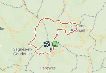
Tour Wandern von 16,1 km verfügbar auf Auvergne-Rhone-Alpen, Ardèche, Péreyres. Diese Tour wird von thonyc vorgeschlagen.
Beschreibung
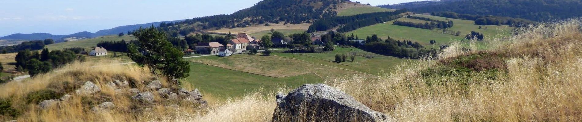
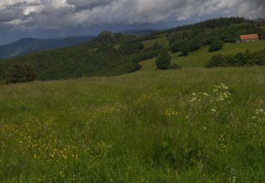
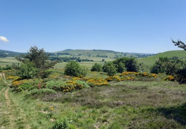
Parcours très varié malgré quelques km sur petites routes goudronnées (très peu de circulation). Les panoramas sont différents et très jolis.
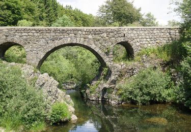
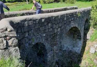
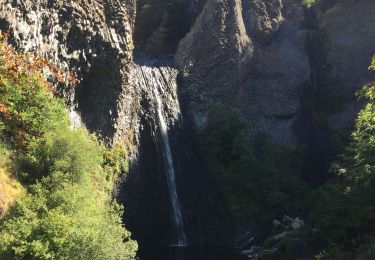
A voir La Tour à Eau sur la ligne de partage des eaux Méditerranée-Atlantique.
Nota: vers le 14ème km, écart carte-terrain entre la cote 1268 et La Baralade. Le début du GRP indiqué sur la carte est impraticable. Entrer dans le champ par le portail (cable électrique) et prendre directement à droite. Le balisage GRP Jaune-Rouge est repris sur les arbres un peu plus loin.
Ort
Kommentare
Touren in der Umgebung
![Tour Wandern Lachamp-Raphaël - 07 lachamp Raphaël orga 10.06.23 - Photo](https://media.geolcdn.com/t/375/260/07456a0b-3bda-48f2-bd40-fb46d8070303.jpg&format=jpg&maxdim=2)
![Wandern Wandern](https://static1.geolcdn.com/sitytour/trail-icons/101.png)
Wandern
![](/images/other/stat-length.png)
![](https://static1.geolcdn.com/siteimages/upload/files/16400158638029165_repeat_loop_refresh_sync_direction_icon.png)
![Tour Wandern Sagnes-et-Goudoulet - Les Coux-Sagnes-Tour à Eau 14km - Photo](https://media.geolcdn.com/t/375/260/7bfff9d7-91a3-4852-a6bf-dd6f46240ce8.jpg&format=jpg&maxdim=2)
![Wandern Wandern](https://static1.geolcdn.com/sitytour/trail-icons/101.png)
Wandern
![](/images/other/stat-length.png)
![](https://static1.geolcdn.com/siteimages/upload/files/16400158638029165_repeat_loop_refresh_sync_direction_icon.png)
![Tour Wandern Saint-Andéol-de-Fourchades - Boucle de la ferme de Bourdalier à Sagnes-et-Gourdoulet - Photo](https://media.geolcdn.com/t/375/260/31c1868a-b2a8-47e4-b863-8b44b5da618e.jpg&format=jpg&maxdim=2)
![Wandern Wandern](https://static1.geolcdn.com/sitytour/trail-icons/101.png)
Wandern
![](/images/other/stat-length.png)
![](https://static1.geolcdn.com/siteimages/upload/files/16400158638029165_repeat_loop_refresh_sync_direction_icon.png)
![Tour Wandern Sagnes-et-Goudoulet - Les Coux - Sagne et Goudoulet - La Tour à Eau 14km - Photo](https://media.geolcdn.com/t/375/260/e50b9160-d833-4b37-8588-2eb7f9e44f6b.jpg&format=jpg&maxdim=2)
![Wandern Wandern](https://static1.geolcdn.com/sitytour/trail-icons/101.png)
Wandern
![](/images/other/stat-length.png)
![](https://static1.geolcdn.com/siteimages/upload/files/16400158638029165_repeat_loop_refresh_sync_direction_icon.png)
![Tour Wandern Lachamp-Raphaël - Lachamp-Raphaël : les sucs - Photo](https://media.geolcdn.com/t/375/260/efd94835-0c85-498e-997c-3f10de9c1e49.jpg&format=jpg&maxdim=2)
![Wandern Wandern](https://static1.geolcdn.com/sitytour/trail-icons/101.png)
Wandern
![](/images/other/stat-length.png)
![](https://static1.geolcdn.com/siteimages/upload/files/16400158638029165_repeat_loop_refresh_sync_direction_icon.png)
![Wandern Wandern](https://static1.geolcdn.com/sitytour/trail-icons/101.png)
Wandern
![](/images/other/stat-length.png)
![](https://static1.geolcdn.com/siteimages/upload/files/16400158638029165_repeat_loop_refresh_sync_direction_icon.png)
![Tour Wandern Péreyres - Ray Pic - Photo](https://media.geolcdn.com/t/375/260/dd6640d7-12e4-4ffa-be91-52ff8d59e7c5.jpg&format=jpg&maxdim=2)
![Wandern Wandern](https://static1.geolcdn.com/sitytour/trail-icons/101.png)
![Tour Wandern Péreyres - Pereyres - Le Ray-Pic 1/6/2019 - Photo](https://media.geolcdn.com/t/375/260/ext.jpg?maxdim=2&url=https%3A%2F%2Fstatic1.geolcdn.com%2Fsiteimages%2Fupload%2Ffiles%2F1553511878bg_sport_marche.png)
![Wandern Wandern](https://static1.geolcdn.com/sitytour/trail-icons/101.png)
Wandern
![](/images/other/stat-length.png)
![](https://static1.geolcdn.com/siteimages/upload/files/16400158638029165_repeat_loop_refresh_sync_direction_icon.png)
![Tour Wandern Péreyres - OR-6578475--Péreyres:pereyres Lachamp 19km - Photo](https://media.geolcdn.com/t/375/260/ext.jpg?maxdim=2&url=https%3A%2F%2Fstatic1.geolcdn.com%2Fsiteimages%2Fupload%2Ffiles%2F1553511878bg_sport_marche.png)
![Wandern Wandern](https://static1.geolcdn.com/sitytour/trail-icons/101.png)
Wandern
![](/images/other/stat-length.png)
![](https://static1.geolcdn.com/siteimages/upload/files/16400158638029165_repeat_loop_refresh_sync_direction_icon.png)