![](/images/other/stat-length.png)
![Tour Mison - Du lac de MISON à celui du Poet par les colombettes - Photo](https://media.geolcdn.com/t/1900/400/df69e039-d0ac-423d-934e-3b88d4778692.jpg&format=pjpeg&maxdim=2)
Du lac de MISON à celui du Poet par les colombettes
babouille
Benutzer
![Länge](/images/other/stat-length.png)
Länge
5,7 km
![Maximale Höhe](https://static1.geolcdn.com/siteimages/upload/files/1508320355ic_sort_altitude_max_24dp.png)
Maximale Höhe
677 m
![Positive Höhendifferenz](https://static1.geolcdn.com/siteimages/upload/files/1508320355ic_sort_den_pos_24dp.png)
Positive Höhendifferenz
80 m
![Km-Effort](/images/other/stat-length.png)
Km-Effort
6,8 km
![Min. Höhe](https://static1.geolcdn.com/siteimages/upload/files/1508320355ic_sort_altitude_min_24dp.png)
Min. Höhe
627 m
![Negative Höhendifferenz](https://static1.geolcdn.com/siteimages/upload/files/1508320355ic_sort_den_neg_24dp.png)
Negative Höhendifferenz
83 m
![Boucle](https://static1.geolcdn.com/siteimages/upload/files/16400158638029165_repeat_loop_refresh_sync_direction_icon.png)
Boucle
Ja
Erstellungsdatum :
2023-09-29 06:57:23.0
Letzte Änderung :
2023-09-29 08:40:53.075
![Scannen Sie diesen QR-Code, um die Tour in der SityTrail-Anwendung zu öffnen](https://capi.geolives.com/qq0zvz2zws4bq2lad0pu/sitytour/trails/3822249/qr.png?size=200)
Kostenlosegpshiking-Anwendung
Über SityTrail
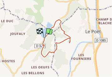
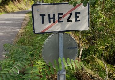
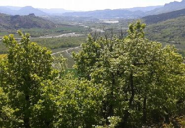
Tour von 5,7 km verfügbar auf Provence-Alpes-Côte d'Azur, Alpes-de-Haute-Provence, Mison. Diese Tour wird von babouille vorgeschlagen.
Beschreibung
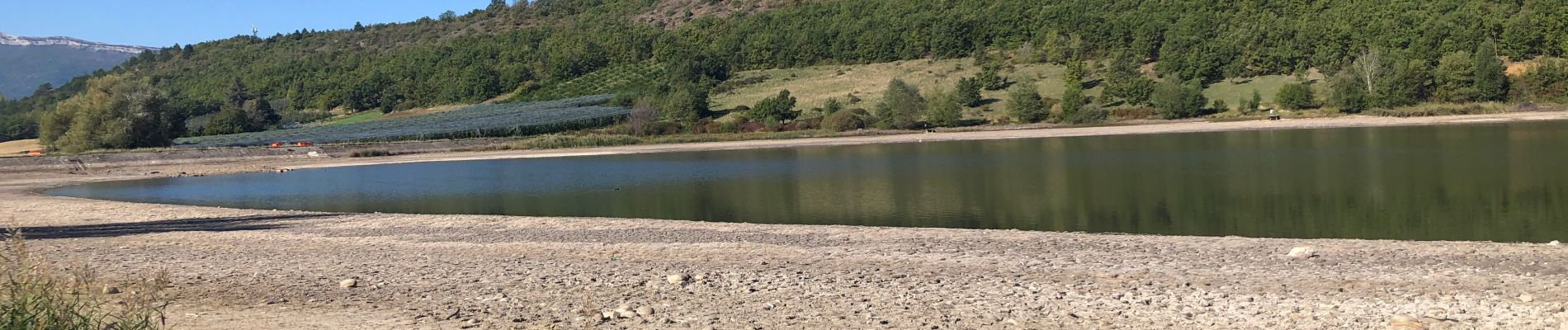
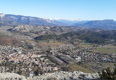
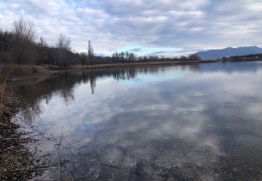
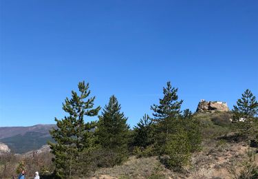
Départ au Parking du lac de MISON monter par le sentier à l’est aux colmbettes rejoindre le réservoir du Poet redescendre par le nord et rejoindre le parking par la route
Ort
Land:
France
Region :
Provence-Alpes-Côte d'Azur
Abteilung/Provinz :
Alpes-de-Haute-Provence
Kommune :
Mison
Standort:
Unknown
Gehen Sie:(Dec)
Gehen Sie:(UTM)
729064 ; 4907999 (31T) N.
Kommentare
Touren in der Umgebung
![Tour Wandern Val-Buëch-Méouge - CHATEAU NEUF DE CHABRE 05 . Piloubeau , les cretes de Chabre o s - Photo](https://media.geolcdn.com/t/375/260/ed0a937c-11c6-45f3-96a2-ba3aa0d6da41.jpg&format=jpg&maxdim=2)
![Wandern Wandern](https://static1.geolcdn.com/sitytour/trail-icons/101.png)
CHATEAU NEUF DE CHABRE 05 . Piloubeau , les cretes de Chabre o s
Wandern
Schwierig
Val-Buëch-Méouge,
Provence-Alpes-Côte d'Azur,
Hochalpen,
France
![](/images/other/stat-length.png)
14,8 km | 24 km-effort
6h 11min
![](https://static1.geolcdn.com/siteimages/upload/files/16400158638029165_repeat_loop_refresh_sync_direction_icon.png)
Ja
![Tour Mountainbike Laragne-Montéglin - Laragne 2008 - Photo](https://media.geolcdn.com/t/375/260/ext.jpg?maxdim=2&url=https%3A%2F%2Fstatic1.geolcdn.com%2Fsiteimages%2Fupload%2Ffiles%2F1524743154velo.jpg)
![Mountainbike Mountainbike](https://static1.geolcdn.com/sitytour/trail-icons/202.png)
Laragne 2008
Mountainbike
Schwierig
(1)
Laragne-Montéglin,
Provence-Alpes-Côte d'Azur,
Hochalpen,
France
![](/images/other/stat-length.png)
35 km | 47 km-effort
3h 0min
![](https://static1.geolcdn.com/siteimages/upload/files/16400158638029165_repeat_loop_refresh_sync_direction_icon.png)
Nein
![Tour sport Mison - De Rame au lac de MISON et retour - Photo](https://media.geolcdn.com/t/375/260/b7ba641c-d6b7-4a61-8d5f-858abbad1cab.jpg&format=jpg&maxdim=2)
De Rame au lac de MISON et retour
sport
Sehr leicht
Mison,
Provence-Alpes-Côte d'Azur,
Alpes-de-Haute-Provence,
France
![](/images/other/stat-length.png)
6,9 km | 8,2 km-effort
Unbekannt
![](https://static1.geolcdn.com/siteimages/upload/files/16400158638029165_repeat_loop_refresh_sync_direction_icon.png)
Ja
![Zu Fuß Zu Fuß](https://static1.geolcdn.com/sitytour/trail-icons/100.png)
Tour du château de MISON par le Buech
Zu Fuß
Einfach
Mison,
Provence-Alpes-Côte d'Azur,
Alpes-de-Haute-Provence,
France
![](/images/other/stat-length.png)
5,9 km | 7,8 km-effort
1h 46min
![](https://static1.geolcdn.com/siteimages/upload/files/16400158638029165_repeat_loop_refresh_sync_direction_icon.png)
Ja
![Tour Wandern Val-Buëch-Méouge - CHATEAU NEUF DE CHABRE . PILOUBEAU . SERRE DE LA CROIX O L M S - Photo](https://media.geolcdn.com/t/375/260/5ada7d01-3c24-447c-a90d-a06e71a0d2e2.jpg&format=jpg&maxdim=2)
![Wandern Wandern](https://static1.geolcdn.com/sitytour/trail-icons/101.png)
CHATEAU NEUF DE CHABRE . PILOUBEAU . SERRE DE LA CROIX O L M S
Wandern
Medium
Val-Buëch-Méouge,
Provence-Alpes-Côte d'Azur,
Hochalpen,
France
![](/images/other/stat-length.png)
12,5 km | 18,5 km-effort
3h 25min
![](https://static1.geolcdn.com/siteimages/upload/files/16400158638029165_repeat_loop_refresh_sync_direction_icon.png)
Ja
![Tour Wandern Le Poët - Reco 1er Rando BF 2022 - Photo](https://media.geolcdn.com/t/375/260/82bf2b90-d75c-4d4a-8b5c-581e7d0aab81.jpg&format=jpg&maxdim=2)
![Wandern Wandern](https://static1.geolcdn.com/sitytour/trail-icons/101.png)
Reco 1er Rando BF 2022
Wandern
Medium
Le Poët,
Provence-Alpes-Côte d'Azur,
Hochalpen,
France
![](/images/other/stat-length.png)
13,2 km | 17,4 km-effort
5h 11min
![](https://static1.geolcdn.com/siteimages/upload/files/16400158638029165_repeat_loop_refresh_sync_direction_icon.png)
Ja
![Tour Mountainbike Thèze - 210322 rouviere theze a velo - Photo](https://media.geolcdn.com/t/375/260/11332bd4-f1eb-453a-b568-0b37b31d0a1b.jpg&format=jpg&maxdim=2)
![Mountainbike Mountainbike](https://static1.geolcdn.com/sitytour/trail-icons/202.png)
210322 rouviere theze a velo
Mountainbike
Sehr leicht
Thèze,
Provence-Alpes-Côte d'Azur,
Alpes-de-Haute-Provence,
France
![](/images/other/stat-length.png)
4,5 km | 5,4 km-effort
1h 21min
![](https://static1.geolcdn.com/siteimages/upload/files/16400158638029165_repeat_loop_refresh_sync_direction_icon.png)
Nein
![Tour Wandern Thèze - Boucle Theze Sigoyer depart Theze - Photo](https://media.geolcdn.com/t/375/260/91670e8d-b25b-43eb-b3a3-a9631c3bd51e.jpg&format=jpg&maxdim=2)
![Wandern Wandern](https://static1.geolcdn.com/sitytour/trail-icons/101.png)
Boucle Theze Sigoyer depart Theze
Wandern
Einfach
Thèze,
Provence-Alpes-Côte d'Azur,
Alpes-de-Haute-Provence,
France
![](/images/other/stat-length.png)
11,4 km | 15,7 km-effort
3h 8min
![](https://static1.geolcdn.com/siteimages/upload/files/16400158638029165_repeat_loop_refresh_sync_direction_icon.png)
Ja
![Tour Wandern Val-Buëch-Méouge - roche de baume rousse - Photo](https://media.geolcdn.com/t/375/260/ext.jpg?maxdim=2&url=https%3A%2F%2Fservices.sitytrail.com%2FGeolivesWS%2FDownloadMedia.ashx%3FTrailID%3D569571%26Media%3Dfix__20160429114139.jpg)
![Wandern Wandern](https://static1.geolcdn.com/sitytour/trail-icons/101.png)
roche de baume rousse
Wandern
Medium
Val-Buëch-Méouge,
Provence-Alpes-Côte d'Azur,
Hochalpen,
France
![](/images/other/stat-length.png)
9,3 km | 14,1 km-effort
3h 37min
![](https://static1.geolcdn.com/siteimages/upload/files/16400158638029165_repeat_loop_refresh_sync_direction_icon.png)
Ja