![](/images/other/stat-length.png)
![Tour Rennrad Massignieu-de-Rives - Activity - Photo](https://media.geolcdn.com/t/1900/400/3b474186-3ae0-49ac-b153-2b0d64e544fe.jpg&format=pjpeg&maxdim=2)
Activity
Ladyclairdelune74
Benutzer
![Länge](/images/other/stat-length.png)
![Maximale Höhe](https://static1.geolcdn.com/siteimages/upload/files/1508320355ic_sort_altitude_max_24dp.png)
![Positive Höhendifferenz](https://static1.geolcdn.com/siteimages/upload/files/1508320355ic_sort_den_pos_24dp.png)
![Km-Effort](/images/other/stat-length.png)
![Min. Höhe](https://static1.geolcdn.com/siteimages/upload/files/1508320355ic_sort_altitude_min_24dp.png)
![Negative Höhendifferenz](https://static1.geolcdn.com/siteimages/upload/files/1508320355ic_sort_den_neg_24dp.png)
![Boucle](https://static1.geolcdn.com/siteimages/upload/files/16400158638029165_repeat_loop_refresh_sync_direction_icon.png)
![Rennrad](https://static1.geolcdn.com/sitytour/trail-icons/201.png)
2h09
Schwierigkeit : Schwierig
![Scannen Sie diesen QR-Code, um die Tour in der SityTrail-Anwendung zu öffnen](https://capi.geolives.com/qq0zvz2zws4bq2lad0pu/sitytour/trails/3811613/qr.png?size=200)
Kostenlosegpshiking-Anwendung
Über SityTrail
Tour Rennrad von 29 km verfügbar auf Auvergne-Rhone-Alpen, Ain, Massignieu-de-Rives. Diese Tour wird von Ladyclairdelune74 vorgeschlagen.
Beschreibung
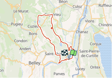
Circuit vélo - Vignobles du Bugey au départ du Lac du Lit au roi
Circuit au relief très limité (250 mètres de dénivelé pour 29 km), il ne comporte pas de difficultés majeures, mais suit un relief doux entre villages et vignobles. Vous cheminerez majoritairement sur des petites routes peu fréquentées et un peu de voie verte au niveau du Lac du Lit au roi.
Balisage de la boucle
La boucle est entièrement balisée avec des panneaux verts et blancs
À ne pas manquer sur cette balade
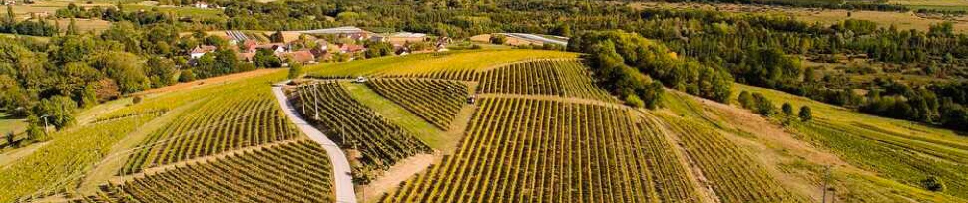
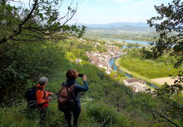
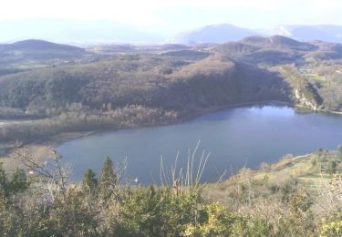
Départ depuis le Lac du Lit au roi, plan d’eau sur le passage du canal de dérivation du Rhône qui doit son nom à un sarcophage gallo-romain utilisé pour ramener la dépouille du roi Charles le Chauve, petit-fils de Charlemagne. Après la courte montée de Cressin-Rochefort, vous découvrirez le Lac de Barterand, lac de baignade surveillée pendant l'été, la partie nord du lac comprend d'impressionnantes roches sculptées en hommage aux légendes du Bugey ou l'on retrouve Gargantua, la vigne et la Vouivre, personnage mi charmeur mi maléfique. Dans le charmant village de Vongnes, le Caveau Bugiste est renommé pour la qualité de son vin et son accueil, vous pourrez profiter gratuitement de deux musées en accès libre toute l'année, d'expositions de peinture et de sculpture et de la projection d'un film.
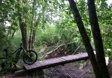
Ort
Kommentare
Touren in der Umgebung
![Tour Mountainbike Pollieu - Entre lac et rivière - Photo](https://media.geolcdn.com/t/375/260/ext.jpg?maxdim=2&url=https%3A%2F%2Fstatic1.geolcdn.com%2Fsiteimages%2Fupload%2Ffiles%2F1524743154velo.jpg)
![Mountainbike Mountainbike](https://static1.geolcdn.com/sitytour/trail-icons/202.png)
Mountainbike
![](/images/other/stat-length.png)
![](https://static1.geolcdn.com/siteimages/upload/files/16400158638029165_repeat_loop_refresh_sync_direction_icon.png)
![Tour Wandern Chanaz - SAVOIE: CHANAZ - SAINT PIERRE DE CURTILLE - JONGIEUX - Photo](https://media.geolcdn.com/t/375/260/a2c9fd3e-2c40-420b-9198-d6795b6e7119.jpg&format=jpg&maxdim=2)
![Wandern Wandern](https://static1.geolcdn.com/sitytour/trail-icons/101.png)
Wandern
![](/images/other/stat-length.png)
![](https://static1.geolcdn.com/siteimages/upload/files/16400158638029165_repeat_loop_refresh_sync_direction_icon.png)
![Tour Wandern Massignieu-de-Rives - Mont Lézieu - Massignieu de Rives - Photo](https://media.geolcdn.com/t/375/260/ext.jpg?maxdim=2&url=https%3A%2F%2Fservices.sitytrail.com%2FGeolivesWS%2FDownloadMedia.ashx%3FTrailID%3D191567%26Media%3D15187_4.jpg)
![Wandern Wandern](https://static1.geolcdn.com/sitytour/trail-icons/101.png)
Wandern
![](/images/other/stat-length.png)
![](https://static1.geolcdn.com/siteimages/upload/files/16400158638029165_repeat_loop_refresh_sync_direction_icon.png)
![Tour Wandern Ontex - M MONT CHARVAZ depuis Ontex - Photo](https://media.geolcdn.com/t/375/260/ext.jpg?maxdim=2&url=https%3A%2F%2Fstatic1.geolcdn.com%2Fsiteimages%2Fupload%2Ffiles%2F1553511878bg_sport_marche.png)
![Wandern Wandern](https://static1.geolcdn.com/sitytour/trail-icons/101.png)
Wandern
![](/images/other/stat-length.png)
![](https://static1.geolcdn.com/siteimages/upload/files/16400158638029165_repeat_loop_refresh_sync_direction_icon.png)
![Tour Wandern Chanaz - Chanaz 2 - Photo](https://media.geolcdn.com/t/375/260/36c3e473-624f-4b42-9be0-21e5ac8bfa86.jpg&format=jpg&maxdim=2)
![Wandern Wandern](https://static1.geolcdn.com/sitytour/trail-icons/101.png)
Wandern
![](/images/other/stat-length.png)
![](https://static1.geolcdn.com/siteimages/upload/files/16400158638029165_repeat_loop_refresh_sync_direction_icon.png)
![Tour Wandern Parves-et-Nattages - parves - Photo](https://media.geolcdn.com/t/375/260/d81b99cb-18d1-4e64-a8a8-4aa5dcd0bab6.jpg&format=jpg&maxdim=2)
![Wandern Wandern](https://static1.geolcdn.com/sitytour/trail-icons/101.png)
Wandern
![](/images/other/stat-length.png)
![](https://static1.geolcdn.com/siteimages/upload/files/16400158638029165_repeat_loop_refresh_sync_direction_icon.png)
![Tour Reiten Lucey - lucey / Serrieres en chautagne - Photo](https://media.geolcdn.com/t/375/260/745b601f-65bc-4daf-949a-9336fa48fcc0.jpg&format=jpg&maxdim=2)
![Reiten Reiten](https://static1.geolcdn.com/sitytour/trail-icons/301.png)
Reiten
![](/images/other/stat-length.png)
![](https://static1.geolcdn.com/siteimages/upload/files/16400158638029165_repeat_loop_refresh_sync_direction_icon.png)
![Tour Wandern Jongieux - jongieux - Photo](https://media.geolcdn.com/t/375/260/e71f1d37-0d8e-4171-bd5c-498175560694.jpg&format=jpg&maxdim=2)
![Wandern Wandern](https://static1.geolcdn.com/sitytour/trail-icons/101.png)
Wandern
![](/images/other/stat-length.png)
![](https://static1.geolcdn.com/siteimages/upload/files/16400158638029165_repeat_loop_refresh_sync_direction_icon.png)
![Tour Mountainbike Lavours - Ceyzérieu - Le marais de Lavours - Photo](https://media.geolcdn.com/t/375/260/ext.jpg?maxdim=2&url=https%3A%2F%2Fservices.sitytrail.com%2FGeolivesWS%2FDownloadMedia.ashx%3FTrailID%3D793862%26Media%3Dfix__20170721115455.jpg)
![Mountainbike Mountainbike](https://static1.geolcdn.com/sitytour/trail-icons/202.png)
Mountainbike
![](/images/other/stat-length.png)
![](https://static1.geolcdn.com/siteimages/upload/files/16400158638029165_repeat_loop_refresh_sync_direction_icon.png)