![](/images/other/stat-length.png)
![Tour Wandern Sasnières - Sasnières - Forêt de Prunay - Photo](https://media.geolcdn.com/t/1900/400/943c2533-1ac2-4bd6-afd5-01cab0555dce.jpg&format=pjpeg&maxdim=2)
Sasnières - Forêt de Prunay
guydu41
Benutzer
![Länge](/images/other/stat-length.png)
![Maximale Höhe](https://static1.geolcdn.com/siteimages/upload/files/1508320355ic_sort_altitude_max_24dp.png)
![Positive Höhendifferenz](https://static1.geolcdn.com/siteimages/upload/files/1508320355ic_sort_den_pos_24dp.png)
![Km-Effort](/images/other/stat-length.png)
![Min. Höhe](https://static1.geolcdn.com/siteimages/upload/files/1508320355ic_sort_altitude_min_24dp.png)
![Negative Höhendifferenz](https://static1.geolcdn.com/siteimages/upload/files/1508320355ic_sort_den_neg_24dp.png)
![Boucle](https://static1.geolcdn.com/siteimages/upload/files/16400158638029165_repeat_loop_refresh_sync_direction_icon.png)
![Wandern](https://static1.geolcdn.com/sitytour/trail-icons/101.png)
2h48
Schwierigkeit : Medium
![Scannen Sie diesen QR-Code, um die Tour in der SityTrail-Anwendung zu öffnen](https://capi.geolives.com/qq0zvz2zws4bq2lad0pu/sitytour/trails/3801478/qr.png?size=200)
Kostenlosegpshiking-Anwendung
Über SityTrail
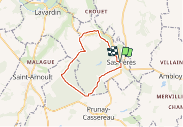
Tour Wandern von 10,6 km verfügbar auf Zentrum-Loiretal, Loir-et-Cher, Sasnières. Diese Tour wird von guydu41 vorgeschlagen.
Beschreibung
Le circuit démarre depuis le parking au niveau de l’intersection de la D108 et de la D67 à Sasnières 41310.
Le parcours se dirige plein sud par la D67 qu'il quitte pour emprunter une petite route communale vers la Racinière puis des chemins à travers champs et des sentiers dans la forêt de Prunay avec deux croix en bois.
Le circuit contourne le Nord de la forêt puis longe la rivière "la Fontaine de Sasnières" en passant à côté de plusieurs caves troglodytes dont une dont on peut voir l'intérieur.
Il se termine en longeant le Jardin du Plessis et son restaurant traditionnel.
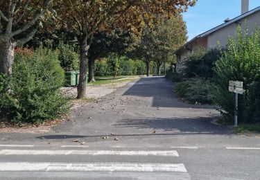
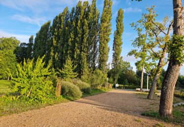
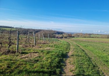
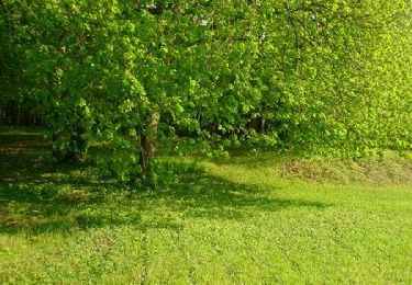
Ort
Kommentare
Touren in der Umgebung
![Tour Wandern Prunay-Cassereau - Prunay-Cassereau - GR655ouest Lavardin GR35 Houssay PR Sasnières - 25.8km 360m 5h40 (25mn) - 2021 11 11 - Photo](https://media.geolcdn.com/t/375/260/7ad2a1b4-506f-410f-a586-b7f8e0a15152.jpg&format=jpg&maxdim=2)
![Wandern Wandern](https://static1.geolcdn.com/sitytour/trail-icons/101.png)
Wandern
![](/images/other/stat-length.png)
![](https://static1.geolcdn.com/siteimages/upload/files/16400158638029165_repeat_loop_refresh_sync_direction_icon.png)
![Tour Wandern - Lavardin - Vallée du Loir - 2015 08 22 - Photo](https://media.geolcdn.com/t/375/260/9217c5be-6f6a-4a6f-89e4-63f2df152ec7.jpg&format=jpg&maxdim=2)
![Wandern Wandern](https://static1.geolcdn.com/sitytour/trail-icons/101.png)
Wandern
![](/images/other/stat-length.png)
![](https://static1.geolcdn.com/siteimages/upload/files/16400158638029165_repeat_loop_refresh_sync_direction_icon.png)
![Tour Wandern - Lavardin - Chemin de la roue des Carriers - Photo](https://media.geolcdn.com/t/375/260/e44cda87-93d4-4d06-b6ec-b3c61a83f120.jpg&format=jpg&maxdim=2)
![Wandern Wandern](https://static1.geolcdn.com/sitytour/trail-icons/101.png)
Wandern
![](/images/other/stat-length.png)
![](https://static1.geolcdn.com/siteimages/upload/files/16400158638029165_repeat_loop_refresh_sync_direction_icon.png)
![Tour Wandern Villavard - Villavard - Bois et champs - Photo](https://media.geolcdn.com/t/375/260/4d475905-90ac-4961-b085-7edf726aaef9.jpg&format=jpg&maxdim=2)
![Wandern Wandern](https://static1.geolcdn.com/sitytour/trail-icons/101.png)
Wandern
![](/images/other/stat-length.png)
![](https://static1.geolcdn.com/siteimages/upload/files/16400158638029165_repeat_loop_refresh_sync_direction_icon.png)
![Tour Wandern Houssay - Houssay - Photo](https://media.geolcdn.com/t/375/260/3bd1239e-bd99-41e7-b552-6fe8c8fd81df.jpg&format=jpg&maxdim=2)
![Wandern Wandern](https://static1.geolcdn.com/sitytour/trail-icons/101.png)
Wandern
![](/images/other/stat-length.png)
![](https://static1.geolcdn.com/siteimages/upload/files/16400158638029165_repeat_loop_refresh_sync_direction_icon.png)
![Tour Wandern Sasnières - Sasnières Nord - Photo](https://media.geolcdn.com/t/375/260/284a3961-0328-4eb2-973d-94855c25ddde.jpg&format=jpg&maxdim=2)
![Wandern Wandern](https://static1.geolcdn.com/sitytour/trail-icons/101.png)
Wandern
![](/images/other/stat-length.png)
![](https://static1.geolcdn.com/siteimages/upload/files/16400158638029165_repeat_loop_refresh_sync_direction_icon.png)
![Tour Wandern Houssay - Circuit Promenades et Randonnées (PR)](https://media.geolcdn.com/t/375/260/5ea570ff-f61f-453e-a15a-2af4ead43e67.jpg&format=jpg&maxdim=2)
![Wandern Wandern](https://static1.geolcdn.com/sitytour/trail-icons/101.png)
Wandern
![](/images/other/stat-length.png)
![](https://static1.geolcdn.com/siteimages/upload/files/16400158638029165_repeat_loop_refresh_sync_direction_icon.png)
![Tour Wandern - Lavardin - 3.9km 1h00 - 2018 01 14 - Photo](https://media.geolcdn.com/t/375/260/362b5480-e7a1-4dba-94e2-8bf831fde151.jpg&format=jpg&maxdim=2)
![Wandern Wandern](https://static1.geolcdn.com/sitytour/trail-icons/101.png)
Wandern
![](/images/other/stat-length.png)
![](https://static1.geolcdn.com/siteimages/upload/files/16400158638029165_repeat_loop_refresh_sync_direction_icon.png)
![Tour Mountainbike Villiersfaux - Balade VTT à Villiersfaux - Photo](https://media.geolcdn.com/t/375/260/ext.jpg?maxdim=2&url=https%3A%2F%2Fservices.sitytrail.com%2FGeolivesWS%2FDownloadMedia.ashx%3FTrailID%3D214841%26Media%3D15363_1.jpg)
![Mountainbike Mountainbike](https://static1.geolcdn.com/sitytour/trail-icons/202.png)
Mountainbike
![](/images/other/stat-length.png)
![](https://static1.geolcdn.com/siteimages/upload/files/16400158638029165_repeat_loop_refresh_sync_direction_icon.png)