![](/images/other/stat-length.png)
![Tour Wandern Thoré-la-Rochette - Thoré-la-Rochette - Vallée et Coteaux du Loir - Photo](https://media.geolcdn.com/t/1900/400/344cfef8-5ffd-42a8-843d-f0a9586064a7.jpg&format=pjpeg&maxdim=2)
Thoré-la-Rochette - Vallée et Coteaux du Loir
guydu41
Benutzer
![Länge](/images/other/stat-length.png)
![Maximale Höhe](https://static1.geolcdn.com/siteimages/upload/files/1508320355ic_sort_altitude_max_24dp.png)
![Positive Höhendifferenz](https://static1.geolcdn.com/siteimages/upload/files/1508320355ic_sort_den_pos_24dp.png)
![Km-Effort](/images/other/stat-length.png)
![Min. Höhe](https://static1.geolcdn.com/siteimages/upload/files/1508320355ic_sort_altitude_min_24dp.png)
![Negative Höhendifferenz](https://static1.geolcdn.com/siteimages/upload/files/1508320355ic_sort_den_neg_24dp.png)
![Boucle](https://static1.geolcdn.com/siteimages/upload/files/16400158638029165_repeat_loop_refresh_sync_direction_icon.png)
![Wandern](https://static1.geolcdn.com/sitytour/trail-icons/101.png)
2h31
Schwierigkeit : Medium
![Scannen Sie diesen QR-Code, um die Tour in der SityTrail-Anwendung zu öffnen](https://capi.geolives.com/qq0zvz2zws4bq2lad0pu/sitytour/trails/3787919/qr.png?size=200)
Kostenlosegpshiking-Anwendung
Über SityTrail
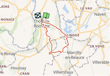
Tour Wandern von 9,5 km verfügbar auf Zentrum-Loiretal, Loir-et-Cher, Thoré-la-Rochette. Diese Tour wird von guydu41 vorgeschlagen.
Beschreibung
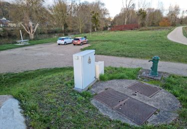
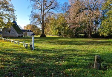
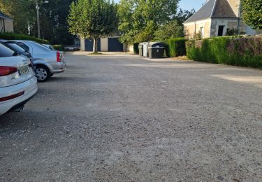
Le parcours commence depuis le parking à côté de l’Église Saint-Denis, 10 Place de l'Église, 41100 Thoré-la-Rochette avec un beau point de vue sur la ville.
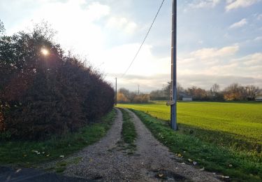
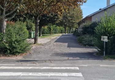
Après avoir descendu la voie pentue vers la Rue de la Brisse, le circuit passe au-dessus de la Brisse, emprunte la Rue de la Basnerie puis un chemin boisé qui monte sur le tertre de Fanchon pour déboucher sur la D82 et franchir la voie ferrée profondément encaissée dans le plateau calcaire.
Ensuite le circuit chemine à travers vignes et champs pour passer à côté du dolmen déstructuré de Vaugouffard puis remonter vers le haut du coteau qui longe le Loir avec passage à côté d’un énorme bloc de grès isolé.
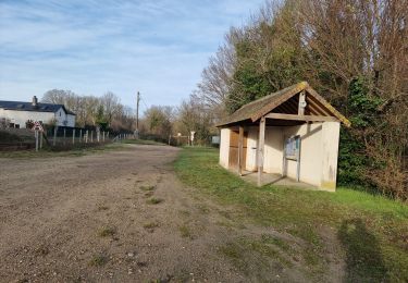
Plusieurs points de vue le long du parcours.
Note : Le passage au lieu-dit "les Morines" n'est pas évident.
Ort
Kommentare
Touren in der Umgebung
![Tour Zu Fuß Villiers-sur-Loir - Circuit des Côteaux - Photo](https://media.geolcdn.com/t/375/260/25cb373c-e85b-47b3-b4c8-0c4c4213b15c.jpeg&format=jpg&maxdim=2)
![Zu Fuß Zu Fuß](https://static1.geolcdn.com/sitytour/trail-icons/100.png)
Zu Fuß
![](/images/other/stat-length.png)
![](https://static1.geolcdn.com/siteimages/upload/files/16400158638029165_repeat_loop_refresh_sync_direction_icon.png)
![Tour Wandern Villavard - Villavard - Bois et champs - Photo](https://media.geolcdn.com/t/375/260/4d475905-90ac-4961-b085-7edf726aaef9.jpg&format=jpg&maxdim=2)
![Wandern Wandern](https://static1.geolcdn.com/sitytour/trail-icons/101.png)
Wandern
![](/images/other/stat-length.png)
![](https://static1.geolcdn.com/siteimages/upload/files/16400158638029165_repeat_loop_refresh_sync_direction_icon.png)
![Tour Wandern Thoré-la-Rochette - Thoré-la-Rochette - Vallée et Coteaux du Loir - Photo](https://media.geolcdn.com/t/375/260/3f4c80d2-3437-4e69-84de-30a02f464543.jpg&format=jpg&maxdim=2)
![Wandern Wandern](https://static1.geolcdn.com/sitytour/trail-icons/101.png)
Wandern
![](/images/other/stat-length.png)
![](https://static1.geolcdn.com/siteimages/upload/files/16400158638029165_repeat_loop_refresh_sync_direction_icon.png)
![Tour Wandern Marcilly-en-Beauce - Varennes - Photo](https://media.geolcdn.com/t/375/260/e5fe1065-d10c-4b43-96c8-69a926a5b2c1.jpg&format=jpg&maxdim=2)
![Wandern Wandern](https://static1.geolcdn.com/sitytour/trail-icons/101.png)
Wandern
![](/images/other/stat-length.png)
![](https://static1.geolcdn.com/siteimages/upload/files/16400158638029165_repeat_loop_refresh_sync_direction_icon.png)
![Tour Wandern Naveil - Naveil - Photo](https://media.geolcdn.com/t/375/260/37d67a4f-f628-4e03-8093-029fa7b56966.jpg&format=jpg&maxdim=2)
![Wandern Wandern](https://static1.geolcdn.com/sitytour/trail-icons/101.png)
Wandern
![](/images/other/stat-length.png)
![](https://static1.geolcdn.com/siteimages/upload/files/16400158638029165_repeat_loop_refresh_sync_direction_icon.png)
![Tour Wandern Mazangé - Bonaventure - Moulin de la Loupe - Photo](https://media.geolcdn.com/t/375/260/759d7924-4ccb-43c3-8104-ebc2f5335c97.jpg&format=jpg&maxdim=2)
![Wandern Wandern](https://static1.geolcdn.com/sitytour/trail-icons/101.png)
Wandern
![](/images/other/stat-length.png)
![](https://static1.geolcdn.com/siteimages/upload/files/16400158638029165_repeat_loop_refresh_sync_direction_icon.png)
![Tour Wandern Lunay - Château de la Mézière - Asnières - Photo](https://media.geolcdn.com/t/375/260/7020eb26-114b-4b8b-93d9-05c4bb72eb01.jpg&format=jpg&maxdim=2)
![Wandern Wandern](https://static1.geolcdn.com/sitytour/trail-icons/101.png)
Wandern
![](/images/other/stat-length.png)
![](https://static1.geolcdn.com/siteimages/upload/files/16400158638029165_repeat_loop_refresh_sync_direction_icon.png)
![Tour Wandern Saint-Rimay - Saint-Rimay - Photo](https://media.geolcdn.com/t/375/260/4102077f-f972-4a74-9982-90e370a0028d.jpg&format=jpg&maxdim=2)
![Wandern Wandern](https://static1.geolcdn.com/sitytour/trail-icons/101.png)
Wandern
![](/images/other/stat-length.png)
![](https://static1.geolcdn.com/siteimages/upload/files/16400158638029165_repeat_loop_refresh_sync_direction_icon.png)
![Tour Wandern Houssay - Houssay - Photo](https://media.geolcdn.com/t/375/260/3bd1239e-bd99-41e7-b552-6fe8c8fd81df.jpg&format=jpg&maxdim=2)
![Wandern Wandern](https://static1.geolcdn.com/sitytour/trail-icons/101.png)
Wandern
![](/images/other/stat-length.png)
![](https://static1.geolcdn.com/siteimages/upload/files/16400158638029165_repeat_loop_refresh_sync_direction_icon.png)