![](/images/other/stat-length.png)
![Tour Wandern Juvisy-sur-Orge - GRP CV-IDF 2023 - Photo](https://media.geolcdn.com/t/1900/400/fc32371e-a9db-4ebb-87ec-b0b2ec43c0ff.jpg&format=pjpeg&maxdim=2)
GRP CV-IDF 2023
clalaur
Benutzer
![Länge](/images/other/stat-length.png)
Länge
14,8 km
![Maximale Höhe](https://static1.geolcdn.com/siteimages/upload/files/1508320355ic_sort_altitude_max_24dp.png)
Maximale Höhe
85 m
![Positive Höhendifferenz](https://static1.geolcdn.com/siteimages/upload/files/1508320355ic_sort_den_pos_24dp.png)
Positive Höhendifferenz
175 m
![Km-Effort](/images/other/stat-length.png)
Km-Effort
17 km
![Min. Höhe](https://static1.geolcdn.com/siteimages/upload/files/1508320355ic_sort_altitude_min_24dp.png)
Min. Höhe
34 m
![Negative Höhendifferenz](https://static1.geolcdn.com/siteimages/upload/files/1508320355ic_sort_den_neg_24dp.png)
Negative Höhendifferenz
138 m
![Boucle](https://static1.geolcdn.com/siteimages/upload/files/16400158638029165_repeat_loop_refresh_sync_direction_icon.png)
Boucle
Nein
Erstellungsdatum :
2023-08-27 17:24:40.064
Letzte Änderung :
2024-04-21 16:46:21.604
![Wandern](https://static1.geolcdn.com/sitytour/trail-icons/101.png)
3h52
Schwierigkeit : Schwierig
![Scannen Sie diesen QR-Code, um die Tour in der SityTrail-Anwendung zu öffnen](https://capi.geolives.com/qq0zvz2zws4bq2lad0pu/sitytour/trails/3786502/qr.png?size=200)
Kostenlosegpshiking-Anwendung
Über SityTrail
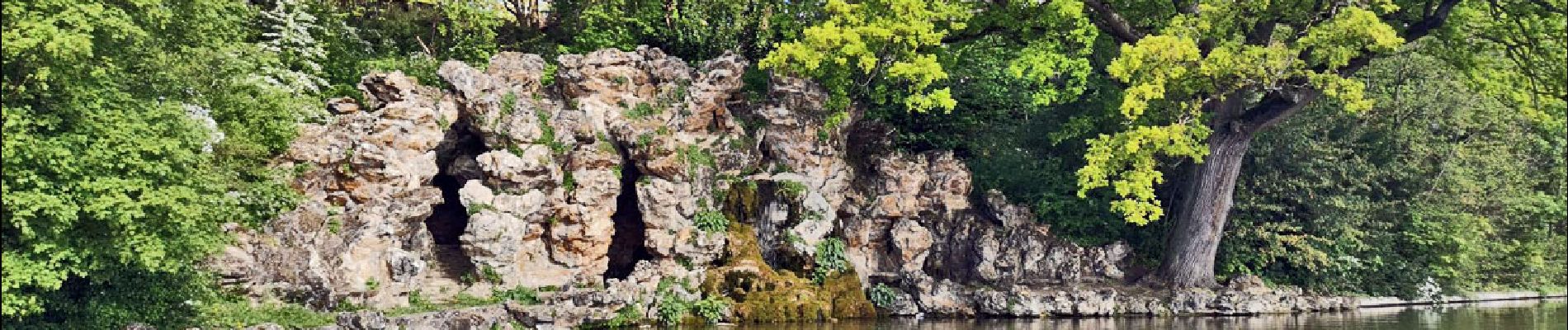
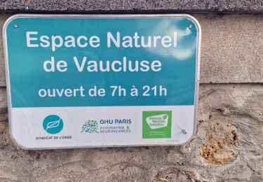
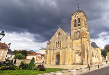
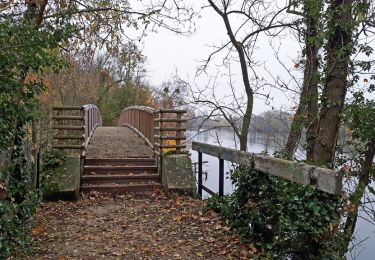
Tour Wandern von 14,8 km verfügbar auf Île-de-France, Essonne, Juvisy-sur-Orge. Diese Tour wird von clalaur vorgeschlagen.
Beschreibung
Randonné faite le 15 avril 2024.
Départ : Gare de Juvisy (RER C & D) Juvisy-sur-Orge : Arrivée : Arrêt - Mairie (Bus M141 & M153 Transdev) Ballainvilliers
Ort
Land:
France
Region :
Île-de-France
Abteilung/Provinz :
Essonne
Kommune :
Juvisy-sur-Orge
Standort:
Unknown
Gehen Sie:(Dec)
Gehen Sie:(UTM)
454649 ; 5393093 (31U) N.
Kommentare
Touren in der Umgebung
![Tour Wandern Draveil - Port aux Cerises - Ablon 21 km - Photo](https://media.geolcdn.com/t/375/260/ext.jpg?maxdim=2&url=https%3A%2F%2Fstatic1.geolcdn.com%2Fsiteimages%2Fupload%2Ffiles%2F1553511878bg_sport_marche.png)
![Wandern Wandern](https://static1.geolcdn.com/sitytour/trail-icons/101.png)
Port aux Cerises - Ablon 21 km
Wandern
Sehr schwierig
(1)
Draveil,
Île-de-France,
Essonne,
France
![](/images/other/stat-length.png)
22 km | 25 km-effort
4h 51min
![](https://static1.geolcdn.com/siteimages/upload/files/16400158638029165_repeat_loop_refresh_sync_direction_icon.png)
Ja
![Tour Zu Fuß Morsang-sur-Orge - Boucle 20 km Morsang sur Orge - Photo](https://media.geolcdn.com/t/375/260/d37a7650-c254-47eb-95bf-21850c3f3dae.jpg&format=jpg&maxdim=2)
![Zu Fuß Zu Fuß](https://static1.geolcdn.com/sitytour/trail-icons/100.png)
Boucle 20 km Morsang sur Orge
Zu Fuß
Einfach
Morsang-sur-Orge,
Île-de-France,
Essonne,
France
![](/images/other/stat-length.png)
20 km | 22 km-effort
5h 6min
![](https://static1.geolcdn.com/siteimages/upload/files/16400158638029165_repeat_loop_refresh_sync_direction_icon.png)
Ja
![Tour Wandern Longjumeau - Le pont des templiers - Photo](https://media.geolcdn.com/t/375/260/47ca11fe-9e23-483d-8b98-cc620d4b03d7.jpg&format=jpg&maxdim=2)
![Wandern Wandern](https://static1.geolcdn.com/sitytour/trail-icons/101.png)
Le pont des templiers
Wandern
Medium
Longjumeau,
Île-de-France,
Essonne,
France
![](/images/other/stat-length.png)
15,4 km | 17,2 km-effort
3h 56min
![](https://static1.geolcdn.com/siteimages/upload/files/16400158638029165_repeat_loop_refresh_sync_direction_icon.png)
Ja
![Tour Wandern Longjumeau - La rivière morte - Photo](https://media.geolcdn.com/t/375/260/0639c636-16c8-4a86-9159-a268a730aa8b.jpg&format=jpg&maxdim=2)
![Wandern Wandern](https://static1.geolcdn.com/sitytour/trail-icons/101.png)
La rivière morte
Wandern
Medium
Longjumeau,
Île-de-France,
Essonne,
France
![](/images/other/stat-length.png)
14,8 km | 16,8 km-effort
3h 49min
![](https://static1.geolcdn.com/siteimages/upload/files/16400158638029165_repeat_loop_refresh_sync_direction_icon.png)
Nein
![Tour Wandern Longjumeau - ALBG RANDO MERCREDI BALIZY MORSANG BALIZY 2024 - Photo](https://media.geolcdn.com/t/375/260/ext.jpg?maxdim=2&url=https%3A%2F%2Fstatic1.geolcdn.com%2Fsiteimages%2Fupload%2Ffiles%2F1553511878bg_sport_marche.png)
![Wandern Wandern](https://static1.geolcdn.com/sitytour/trail-icons/101.png)
ALBG RANDO MERCREDI BALIZY MORSANG BALIZY 2024
Wandern
Medium
(1)
Longjumeau,
Île-de-France,
Essonne,
France
![](/images/other/stat-length.png)
7,9 km | 9,2 km-effort
2h 5min
![](https://static1.geolcdn.com/siteimages/upload/files/16400158638029165_repeat_loop_refresh_sync_direction_icon.png)
Ja
![Tour Zu Fuß Soisy-sur-Seine - Boucle Soisy / Seine / Sénart - Photo](https://media.geolcdn.com/t/375/260/4a1feccf-2abe-4449-b3b1-c318219c819e.jpg&format=jpg&maxdim=2)
![Zu Fuß Zu Fuß](https://static1.geolcdn.com/sitytour/trail-icons/100.png)
Boucle Soisy / Seine / Sénart
Zu Fuß
Sehr leicht
Soisy-sur-Seine,
Île-de-France,
Essonne,
France
![](/images/other/stat-length.png)
18,6 km | 21 km-effort
4h 49min
![](https://static1.geolcdn.com/siteimages/upload/files/16400158638029165_repeat_loop_refresh_sync_direction_icon.png)
Ja
![Tour Zu Fuß Draveil - Port aux Cerises - Photo](https://media.geolcdn.com/t/375/260/ext.jpg?maxdim=2&url=https%3A%2F%2Fstatic1.geolcdn.com%2Fsiteimages%2Fupload%2Ffiles%2F1545311037marcheuse_200dpi.jpg)
![Zu Fuß Zu Fuß](https://static1.geolcdn.com/sitytour/trail-icons/100.png)
Port aux Cerises
Zu Fuß
Einfach
(1)
Draveil,
Île-de-France,
Essonne,
France
![](/images/other/stat-length.png)
7,8 km | 8,5 km-effort
2h 32min
![](https://static1.geolcdn.com/siteimages/upload/files/16400158638029165_repeat_loop_refresh_sync_direction_icon.png)
Ja
![Tour Wandern Savigny-sur-Orge - GRP CV-IDF 04 - Photo](https://media.geolcdn.com/t/375/260/730885e3-b1ea-45f7-96ff-d68eb826711c.jpg&format=jpg&maxdim=2)
![Wandern Wandern](https://static1.geolcdn.com/sitytour/trail-icons/101.png)
GRP CV-IDF 04
Wandern
Schwierig
Savigny-sur-Orge,
Île-de-France,
Essonne,
France
![](/images/other/stat-length.png)
23 km | 26 km-effort
6h 30min
![](https://static1.geolcdn.com/siteimages/upload/files/16400158638029165_repeat_loop_refresh_sync_direction_icon.png)
Nein
![Tour Wandern Athis-Mons - Orge 1 Athis - Epinay - Photo](https://media.geolcdn.com/t/375/260/ext.jpg?maxdim=2&url=https%3A%2F%2Fservices.sitytrail.com%2FGeolivesWS%2FDownloadMedia.ashx%3FTrailID%3D878654%26Media%3Dfix__20171222153913.jpg)
![Wandern Wandern](https://static1.geolcdn.com/sitytour/trail-icons/101.png)
Orge 1 Athis - Epinay
Wandern
Einfach
Athis-Mons,
Île-de-France,
Essonne,
France
![](/images/other/stat-length.png)
10,7 km | 12,4 km-effort
2h 42min
![](https://static1.geolcdn.com/siteimages/upload/files/16400158638029165_repeat_loop_refresh_sync_direction_icon.png)
Nein