![](/images/other/stat-length.png)
![Tour Wandern Mont Lozère et Goulet - Etape 6 le Bleymard / Pont Montvert - Photo](https://media.geolcdn.com/t/1900/400/a6e4cbab-29ac-4753-9ee3-6bb7657590cb.jpg&format=pjpeg&maxdim=2)
Etape 6 le Bleymard / Pont Montvert
Nathalie. Mercier
Benutzer
![Länge](/images/other/stat-length.png)
![Maximale Höhe](https://static1.geolcdn.com/siteimages/upload/files/1508320355ic_sort_altitude_max_24dp.png)
![Positive Höhendifferenz](https://static1.geolcdn.com/siteimages/upload/files/1508320355ic_sort_den_pos_24dp.png)
![Km-Effort](/images/other/stat-length.png)
![Min. Höhe](https://static1.geolcdn.com/siteimages/upload/files/1508320355ic_sort_altitude_min_24dp.png)
![Negative Höhendifferenz](https://static1.geolcdn.com/siteimages/upload/files/1508320355ic_sort_den_neg_24dp.png)
![Boucle](https://static1.geolcdn.com/siteimages/upload/files/16400158638029165_repeat_loop_refresh_sync_direction_icon.png)
![Wandern](https://static1.geolcdn.com/sitytour/trail-icons/101.png)
5h31
Schwierigkeit : Schwierig
![Scannen Sie diesen QR-Code, um die Tour in der SityTrail-Anwendung zu öffnen](https://capi.geolives.com/qq0zvz2zws4bq2lad0pu/sitytour/trails/3759527/qr.png?size=200)
Kostenlosegpshiking-Anwendung
Über SityTrail
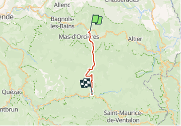
Tour Wandern von 20 km verfügbar auf Okzitanien, Lozère, Mont Lozère et Goulet. Diese Tour wird von Nathalie. Mercier vorgeschlagen.
Beschreibung
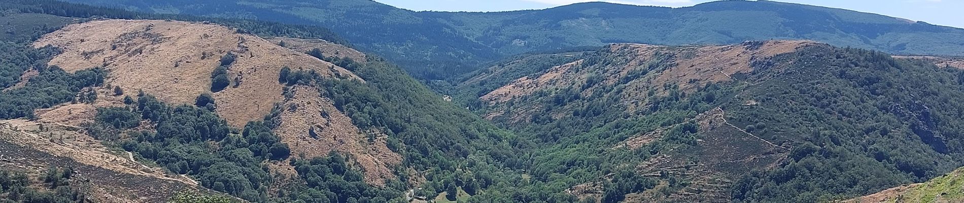
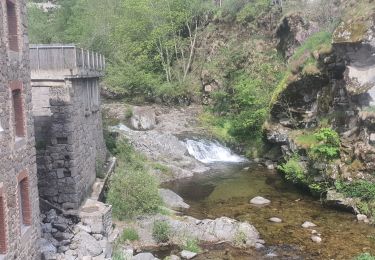
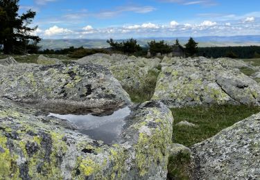
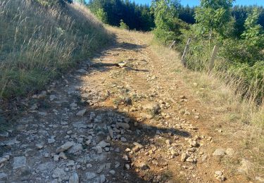
un super petit déjeuner à l'hôtel la remise pour bien démarrer tes beau parcours tout en montée je ne suis pas allée jusqu au sommet du col Finiels et pris la direction Pont Monvert chemin tres reposant , pause a Finiels des bancs y ont ete installés et un abri avec des tables par un habitant du village moins de vent et surtout moins froid puis descente à Pont Montvert très beaux panoramas
Ort
Kommentare
Touren in der Umgebung
![Tour Mountainbike Cubières - TOUR MONT LOZERE - Photo](https://media.geolcdn.com/t/375/260/a1bfdb58-8337-4d84-b53e-6cb2f940b716.jpeg&format=jpg&maxdim=2)
![Mountainbike Mountainbike](https://static1.geolcdn.com/sitytour/trail-icons/202.png)
Mountainbike
![](/images/other/stat-length.png)
![](https://static1.geolcdn.com/siteimages/upload/files/16400158638029165_repeat_loop_refresh_sync_direction_icon.png)
![Tour Wandern Mont Lozère et Goulet - Bleymar _ Le Pont Montvert - Photo](https://media.geolcdn.com/t/375/260/ext.jpg?maxdim=2&url=https%3A%2F%2Fservices.sitytrail.com%2FGeolivesWS%2FDownloadMedia.ashx%3FTrailID%3D463465%26Media%3Dfix__20150819092348.jpg)
![Wandern Wandern](https://static1.geolcdn.com/sitytour/trail-icons/101.png)
Wandern
![](/images/other/stat-length.png)
![](https://static1.geolcdn.com/siteimages/upload/files/16400158638029165_repeat_loop_refresh_sync_direction_icon.png)
![Tour Wandern Mont Lozère et Goulet - Chemin de Stevenson - Le Bleymard vers Le Pont de Montvert - Photo](https://media.geolcdn.com/t/375/260/ext.jpg?maxdim=2&url=https%3A%2F%2Fservices.sitytrail.com%2FGeolivesWS%2FDownloadMedia.ashx%3FTrailID%3D109272%26Media%3D3392_1.jpg)
![Wandern Wandern](https://static1.geolcdn.com/sitytour/trail-icons/101.png)
Wandern
![](/images/other/stat-length.png)
![](https://static1.geolcdn.com/siteimages/upload/files/16400158638029165_repeat_loop_refresh_sync_direction_icon.png)
![Tour Wandern Mont Lozère et Goulet - 12-05-2023 E7 Bonnetés - Le Pont de Monvers - Photo](https://media.geolcdn.com/t/375/260/d16bfac8-7ce8-4044-a757-ffb026543eb4.jpg&format=jpg&maxdim=2)
![Wandern Wandern](https://static1.geolcdn.com/sitytour/trail-icons/101.png)
Wandern
![](/images/other/stat-length.png)
![](https://static1.geolcdn.com/siteimages/upload/files/16400158638029165_repeat_loop_refresh_sync_direction_icon.png)
![Tour Wandern Mont Lozère et Goulet - Stevenson étape 8 - Photo](https://media.geolcdn.com/t/375/260/b34e09af-9026-4127-8636-d1e451b59807.jpg&format=jpg&maxdim=2)
![Wandern Wandern](https://static1.geolcdn.com/sitytour/trail-icons/101.png)
Wandern
![](/images/other/stat-length.png)
![](https://static1.geolcdn.com/siteimages/upload/files/16400158638029165_repeat_loop_refresh_sync_direction_icon.png)
![Tour Wandern Mont Lozère et Goulet - Le Bleymard_La Crouzette par le chemin Stevenson_10,5Km - Photo](https://media.geolcdn.com/t/375/260/ext.jpg?maxdim=2&url=https%3A%2F%2Fstatic1.geolcdn.com%2Fsiteimages%2Fupload%2Ffiles%2F1553511878bg_sport_marche.png)
![Wandern Wandern](https://static1.geolcdn.com/sitytour/trail-icons/101.png)
Wandern
![](/images/other/stat-length.png)
![](https://static1.geolcdn.com/siteimages/upload/files/16400158638029165_repeat_loop_refresh_sync_direction_icon.png)
![Tour Elektrofahrrad Cubières - ETANG DE BARANDON PAR LA STATION DE SKI - Photo](https://media.geolcdn.com/t/375/260/02cfb49c-be69-4aa6-8d1f-cab2e83a60e7.jpeg&format=jpg&maxdim=2)
![Elektrofahrrad Elektrofahrrad](https://static1.geolcdn.com/sitytour/trail-icons/205.png)
Elektrofahrrad
![](/images/other/stat-length.png)
![](https://static1.geolcdn.com/siteimages/upload/files/16400158638029165_repeat_loop_refresh_sync_direction_icon.png)
![Tour Mountainbike Mont Lozère et Goulet - Fait GTMC 2022 E3 3b - Photo](https://media.geolcdn.com/t/375/260/46bf832c-db4a-40a5-a543-74cca6354959.jpg&format=jpg&maxdim=2)
![Mountainbike Mountainbike](https://static1.geolcdn.com/sitytour/trail-icons/202.png)
Mountainbike
![](/images/other/stat-length.png)
![](https://static1.geolcdn.com/siteimages/upload/files/16400158638029165_repeat_loop_refresh_sync_direction_icon.png)
![Tour Wandern Mont Lozère et Goulet - Pont de Montvert - Photo](https://media.geolcdn.com/t/375/260/ef737a4f-a7c1-4642-affe-b45fe92c561f.jpg&format=jpg&maxdim=2)
![Wandern Wandern](https://static1.geolcdn.com/sitytour/trail-icons/101.png)
Wandern
![](/images/other/stat-length.png)
![](https://static1.geolcdn.com/siteimages/upload/files/16400158638029165_repeat_loop_refresh_sync_direction_icon.png)