![](/images/other/stat-length.png)
![Tour Wandern Saint-Priest-la-Prugne - Randonnée au dessus de St Priest la Prugne - Photo](https://media.geolcdn.com/t/1900/400/1b1e4641-662f-4ea2-93c2-f60cb9a03b92.jpg&format=pjpeg&maxdim=2)
Randonnée au dessus de St Priest la Prugne
dudu42
Benutzer GUIDE
![Länge](/images/other/stat-length.png)
Länge
10,9 km
![Maximale Höhe](https://static1.geolcdn.com/siteimages/upload/files/1508320355ic_sort_altitude_max_24dp.png)
Maximale Höhe
1005 m
![Positive Höhendifferenz](https://static1.geolcdn.com/siteimages/upload/files/1508320355ic_sort_den_pos_24dp.png)
Positive Höhendifferenz
369 m
![Km-Effort](/images/other/stat-length.png)
Km-Effort
15,8 km
![Min. Höhe](https://static1.geolcdn.com/siteimages/upload/files/1508320355ic_sort_altitude_min_24dp.png)
Min. Höhe
746 m
![Negative Höhendifferenz](https://static1.geolcdn.com/siteimages/upload/files/1508320355ic_sort_den_neg_24dp.png)
Negative Höhendifferenz
369 m
![Boucle](https://static1.geolcdn.com/siteimages/upload/files/16400158638029165_repeat_loop_refresh_sync_direction_icon.png)
Boucle
Ja
Erstellungsdatum :
2023-08-02 08:01:39.318
Letzte Änderung :
2023-08-02 12:30:11.968
![Wandern](https://static1.geolcdn.com/sitytour/trail-icons/101.png)
3h21
Schwierigkeit : Medium
![Scannen Sie diesen QR-Code, um die Tour in der SityTrail-Anwendung zu öffnen](https://capi.geolives.com/qq0zvz2zws4bq2lad0pu/sitytour/trails/3756019/qr.png?size=200)
Kostenlosegpshiking-Anwendung
Über SityTrail
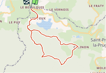
Tour Wandern von 10,9 km verfügbar auf Auvergne-Rhone-Alpen, Loire, Saint-Priest-la-Prugne. Diese Tour wird von dudu42 vorgeschlagen.
Beschreibung
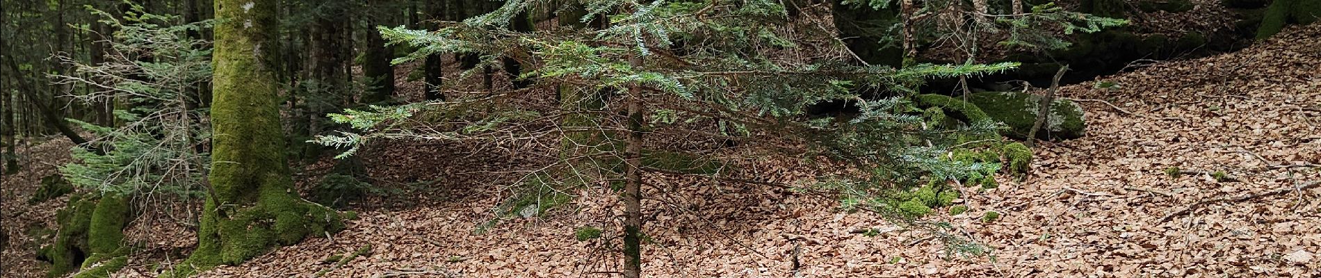
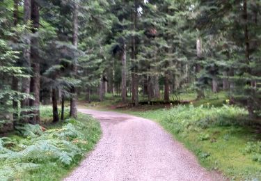
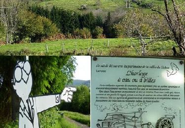
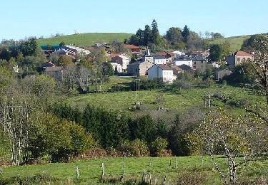
très beau circuit au milieu des bois. Point de vue sur le parcours
Ort
Land:
France
Region :
Auvergne-Rhone-Alpen
Abteilung/Provinz :
Loire
Kommune :
Saint-Priest-la-Prugne
Standort:
Unknown
Gehen Sie:(Dec)
Gehen Sie:(UTM)
554963 ; 5091400 (31T) N.
Kommentare
Touren in der Umgebung
![Tour Zu Fuß Lavoine - Le Puy de Montoncel - Photo](https://media.geolcdn.com/t/375/260/ce3ba7c9-fa72-4795-886f-e43e7d26901e.jpeg&format=jpg&maxdim=2)
![Zu Fuß Zu Fuß](https://static1.geolcdn.com/sitytour/trail-icons/100.png)
Le Puy de Montoncel
Zu Fuß
Einfach
Lavoine,
Auvergne-Rhone-Alpen,
Allier,
France
![](/images/other/stat-length.png)
12,5 km | 19,7 km-effort
4h 28min
![](https://static1.geolcdn.com/siteimages/upload/files/16400158638029165_repeat_loop_refresh_sync_direction_icon.png)
Ja
![Tour Wandern Lavoine - Les sources de la Besbre - Photo](https://media.geolcdn.com/t/375/260/04ab30d0-5737-48f4-860a-2c91bc54747c.jpg&format=jpg&maxdim=2)
![Wandern Wandern](https://static1.geolcdn.com/sitytour/trail-icons/101.png)
Les sources de la Besbre
Wandern
Medium
(1)
Lavoine,
Auvergne-Rhone-Alpen,
Allier,
France
![](/images/other/stat-length.png)
8,4 km | 11,6 km-effort
42h 44min
![](https://static1.geolcdn.com/siteimages/upload/files/16400158638029165_repeat_loop_refresh_sync_direction_icon.png)
Ja
![Tour Mountainbike Lavoine - VTT au pied des 8 éoliennes du Chemin de la Ligue - Lavoine - Photo](https://media.geolcdn.com/t/375/260/ext.jpg?maxdim=2&url=https%3A%2F%2Fservices.sitytrail.com%2FGeolivesWS%2FDownloadMedia.ashx%3FTrailID%3D215020%26Media%3D15584_6.jpg)
![Mountainbike Mountainbike](https://static1.geolcdn.com/sitytour/trail-icons/202.png)
VTT au pied des 8 éoliennes du Chemin de la Ligue - Lavoine
Mountainbike
Sehr schwierig
Lavoine,
Auvergne-Rhone-Alpen,
Allier,
France
![](/images/other/stat-length.png)
42 km | 58 km-effort
4h 15min
![](https://static1.geolcdn.com/siteimages/upload/files/16400158638029165_repeat_loop_refresh_sync_direction_icon.png)
Ja
![Tour Wandern Lavoine - Lavoine - Le Rocher Saint Vincent et le Roc des Gabelous - Photo](https://media.geolcdn.com/t/375/260/ext.jpg?maxdim=2&url=https%3A%2F%2Fservices.sitytrail.com%2FGeolivesWS%2FDownloadMedia.ashx%3FTrailID%3D105808%26Media%3D9730_6.jpg)
![Wandern Wandern](https://static1.geolcdn.com/sitytour/trail-icons/101.png)
Lavoine - Le Rocher Saint Vincent et le Roc des Gabelous
Wandern
Schwierig
Lavoine,
Auvergne-Rhone-Alpen,
Allier,
France
![](/images/other/stat-length.png)
10,8 km | 15,3 km-effort
2h 30min
![](https://static1.geolcdn.com/siteimages/upload/files/16400158638029165_repeat_loop_refresh_sync_direction_icon.png)
Ja
![Tour Wandern Lavoine - Lavoine - le sentier des scieries - Photo](https://media.geolcdn.com/t/375/260/ext.jpg?maxdim=2&url=https%3A%2F%2Fservices.sitytrail.com%2FGeolivesWS%2FDownloadMedia.ashx%3FTrailID%3D599896%26Media%3Dfix__20160717185707.jpg)
![Wandern Wandern](https://static1.geolcdn.com/sitytour/trail-icons/101.png)
Lavoine - le sentier des scieries
Wandern
Medium
Lavoine,
Auvergne-Rhone-Alpen,
Allier,
France
![](/images/other/stat-length.png)
11,5 km | 16,6 km-effort
3h 40min
![](https://static1.geolcdn.com/siteimages/upload/files/16400158638029165_repeat_loop_refresh_sync_direction_icon.png)
Ja
![Tour Wandern Lavoine - LAVOINE petite - Photo](https://media.geolcdn.com/t/375/260/ext.jpg?maxdim=2&url=https%3A%2F%2Fservices.sitytrail.com%2FGeolivesWS%2FDownloadMedia.ashx%3FTrailID%3D538262%26Media%3D20160315103345.jpg)
![Wandern Wandern](https://static1.geolcdn.com/sitytour/trail-icons/101.png)
LAVOINE petite
Wandern
Medium
Lavoine,
Auvergne-Rhone-Alpen,
Allier,
France
![](/images/other/stat-length.png)
9,7 km | 12,7 km-effort
3h 2min
![](https://static1.geolcdn.com/siteimages/upload/files/16400158638029165_repeat_loop_refresh_sync_direction_icon.png)
Ja
![Tour Wandern Laprugne - La peigne - Photo](https://media.geolcdn.com/t/375/260/ext.jpg?maxdim=2&url=https%3A%2F%2Fstatic1.geolcdn.com%2Fsiteimages%2Fupload%2Ffiles%2F1553511878bg_sport_marche.png)
![Wandern Wandern](https://static1.geolcdn.com/sitytour/trail-icons/101.png)
![Tour Wandern Lavoine - source bresde - Photo](https://media.geolcdn.com/t/375/260/ext.jpg?maxdim=2&url=https%3A%2F%2Fstatic1.geolcdn.com%2Fsiteimages%2Fupload%2Ffiles%2F1553511878bg_sport_marche.png)
![Wandern Wandern](https://static1.geolcdn.com/sitytour/trail-icons/101.png)
source bresde
Wandern
Medium
Lavoine,
Auvergne-Rhone-Alpen,
Allier,
France
![](/images/other/stat-length.png)
8,6 km | 11,8 km-effort
2h 52min
![](https://static1.geolcdn.com/siteimages/upload/files/16400158638029165_repeat_loop_refresh_sync_direction_icon.png)
Nein
![Tour Mountainbike Lavoine - 2022-06-08_08h37m50 - Photo](https://media.geolcdn.com/t/375/260/ext.jpg?maxdim=2&url=https%3A%2F%2Fstatic1.geolcdn.com%2Fsiteimages%2Fupload%2Ffiles%2F1524743154velo.jpg)
![Mountainbike Mountainbike](https://static1.geolcdn.com/sitytour/trail-icons/202.png)
2022-06-08_08h37m50
Mountainbike
Sehr schwierig
Lavoine,
Auvergne-Rhone-Alpen,
Allier,
France
![](/images/other/stat-length.png)
50 km | 71 km-effort
4h 56min
![](https://static1.geolcdn.com/siteimages/upload/files/16400158638029165_repeat_loop_refresh_sync_direction_icon.png)
Ja