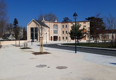
14,6 km | 15,9 km-effort
étape 9
cher truc
Benutzer
Länge
62 km
Maximale Höhe
121 m
Positive Höhendifferenz
432 m
Km-Effort
68 km
Min. Höhe
56 m
Negative Höhendifferenz
456 m
Boucle
Nein
Erstellungsdatum :
2023-07-21 07:29:28.889
Letzte Änderung :
2023-07-21 14:36:28.136
3h47
Schwierigkeit : Sehr schwierig
Kostenlosegpshiking-Anwendung
Über SityTrail
Tour Rennrad von 62 km verfügbar auf Zentrum-Loiretal, Loir-et-Cher, Romorantin-Lanthenay. Diese Tour wird von cher truc vorgeschlagen.
Ort
Land:
France
Region :
Zentrum-Loiretal
Abteilung/Provinz :
Loir-et-Cher
Kommune :
Romorantin-Lanthenay
Standort:
Unknown
Gehen Sie:(Dec)
Gehen Sie:(UTM)
406067 ; 5245286 (31T) N.
Kommentare
Touren in der Umgebung
boucle Romorantin
Laufen
Sehr leicht
Romorantin-Lanthenay,
Zentrum-Loiretal,
Loir-et-Cher,
France
2h 6min
Ja
boucle Romorantin
Nordic Walking
Sehr leicht
Romorantin-Lanthenay,
Zentrum-Loiretal,
Loir-et-Cher,
France
7,6 km | 8,3 km-effort
1h 37min
Ja
romo marcilly romo
Rennrad
Sehr leicht
Romorantin-Lanthenay,
Zentrum-Loiretal,
Loir-et-Cher,
France
40 km | 44 km-effort
1h 48min
Ja
Villefranche sur cher
Wandern
Einfach
Villefranche-sur-Cher,
Zentrum-Loiretal,
Loir-et-Cher,
France
11,4 km | 12,5 km-effort
2h 47min
Ja
Romo Valençay
Wandern
Medium
Romorantin-Lanthenay,
Zentrum-Loiretal,
Loir-et-Cher,
France
36 km | 40 km-effort
7h 26min
Nein
romorantin
Wandern
Einfach
Romorantin-Lanthenay,
Zentrum-Loiretal,
Loir-et-Cher,
France
11 km | 12,1 km-effort
1h 46min
Ja
villeherviers
Wandern
Einfach
Villeherviers,
Zentrum-Loiretal,
Loir-et-Cher,
France
7,8 km | 8,5 km-effort
1h 51min
Ja
pruniers
Wandern
Einfach
Gièvres,
Zentrum-Loiretal,
Loir-et-Cher,
France
7,5 km | 8,2 km-effort
2h 4min
Ja
pruniers
Nordic Walking
Sehr leicht
Pruniers-en-Sologne,
Zentrum-Loiretal,
Loir-et-Cher,
France
12 km | 13,2 km-effort
2h 41min
Ja