![](/images/other/stat-length.png)
![Tour Reiten Dossenheim - 2023-07-09 Picnic CVA Dossenheim sur Zinsel - Photo](https://media.geolcdn.com/t/1900/400/2d8e477c-5a5a-4290-8e15-7358176992bc.jpg&format=pjpeg&maxdim=2)
2023-07-09 Picnic CVA Dossenheim sur Zinsel
holtzv
Benutzer GUIDE
![Länge](/images/other/stat-length.png)
![Maximale Höhe](https://static1.geolcdn.com/siteimages/upload/files/1508320355ic_sort_altitude_max_24dp.png)
![Positive Höhendifferenz](https://static1.geolcdn.com/siteimages/upload/files/1508320355ic_sort_den_pos_24dp.png)
![Km-Effort](/images/other/stat-length.png)
![Min. Höhe](https://static1.geolcdn.com/siteimages/upload/files/1508320355ic_sort_altitude_min_24dp.png)
![Negative Höhendifferenz](https://static1.geolcdn.com/siteimages/upload/files/1508320355ic_sort_den_neg_24dp.png)
![Boucle](https://static1.geolcdn.com/siteimages/upload/files/16400158638029165_repeat_loop_refresh_sync_direction_icon.png)
![Reiten](https://static1.geolcdn.com/sitytour/trail-icons/301.png)
5h45
Schwierigkeit : Medium
![Scannen Sie diesen QR-Code, um die Tour in der SityTrail-Anwendung zu öffnen](https://capi.geolives.com/qq0zvz2zws4bq2lad0pu/sitytour/trails/3728181/qr.png?size=200)
Kostenlosegpshiking-Anwendung
Über SityTrail
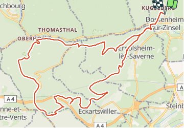
Tour Reiten von 29 km verfügbar auf Großer Osten, Unterelsass, Dossenheim. Diese Tour wird von holtzv vorgeschlagen.
Beschreibung
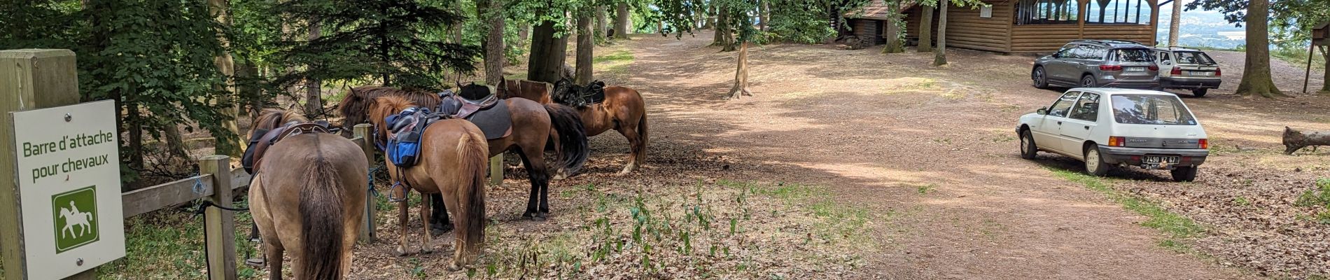
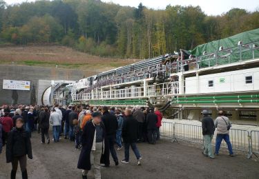
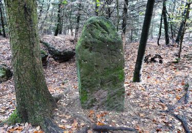
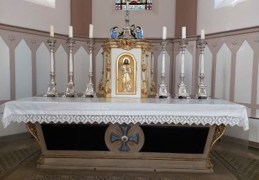
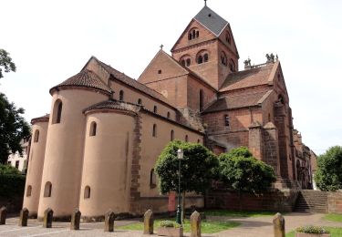
Boucle au départ de Dossenheim sur Zinsel depuis le grand parking en face du cimetière permettant d’aller chercher de l’eau au fond du cimetière et de faire brouter tranquillement les chevaux. Journée de 29 km sur le massif du Mont Saint Michel alsacien en passant par la passerelle du moulin Schweyer qui donne un accès aux chevaux à l’eau de la Zinsel du Sud, le pont au-dessus de la ligne TGV et de l’autoroute A4 de l’Est, le rocher des Faucons, la passerelle à gibier (même interdite aux chevaux 😉), le rocher des Dames, la chapelle Saint Michel où l’on a pu profiter de la barre d’attaches pour les chevaux et de se restaurer, l’Opferteller (pierres à cupules), le Huhnerfelsen et le château du Warthenberg.
Ort
Kommentare
Touren in der Umgebung
![Tour Reiten Dossenheim - Boucle ErnolsheimLesSaverne Chapelle St Michel - Photo](https://media.geolcdn.com/t/375/260/e77b9dfe-1e41-4fcc-97a3-ca33da6f3991.jpg&format=jpg&maxdim=2)
![Reiten Reiten](https://static1.geolcdn.com/sitytour/trail-icons/301.png)
Reiten
![](/images/other/stat-length.png)
![](https://static1.geolcdn.com/siteimages/upload/files/16400158638029165_repeat_loop_refresh_sync_direction_icon.png)
![Tour Zu Fuß Dossenheim - Triangle rouge - Photo](https://media.geolcdn.com/t/375/260/b33fe5d5-b26e-4d19-9ef2-1295dcc5780a.jpeg&format=jpg&maxdim=2)
![Zu Fuß Zu Fuß](https://static1.geolcdn.com/sitytour/trail-icons/100.png)
Zu Fuß
![](/images/other/stat-length.png)
![](https://static1.geolcdn.com/siteimages/upload/files/16400158638029165_repeat_loop_refresh_sync_direction_icon.png)
![Tour Zu Fuß Ernolsheim - Rectangle bleu barré de blanc - Photo](https://media.geolcdn.com/t/375/260/03314272-aa3e-4322-97f6-7afd0207efcf.jpeg&format=jpg&maxdim=2)
![Zu Fuß Zu Fuß](https://static1.geolcdn.com/sitytour/trail-icons/100.png)
Zu Fuß
![](/images/other/stat-length.png)
![](https://static1.geolcdn.com/siteimages/upload/files/16400158638029165_repeat_loop_refresh_sync_direction_icon.png)
![Tour Zu Fuß Ernolsheim - Anneau jaune - Photo](https://media.geolcdn.com/t/375/260/3cb28aaa-d36b-490a-bf7b-0a37964c9ea6.jpeg&format=jpg&maxdim=2)
![Zu Fuß Zu Fuß](https://static1.geolcdn.com/sitytour/trail-icons/100.png)
Zu Fuß
![](/images/other/stat-length.png)
![](https://static1.geolcdn.com/siteimages/upload/files/16400158638029165_repeat_loop_refresh_sync_direction_icon.png)
![Tour Zu Fuß Sankt Johann bei Zabern - Chevalet rouge - Photo](https://media.geolcdn.com/t/375/260/0dd39903-a686-40c3-9785-4ead1bbebc8f.jpeg&format=jpg&maxdim=2)
![Zu Fuß Zu Fuß](https://static1.geolcdn.com/sitytour/trail-icons/100.png)
Zu Fuß
![](/images/other/stat-length.png)
![](https://static1.geolcdn.com/siteimages/upload/files/16400158638029165_repeat_loop_refresh_sync_direction_icon.png)
![Tour Zu Fuß Sankt Johann bei Zabern - Circuit Archéologique d'Ernolsheim-lès-Saverne - Photo](https://media.geolcdn.com/t/375/260/60c6095c-d8e2-44d1-91f6-754fc6d8b002.jpeg&format=jpg&maxdim=2)
![Zu Fuß Zu Fuß](https://static1.geolcdn.com/sitytour/trail-icons/100.png)
Zu Fuß
![](/images/other/stat-length.png)
![](https://static1.geolcdn.com/siteimages/upload/files/16400158638029165_repeat_loop_refresh_sync_direction_icon.png)
![Tour Zu Fuß Sankt Johann bei Zabern - Circuit du Frohnberg - Photo](https://media.geolcdn.com/t/375/260/7f477f52-186a-47be-97f3-d4b05d97d596.jpeg&format=jpg&maxdim=2)
![Zu Fuß Zu Fuß](https://static1.geolcdn.com/sitytour/trail-icons/100.png)
Zu Fuß
![](/images/other/stat-length.png)
![](https://static1.geolcdn.com/siteimages/upload/files/16400158638029165_repeat_loop_refresh_sync_direction_icon.png)
![Tour Zu Fuß Sankt Johann bei Zabern - Circuit de la Forêt des Dames - Photo](https://media.geolcdn.com/t/375/260/940f4f7a-5ffe-4be9-a519-9b1fc81fa3eb.jpeg&format=jpg&maxdim=2)
![Zu Fuß Zu Fuß](https://static1.geolcdn.com/sitytour/trail-icons/100.png)
Zu Fuß
![](/images/other/stat-length.png)
![](https://static1.geolcdn.com/siteimages/upload/files/16400158638029165_repeat_loop_refresh_sync_direction_icon.png)
![Tour Zu Fuß Neuweiler - Croix bleu - Photo](https://media.geolcdn.com/t/375/260/ac14cb89-5ba1-4ba9-9b9a-6e7178a855f4.jpeg&format=jpg&maxdim=2)
![Zu Fuß Zu Fuß](https://static1.geolcdn.com/sitytour/trail-icons/100.png)
Zu Fuß
![](/images/other/stat-length.png)
![](https://static1.geolcdn.com/siteimages/upload/files/16400158638029165_repeat_loop_refresh_sync_direction_icon.png)