![](/images/other/stat-length.png)
![Tour Mountainbike Vouthon-Haut - Les Chemins d'Isabelle P1 25 Km - Photo](https://media.geolcdn.com/t/1900/400/f082664c-325d-4085-9856-eddb89349109.jpg&format=pjpeg&maxdim=2)
Les Chemins d'Isabelle P1 25 Km
Club CDSM
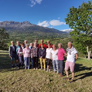
On part et on rentre ensemble avec le sourire
![Länge](/images/other/stat-length.png)
Länge
26 km
![Maximale Höhe](https://static1.geolcdn.com/siteimages/upload/files/1508320355ic_sort_altitude_max_24dp.png)
Maximale Höhe
414 m
![Positive Höhendifferenz](https://static1.geolcdn.com/siteimages/upload/files/1508320355ic_sort_den_pos_24dp.png)
Positive Höhendifferenz
489 m
![Km-Effort](/images/other/stat-length.png)
Km-Effort
32 km
![Min. Höhe](https://static1.geolcdn.com/siteimages/upload/files/1508320355ic_sort_altitude_min_24dp.png)
Min. Höhe
291 m
![Negative Höhendifferenz](https://static1.geolcdn.com/siteimages/upload/files/1508320355ic_sort_den_neg_24dp.png)
Negative Höhendifferenz
489 m
![Boucle](https://static1.geolcdn.com/siteimages/upload/files/16400158638029165_repeat_loop_refresh_sync_direction_icon.png)
Boucle
Ja
Erstellungsdatum :
2023-07-03 15:00:03.207
Letzte Änderung :
2023-07-03 15:00:42.658
![Mountainbike](https://static1.geolcdn.com/sitytour/trail-icons/202.png)
2h13
Schwierigkeit : Schwierig
![Scannen Sie diesen QR-Code, um die Tour in der SityTrail-Anwendung zu öffnen](https://capi.geolives.com/qq0zvz2zws4bq2lad0pu/sitytour/trails/3721398/qr.png?size=200)
Kostenlosegpshiking-Anwendung
Über SityTrail
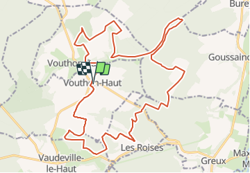
Tour Mountainbike von 26 km verfügbar auf Großer Osten, Meuse, Vouthon-Haut. Diese Tour wird von Club CDSM vorgeschlagen.
Beschreibung
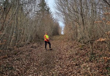
Boucle autour de Vouthon Haut, Vouthon Bas lors de l'édition 2023
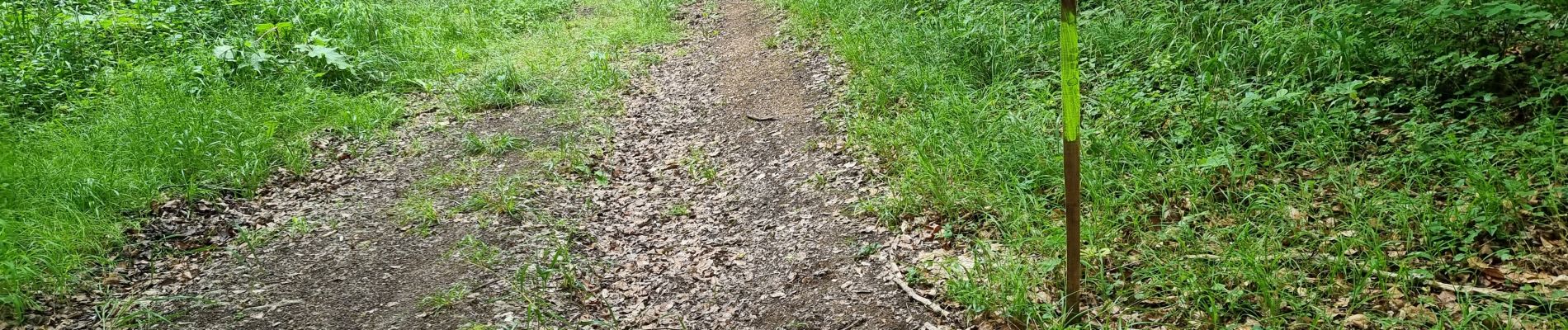
En suivant quelques raccourcis signalés au fléchage ce parcours peut être famillial
Ort
Land:
France
Region :
Großer Osten
Abteilung/Provinz :
Meuse
Kommune :
Vouthon-Haut
Standort:
Unknown
Gehen Sie:(Dec)
Gehen Sie:(UTM)
693478 ; 5372515 (31U) N.
Kommentare
Touren in der Umgebung
![Tour Wandern Vouthon-Haut - En mémoire de Sidonie - Photo](https://media.geolcdn.com/t/375/260/475005be-6364-4eab-8d4a-fe76ea442e3f.jpg&format=jpg&maxdim=2)
![Wandern Wandern](https://static1.geolcdn.com/sitytour/trail-icons/101.png)
En mémoire de Sidonie
Wandern
Medium
(1)
Vouthon-Haut,
Großer Osten,
Meuse,
France
![](/images/other/stat-length.png)
7,7 km | 9,3 km-effort
1h 46min
![](https://static1.geolcdn.com/siteimages/upload/files/16400158638029165_repeat_loop_refresh_sync_direction_icon.png)
Nein
![Tour Wandern Vouthon-Haut - Marche 8 Km Isa 2024 - Photo](https://media.geolcdn.com/t/375/260/350467fa-bfe6-4501-8ccd-588dc75c2f86.jpg&format=jpg&maxdim=2)
![Wandern Wandern](https://static1.geolcdn.com/sitytour/trail-icons/101.png)
Marche 8 Km Isa 2024
Wandern
Medium
(1)
Vouthon-Haut,
Großer Osten,
Meuse,
France
![](/images/other/stat-length.png)
8,2 km | 10,3 km-effort
2h 20min
![](https://static1.geolcdn.com/siteimages/upload/files/16400158638029165_repeat_loop_refresh_sync_direction_icon.png)
Ja
![Tour Wandern Vouthon-Haut - sur les chemins d'Isabelle partiel les Roises - Photo](https://media.geolcdn.com/t/375/260/25c45dc4-16f2-40f7-b99f-00057743b3ef.jpg&format=jpg&maxdim=2)
![Wandern Wandern](https://static1.geolcdn.com/sitytour/trail-icons/101.png)
sur les chemins d'Isabelle partiel les Roises
Wandern
Medium
(1)
Vouthon-Haut,
Großer Osten,
Meuse,
France
![](/images/other/stat-length.png)
8,4 km | 11 km-effort
1h 8min
![](https://static1.geolcdn.com/siteimages/upload/files/16400158638029165_repeat_loop_refresh_sync_direction_icon.png)
Ja
![Tour Wandern Vouthon-Haut - reco site VTT - Photo](https://media.geolcdn.com/t/375/260/cb6bfae4-1972-41fb-9550-f08b8b9d04f9.jpg&format=jpg&maxdim=2)
![Wandern Wandern](https://static1.geolcdn.com/sitytour/trail-icons/101.png)
reco site VTT
Wandern
Einfach
(1)
Vouthon-Haut,
Großer Osten,
Meuse,
France
![](/images/other/stat-length.png)
4 km | 5,4 km-effort
1h 20min
![](https://static1.geolcdn.com/siteimages/upload/files/16400158638029165_repeat_loop_refresh_sync_direction_icon.png)
Ja
![Tour Wandern Vouthon-Haut - Vouthon-Haut - Photo](https://media.geolcdn.com/t/375/260/c32a0535-be46-436c-be69-0c270c044d41.jpg&format=jpg&maxdim=2)
![Wandern Wandern](https://static1.geolcdn.com/sitytour/trail-icons/101.png)
Vouthon-Haut
Wandern
Sehr schwierig
(1)
Vouthon-Haut,
Großer Osten,
Meuse,
France
![](/images/other/stat-length.png)
16,7 km | 19,5 km-effort
2h 41min
![](https://static1.geolcdn.com/siteimages/upload/files/16400158638029165_repeat_loop_refresh_sync_direction_icon.png)
Nein
![Tour Wandern Vouthon-Haut - marche 15 km Isa 2024 - Photo](https://media.geolcdn.com/t/375/260/ext.jpg?maxdim=2&url=https%3A%2F%2Fstatic1.geolcdn.com%2Fsiteimages%2Fupload%2Ffiles%2F1553511878bg_sport_marche.png)
![Wandern Wandern](https://static1.geolcdn.com/sitytour/trail-icons/101.png)
marche 15 km Isa 2024
Wandern
Schwierig
(1)
Vouthon-Haut,
Großer Osten,
Meuse,
France
![](/images/other/stat-length.png)
15,1 km | 18,1 km-effort
4h 7min
![](https://static1.geolcdn.com/siteimages/upload/files/16400158638029165_repeat_loop_refresh_sync_direction_icon.png)
Ja
![Tour Mountainbike Vouthon-Haut - Chemin d'Isabelle partiel - Photo](https://media.geolcdn.com/t/375/260/ext.jpg?maxdim=2&url=https%3A%2F%2Fstatic1.geolcdn.com%2Fsiteimages%2Fupload%2Ffiles%2F1524743154velo.jpg)
![Mountainbike Mountainbike](https://static1.geolcdn.com/sitytour/trail-icons/202.png)
Chemin d'Isabelle partiel
Mountainbike
Einfach
(1)
Vouthon-Haut,
Großer Osten,
Meuse,
France
![](/images/other/stat-length.png)
14,6 km | 17,4 km-effort
1h 8min
![](https://static1.geolcdn.com/siteimages/upload/files/16400158638029165_repeat_loop_refresh_sync_direction_icon.png)
Ja
![Tour Mountainbike Vouthon-Haut - Les Chemins d'Isabelle P2 - Photo](https://media.geolcdn.com/t/375/260/ext.jpg?maxdim=2&url=https%3A%2F%2Fstatic1.geolcdn.com%2Fsiteimages%2Fupload%2Ffiles%2F1524743154velo.jpg)
![Mountainbike Mountainbike](https://static1.geolcdn.com/sitytour/trail-icons/202.png)
Les Chemins d'Isabelle P2
Mountainbike
Sehr schwierig
(1)
Vouthon-Haut,
Großer Osten,
Meuse,
France
![](/images/other/stat-length.png)
34 km | 42 km-effort
2h 54min
![](https://static1.geolcdn.com/siteimages/upload/files/16400158638029165_repeat_loop_refresh_sync_direction_icon.png)
Ja
![Tour Wandern Vouthon-Haut - reco VTT Chemins d'Isabelle - Photo](https://media.geolcdn.com/t/375/260/3186ceb5-b32f-47c0-9987-40f83d046360.jpg&format=jpg&maxdim=2)
![Wandern Wandern](https://static1.geolcdn.com/sitytour/trail-icons/101.png)
reco VTT Chemins d'Isabelle
Wandern
Medium
(1)
Vouthon-Haut,
Großer Osten,
Meuse,
France
![](/images/other/stat-length.png)
7,9 km | 10,9 km-effort
1h 17min
![](https://static1.geolcdn.com/siteimages/upload/files/16400158638029165_repeat_loop_refresh_sync_direction_icon.png)
Ja