![](/images/other/stat-length.png)
![Tour Wandern Beauraing - Balade de Dion à Winenne - Beauraing - Photo](https://media.geolcdn.com/t/1900/400/5c1dc6e2-7e96-43cd-a912-ceabbaabe8bc.jpeg&format=pjpeg&maxdim=2)
Balade de Dion à Winenne - Beauraing
Desrumaux
Benutzer GUIDE
![Länge](/images/other/stat-length.png)
Länge
6,5 km
![Maximale Höhe](https://static1.geolcdn.com/siteimages/upload/files/1508320355ic_sort_altitude_max_24dp.png)
Maximale Höhe
293 m
![Positive Höhendifferenz](https://static1.geolcdn.com/siteimages/upload/files/1508320355ic_sort_den_pos_24dp.png)
Positive Höhendifferenz
151 m
![Km-Effort](/images/other/stat-length.png)
Km-Effort
8,5 km
![Min. Höhe](https://static1.geolcdn.com/siteimages/upload/files/1508320355ic_sort_altitude_min_24dp.png)
Min. Höhe
172 m
![Negative Höhendifferenz](https://static1.geolcdn.com/siteimages/upload/files/1508320355ic_sort_den_neg_24dp.png)
Negative Höhendifferenz
147 m
![Boucle](https://static1.geolcdn.com/siteimages/upload/files/16400158638029165_repeat_loop_refresh_sync_direction_icon.png)
Boucle
Ja
Erstellungsdatum :
2023-06-26 19:02:56.099
Letzte Änderung :
2023-06-27 05:29:34.705
![Wandern](https://static1.geolcdn.com/sitytour/trail-icons/101.png)
1h55
Schwierigkeit : Medium
![Scannen Sie diesen QR-Code, um die Tour in der SityTrail-Anwendung zu öffnen](https://capi.geolives.com/qq0zvz2zws4bq2lad0pu/sitytour/trails/3713777/qr.png?size=200)
Kostenlosegpshiking-Anwendung
Über SityTrail
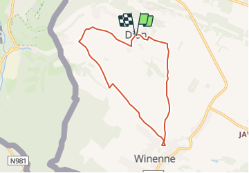
Tour Wandern von 6,5 km verfügbar auf Wallonien, Namur, Beauraing. Diese Tour wird von Desrumaux vorgeschlagen.
Beschreibung
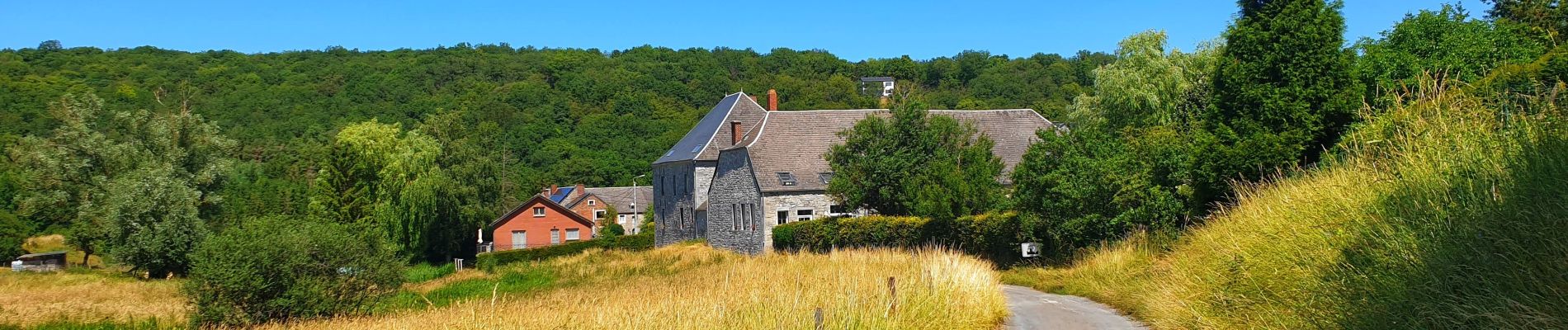
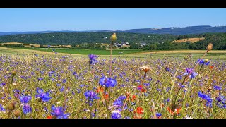
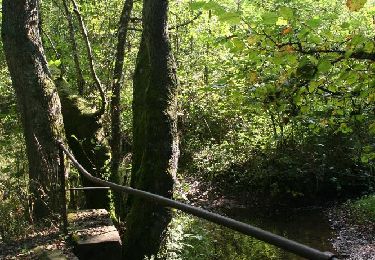
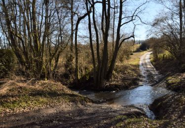
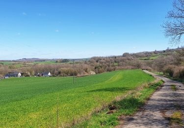
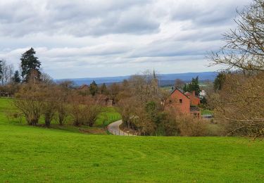
Jolie balade proposée par l'office du tourisme de Beauraing reliant le village de Dion au village de Winenne par d'agréables petites routes de campagne dans un décor typiquement famennois.
Balisage rectangle jaune numéroté 2
Ort
Land:
Belgium
Region :
Wallonien
Abteilung/Provinz :
Namur
Kommune :
Beauraing
Standort:
Unknown
Gehen Sie:(Dec)
Gehen Sie:(UTM)
635015 ; 5553420 (31U) N.
Kommentare
Touren in der Umgebung
![Tour Wandern Beauraing - Winenne - Nature: trip to the countryside - Photo](https://media.geolcdn.com/t/375/260/ext.jpg?maxdim=2&url=https%3A%2F%2Fservices.sitytrail.com%2FGeolivesWS%2FDownloadMedia.ashx%3FTrailID%3D208730%26Media%3Dec2b8399-61b2-47f0-8c4e-ffe9506b5f79.jpg)
![Wandern Wandern](https://static1.geolcdn.com/sitytour/trail-icons/101.png)
Winenne - Nature: trip to the countryside
Wandern
Schwierig
(7)
Beauraing,
Wallonien,
Namur,
Belgium
![](/images/other/stat-length.png)
20 km | 26 km-effort
6h 0min
![](https://static1.geolcdn.com/siteimages/upload/files/16400158638029165_repeat_loop_refresh_sync_direction_icon.png)
Ja
![Wandern Wandern](https://static1.geolcdn.com/sitytour/trail-icons/101.png)
RB-Na-28-En Famenne occidentale
Wandern
Sehr schwierig
(5)
Beauraing,
Wallonien,
Namur,
Belgium
![](/images/other/stat-length.png)
19,4 km | 24 km-effort
5h 33min
![](https://static1.geolcdn.com/siteimages/upload/files/16400158638029165_repeat_loop_refresh_sync_direction_icon.png)
Ja
![Tour Wandern Beauraing - Javingue-Sevry - Roadbook discovering villages & landscapes - Photo](https://media.geolcdn.com/t/375/260/ext.jpg?maxdim=2&url=https%3A%2F%2Fservices.sitytrail.com%2FGeolivesWS%2FDownloadMedia.ashx%3FTrailID%3D230063%26Media%3D65d10601-99c2-4ec7-afa5-e6b7caea9bd6.jpg)
![Wandern Wandern](https://static1.geolcdn.com/sitytour/trail-icons/101.png)
Javingue-Sevry - Roadbook discovering villages & landscapes
Wandern
Einfach
(6)
Beauraing,
Wallonien,
Namur,
Belgium
![](/images/other/stat-length.png)
7,7 km | 10,2 km-effort
2h 0min
![](https://static1.geolcdn.com/siteimages/upload/files/16400158638029165_repeat_loop_refresh_sync_direction_icon.png)
Ja
![Tour Wandern Givet - Balade à Givet - Photo](https://media.geolcdn.com/t/375/260/ext.jpg?maxdim=2&url=https%3A%2F%2Fservices.sitytrail.com%2FGeolivesWS%2FDownloadMedia.ashx%3FTrailID%3D110616%26Media%3D6179_5.jpg)
![Wandern Wandern](https://static1.geolcdn.com/sitytour/trail-icons/101.png)
Balade à Givet
Wandern
Medium
(3)
Givet,
Großer Osten,
Ardennes,
France
![](/images/other/stat-length.png)
8 km | 9,4 km-effort
2h 0min
![](https://static1.geolcdn.com/siteimages/upload/files/16400158638029165_repeat_loop_refresh_sync_direction_icon.png)
Ja
![Tour Wandern Givet - Promenade sur les remparts du Mont d'Haurs - Photo](https://media.geolcdn.com/t/375/260/ext.jpg?maxdim=2&url=https%3A%2F%2Fservices.sitytrail.com%2FGeolivesWS%2FDownloadMedia.ashx%3FTrailID%3D108905%26Media%3D2570_6.jpg)
![Wandern Wandern](https://static1.geolcdn.com/sitytour/trail-icons/101.png)
Promenade sur les remparts du Mont d'Haurs
Wandern
Medium
(3)
Givet,
Großer Osten,
Ardennes,
France
![](/images/other/stat-length.png)
5,1 km | 6,7 km-effort
2h 0min
![](https://static1.geolcdn.com/siteimages/upload/files/16400158638029165_repeat_loop_refresh_sync_direction_icon.png)
Ja
![Tour Mountainbike Beauraing - Winenne - Nature: trip to the countryside - Photo](https://media.geolcdn.com/t/375/260/ext.jpg?maxdim=2&url=https%3A%2F%2Fservices.sitytrail.com%2FGeolivesWS%2FDownloadMedia.ashx%3FTrailID%3D225225%26Media%3D30a4a7fc-abda-4afa-ad3f-06c878f2db6f.jpg)
![Mountainbike Mountainbike](https://static1.geolcdn.com/sitytour/trail-icons/202.png)
Winenne - Nature: trip to the countryside
Mountainbike
Medium
(3)
Beauraing,
Wallonien,
Namur,
Belgium
![](/images/other/stat-length.png)
20 km | 26 km-effort
1h 41min
![](https://static1.geolcdn.com/siteimages/upload/files/16400158638029165_repeat_loop_refresh_sync_direction_icon.png)
Ja
![Tour Wandern Beauraing - Balade à Winenne - Beauraing - Photo](https://media.geolcdn.com/t/375/260/8bfd43ea-288d-45ae-81cb-56021fe3f6e3.jpeg&format=jpg&maxdim=2)
![Wandern Wandern](https://static1.geolcdn.com/sitytour/trail-icons/101.png)
Balade à Winenne - Beauraing
Wandern
Schwierig
Beauraing,
Wallonien,
Namur,
Belgium
![](/images/other/stat-length.png)
11,7 km | 14,7 km-effort
3h 20min
![](https://static1.geolcdn.com/siteimages/upload/files/16400158638029165_repeat_loop_refresh_sync_direction_icon.png)
Ja
![Tour Wandern Beauraing - Balade à Javingue-Sevry - Photo](https://media.geolcdn.com/t/375/260/60dbfcb3-e867-4480-b101-a047b64bbff2.jpeg&format=jpg&maxdim=2)
![Wandern Wandern](https://static1.geolcdn.com/sitytour/trail-icons/101.png)
Balade à Javingue-Sevry
Wandern
Schwierig
Beauraing,
Wallonien,
Namur,
Belgium
![](/images/other/stat-length.png)
9,5 km | 12,4 km-effort
2h 49min
![](https://static1.geolcdn.com/siteimages/upload/files/16400158638029165_repeat_loop_refresh_sync_direction_icon.png)
Ja
![Tour Wandern Beauraing - Beauraing Aire d'envol - Photo](https://media.geolcdn.com/t/375/260/ext.jpg?maxdim=2&url=https%3A%2F%2Fstatic1.geolcdn.com%2Fsiteimages%2Fupload%2Ffiles%2F1553511878bg_sport_marche.png)
![Wandern Wandern](https://static1.geolcdn.com/sitytour/trail-icons/101.png)
Beauraing Aire d'envol
Wandern
Sehr leicht
(1)
Beauraing,
Wallonien,
Namur,
Belgium
![](/images/other/stat-length.png)
12,8 km | 16,8 km-effort
3h 3min
![](https://static1.geolcdn.com/siteimages/upload/files/16400158638029165_repeat_loop_refresh_sync_direction_icon.png)
Ja