![](/images/other/stat-length.png)
![Tour Wandern Saint-Laurent-en-Beaumont - Croix de la Roche et Signal St-Michel - Photo](https://media.geolcdn.com/t/1900/400/52236408-4d5b-4a9f-bbaa-7fca94a30aee.jpg&format=pjpeg&maxdim=2)
Croix de la Roche et Signal St-Michel
GuyVachet
Benutzer
![Länge](/images/other/stat-length.png)
![Maximale Höhe](https://static1.geolcdn.com/siteimages/upload/files/1508320355ic_sort_altitude_max_24dp.png)
![Positive Höhendifferenz](https://static1.geolcdn.com/siteimages/upload/files/1508320355ic_sort_den_pos_24dp.png)
![Km-Effort](/images/other/stat-length.png)
![Min. Höhe](https://static1.geolcdn.com/siteimages/upload/files/1508320355ic_sort_altitude_min_24dp.png)
![Negative Höhendifferenz](https://static1.geolcdn.com/siteimages/upload/files/1508320355ic_sort_den_neg_24dp.png)
![Boucle](https://static1.geolcdn.com/siteimages/upload/files/16400158638029165_repeat_loop_refresh_sync_direction_icon.png)
![Wandern](https://static1.geolcdn.com/sitytour/trail-icons/101.png)
5h54
Schwierigkeit : Sehr schwierig
![Scannen Sie diesen QR-Code, um die Tour in der SityTrail-Anwendung zu öffnen](https://capi.geolives.com/qq0zvz2zws4bq2lad0pu/sitytour/trails/3712202/qr.png?size=200)
Kostenlosegpshiking-Anwendung
Über SityTrail
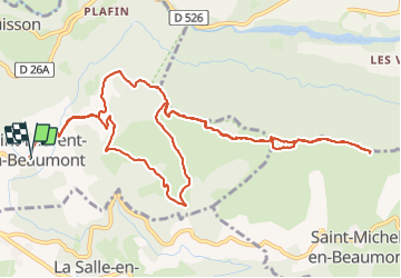
Tour Wandern von 14,2 km verfügbar auf Auvergne-Rhone-Alpen, Isère, Saint-Laurent-en-Beaumont. Diese Tour wird von GuyVachet vorgeschlagen.
Beschreibung
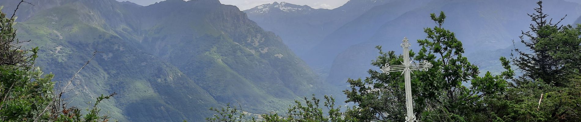
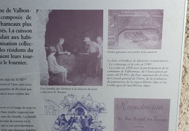
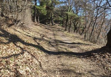
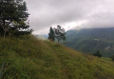
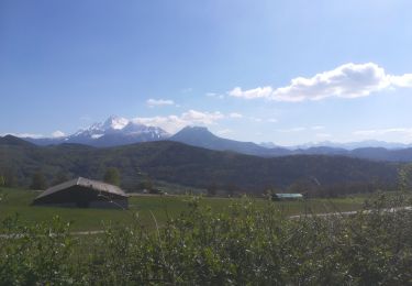
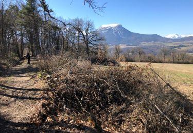
Boucle et en Aller/Retour sur la crête de la Sciau pour arriver à la Croix de la Roche et du Signal St-Michel afin de profiter de la vue sur l'Obiou et sur le Dévoluy avec la Montagne de Faraut et le Pic de Bure au fond avant de rebrousser chemin. L'itinéraire se suit sans problème et il est pour une bonne partie du temps est en couvert.
Ort
Kommentare
Touren in der Umgebung
![Tour Wandern Sainte-Luce - Côte Rouge - Photo](https://media.geolcdn.com/t/375/260/de862aa8-3a89-4016-889b-2ec83352f8c0.jpg&format=jpg&maxdim=2)
![Wandern Wandern](https://static1.geolcdn.com/sitytour/trail-icons/101.png)
Wandern
![](/images/other/stat-length.png)
![](https://static1.geolcdn.com/siteimages/upload/files/16400158638029165_repeat_loop_refresh_sync_direction_icon.png)
![Tour Wandern Saint-Laurent-en-Beaumont - Valbonnais Canal Beaumont StLaurent - Photo](https://media.geolcdn.com/t/375/260/c4704b83-2e24-4742-b66e-bcb05b8bcf7e.jpg&format=jpg&maxdim=2)
![Wandern Wandern](https://static1.geolcdn.com/sitytour/trail-icons/101.png)
Wandern
![](/images/other/stat-length.png)
![](https://static1.geolcdn.com/siteimages/upload/files/16400158638029165_repeat_loop_refresh_sync_direction_icon.png)
![Tour Wandern Valbonnais - le canal du Beaumont ,les verneys - Photo](https://media.geolcdn.com/t/375/260/2798c172-0fea-462e-b7e1-5b2ec3854f74.jpg&format=jpg&maxdim=2)
![Wandern Wandern](https://static1.geolcdn.com/sitytour/trail-icons/101.png)
Wandern
![](/images/other/stat-length.png)
![](https://static1.geolcdn.com/siteimages/upload/files/16400158638029165_repeat_loop_refresh_sync_direction_icon.png)
![Tour Elektrofahrrad Saint-Laurent-en-Beaumont - plafin oris la valette retour pont roizon sievoz - Photo](https://media.geolcdn.com/t/375/260/c30c76dc-6911-42ed-b8ef-ed9754d00933.jpg&format=jpg&maxdim=2)
![Elektrofahrrad Elektrofahrrad](https://static1.geolcdn.com/sitytour/trail-icons/205.png)
Elektrofahrrad
![](/images/other/stat-length.png)
![](https://static1.geolcdn.com/siteimages/upload/files/16400158638029165_repeat_loop_refresh_sync_direction_icon.png)
![Tour Mountainbike Sainte-Luce - St luce canal beaumont - Photo](https://media.geolcdn.com/t/375/260/60142226-66a3-460c-8141-c2be117708e1.jpg&format=jpg&maxdim=2)
![Mountainbike Mountainbike](https://static1.geolcdn.com/sitytour/trail-icons/202.png)
Mountainbike
![](/images/other/stat-length.png)
![](https://static1.geolcdn.com/siteimages/upload/files/16400158638029165_repeat_loop_refresh_sync_direction_icon.png)
![Tour Wandern Valbonnais - Tour de Belle Roche - Photo](https://media.geolcdn.com/t/375/260/91066cd2-60eb-4718-9a52-c7ed0cc960b6.jpg&format=jpg&maxdim=2)
![Wandern Wandern](https://static1.geolcdn.com/sitytour/trail-icons/101.png)
Wandern
![](/images/other/stat-length.png)
![](https://static1.geolcdn.com/siteimages/upload/files/16400158638029165_repeat_loop_refresh_sync_direction_icon.png)
![Tour Wandern Siévoz - foison 2019 - Photo](https://media.geolcdn.com/t/375/260/537d50cf-b64a-4f53-8391-3ea482796d94.jpg&format=jpg&maxdim=2)
![Wandern Wandern](https://static1.geolcdn.com/sitytour/trail-icons/101.png)
Wandern
![](/images/other/stat-length.png)
![](https://static1.geolcdn.com/siteimages/upload/files/16400158638029165_repeat_loop_refresh_sync_direction_icon.png)
![Tour Wandern Valbonnais - Plan d'eau de Valbonnais - Les Angelas - Photo](https://media.geolcdn.com/t/375/260/9ae4a389-9dd0-471c-a080-0d4fd731465e.jpg&format=jpg&maxdim=2)
![Wandern Wandern](https://static1.geolcdn.com/sitytour/trail-icons/101.png)
Wandern
![](/images/other/stat-length.png)
![](https://static1.geolcdn.com/siteimages/upload/files/16400158638029165_repeat_loop_refresh_sync_direction_icon.png)
![Tour Wandern Saint-Laurent-en-Beaumont - Tour du canal de Beaumont - Photo](https://media.geolcdn.com/t/375/260/ext.jpg?maxdim=2&url=https%3A%2F%2Fservices.sitytrail.com%2FGeolivesWS%2FDownloadMedia.ashx%3FTrailID%3D1126212%26Media%3D20190324104750.jpg)
![Wandern Wandern](https://static1.geolcdn.com/sitytour/trail-icons/101.png)
Wandern
![](/images/other/stat-length.png)
![](https://static1.geolcdn.com/siteimages/upload/files/16400158638029165_repeat_loop_refresh_sync_direction_icon.png)