![](/images/other/stat-length.png)
![Tour Wandern Doucier - Balisage Lac de Chambly - Photo](https://media.geolcdn.com/t/1900/400/a66299b1-acba-4c28-b135-ec0a9e2beef8.jpg&format=pjpeg&maxdim=2)
Balisage Lac de Chambly
drarep
Benutzer
![Länge](/images/other/stat-length.png)
![Maximale Höhe](https://static1.geolcdn.com/siteimages/upload/files/1508320355ic_sort_altitude_max_24dp.png)
![Positive Höhendifferenz](https://static1.geolcdn.com/siteimages/upload/files/1508320355ic_sort_den_pos_24dp.png)
![Km-Effort](/images/other/stat-length.png)
![Min. Höhe](https://static1.geolcdn.com/siteimages/upload/files/1508320355ic_sort_altitude_min_24dp.png)
![Negative Höhendifferenz](https://static1.geolcdn.com/siteimages/upload/files/1508320355ic_sort_den_neg_24dp.png)
![Boucle](https://static1.geolcdn.com/siteimages/upload/files/16400158638029165_repeat_loop_refresh_sync_direction_icon.png)
![Wandern](https://static1.geolcdn.com/sitytour/trail-icons/101.png)
3h19
Schwierigkeit : Schwierig
![Scannen Sie diesen QR-Code, um die Tour in der SityTrail-Anwendung zu öffnen](https://capi.geolives.com/qq0zvz2zws4bq2lad0pu/sitytour/trails/3684608/qr.png?size=200)
Kostenlosegpshiking-Anwendung
Über SityTrail
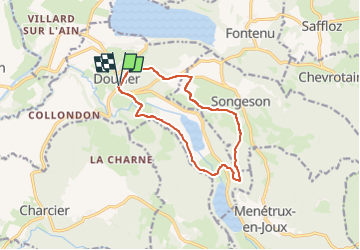
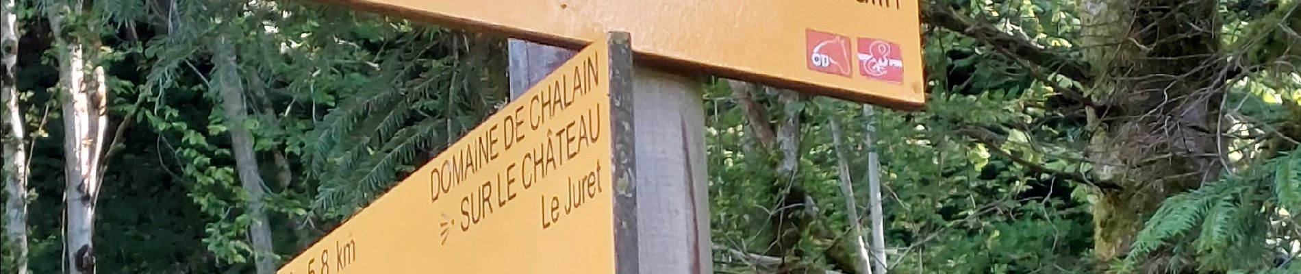
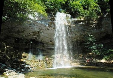
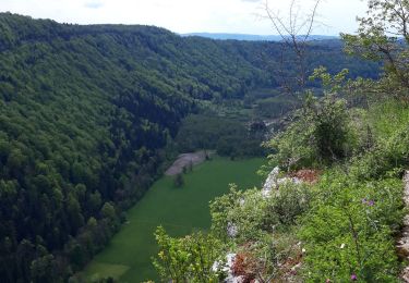
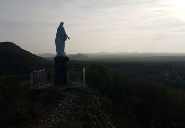
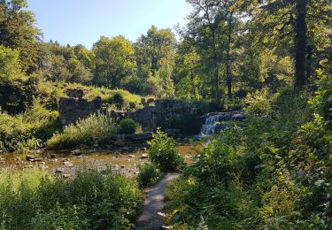
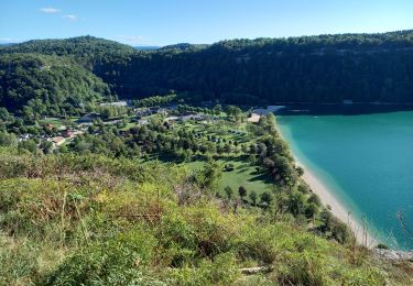
Tour Wandern von 11,4 km verfügbar auf Burgund und Freigrafschaft, Jura, Doucier. Diese Tour wird von drarep vorgeschlagen.
Beschreibung
Balisage assuré aller et retour en intégralité, 2 passages soit 24 kms effectifs
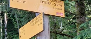
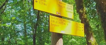
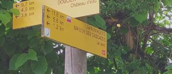
Rien de particulier à signaler, les lames propres, balisage repris, peintures anciennes et balises trop nombreuses sur l'ensemble du parcours mais pas d'anomalie majeure; les croix existantes ont été maintenues sans être ravivées.
Le défrichage sous les poteaux à été un gros travail ; rien de fait depuis plusieurs années de même que sur les balises du parcours.
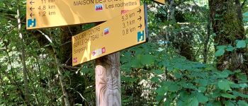
Le tronçon Poteau "La Rochette" - "Songesson" a été créer.
Le Tronçon Tourne à Droite sur le retour sur Doucier depuis Chambly à été créer en aller et retour
Ort
Kommentare
Touren in der Umgebung
![Tour Wandern Menétrux-en-Joux - Les cascades du Hérisson : Boucle du randonneur - Photo](https://media.geolcdn.com/t/375/260/ext.jpg?maxdim=2&url=https%3A%2F%2Fservices.sitytrail.com%2FGeolivesWS%2FDownloadMedia.ashx%3FTrailID%3D792637%26Media%3Dfix__20170718143932.jpg)
![Wandern Wandern](https://static1.geolcdn.com/sitytour/trail-icons/101.png)
Wandern
![](/images/other/stat-length.png)
![](https://static1.geolcdn.com/siteimages/upload/files/16400158638029165_repeat_loop_refresh_sync_direction_icon.png)
![Tour Wandern Menétrux-en-Joux - Le Hérisson et ses cascades - Photo](https://media.geolcdn.com/t/375/260/ext.jpg?maxdim=2&url=https%3A%2F%2Fservices.sitytrail.com%2FGeolivesWS%2FDownloadMedia.ashx%3FTrailID%3D109457%26Media%3D3924_2.jpg)
![Wandern Wandern](https://static1.geolcdn.com/sitytour/trail-icons/101.png)
Wandern
![](/images/other/stat-length.png)
![](https://static1.geolcdn.com/siteimages/upload/files/16400158638029165_repeat_loop_refresh_sync_direction_icon.png)
![Tour Mountainbike Doucier - La Dame Blanche - Doucier - Photo](https://media.geolcdn.com/t/375/260/ext.jpg?maxdim=2&url=https%3A%2F%2Fservices.sitytrail.com%2FGeolivesWS%2FDownloadMedia.ashx%3FTrailID%3D104084%26Media%3D7109_1.jpg)
![Mountainbike Mountainbike](https://static1.geolcdn.com/sitytour/trail-icons/202.png)
Mountainbike
![](/images/other/stat-length.png)
![](https://static1.geolcdn.com/siteimages/upload/files/16400158638029165_repeat_loop_refresh_sync_direction_icon.png)
![Tour Reiten Menétrux-en-Joux - suuntoapp-HorsebackRiding-2024-05-19T07-42-52Z - Photo](https://media.geolcdn.com/t/375/260/e9e40113-5fdc-487c-81dd-3f92c59395a0.jpg&format=jpg&maxdim=2)
![Reiten Reiten](https://static1.geolcdn.com/sitytour/trail-icons/301.png)
Reiten
![](/images/other/stat-length.png)
![](https://static1.geolcdn.com/siteimages/upload/files/16400158638029165_repeat_loop_refresh_sync_direction_icon.png)
![Tour Reiten Menétrux-en-Joux - suuntoapp-HorsebackRiding-2024-05-18T07-33-28Z - Photo](https://media.geolcdn.com/t/375/260/afd7f6f4-ca7e-4782-8dbe-8cb940288a5d.jpg&format=jpg&maxdim=2)
![Reiten Reiten](https://static1.geolcdn.com/sitytour/trail-icons/301.png)
Reiten
![](/images/other/stat-length.png)
![](https://static1.geolcdn.com/siteimages/upload/files/16400158638029165_repeat_loop_refresh_sync_direction_icon.png)
![Tour Wandern Menétrux-en-Joux - Menetrux. Les Cascades du hérisson. - Photo](https://media.geolcdn.com/t/375/260/8e5e2f86-bd6e-477f-a743-cdfd861bfcc6.jpg&format=jpg&maxdim=2)
![Wandern Wandern](https://static1.geolcdn.com/sitytour/trail-icons/101.png)
Wandern
![](/images/other/stat-length.png)
![](https://static1.geolcdn.com/siteimages/upload/files/16400158638029165_repeat_loop_refresh_sync_direction_icon.png)
![Tour Wandern Hauteroche - Mirebel avec Taïga - Photo](https://media.geolcdn.com/t/375/260/7abbcb78-a054-422a-acee-9b73230c2c5b.jpg&format=jpg&maxdim=2)
![Wandern Wandern](https://static1.geolcdn.com/sitytour/trail-icons/101.png)
Wandern
![](/images/other/stat-length.png)
![](https://static1.geolcdn.com/siteimages/upload/files/16400158638029165_repeat_loop_refresh_sync_direction_icon.png)
![Tour Wandern Menétrux-en-Joux - Ménétrux-en-Joux - cascades Evantail et Hérisson - Saut de la Forge - La Fromagerie - Photo](https://media.geolcdn.com/t/375/260/d48ed8df-2feb-4b91-8f37-fd07908921c0.jpg&format=jpg&maxdim=2)
![Wandern Wandern](https://static1.geolcdn.com/sitytour/trail-icons/101.png)
Wandern
![](/images/other/stat-length.png)
![](https://static1.geolcdn.com/siteimages/upload/files/16400158638029165_repeat_loop_refresh_sync_direction_icon.png)
![Tour Wandern Fontenu - Tour du lac de Chalain - Photo](https://media.geolcdn.com/t/375/260/1c5595f4-5d36-4f85-b728-7ff9b046c0c9.jpg&format=jpg&maxdim=2)
![Wandern Wandern](https://static1.geolcdn.com/sitytour/trail-icons/101.png)
Wandern
![](/images/other/stat-length.png)
![](https://static1.geolcdn.com/siteimages/upload/files/16400158638029165_repeat_loop_refresh_sync_direction_icon.png)